
Journal of Samuel Kiechel
19 – 28 October 1586
From Breslau to Vienna
“On 22 October, an hour into the day, we set out, and the road immediately became very rough, rocky and mountainous. At lunchtime, we stopped in the town of Zuckmantel, which belongs to the Bishop of Neisse […]; there, we had two more horses harnessed to our carriage because of the high mountains and the poor road ahead.”
Die Reisen des Samuel Kiechel aus drei Handschriften, K. D. Haszler (ed.), Stuttgart 1866, p. 140; Bayerische Staatsbibliothek.
Southwards
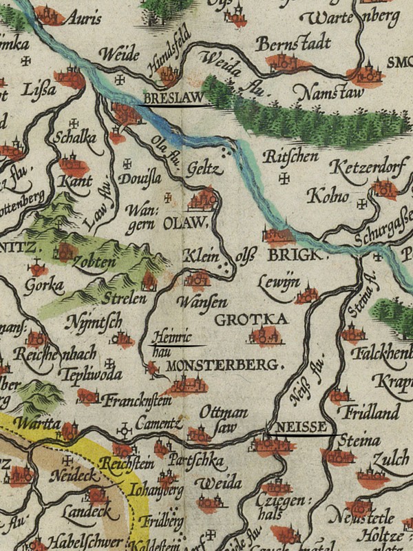
Map of Silesia with Breslau (Breslaw), the Heinrichau and Neisse, 1608
After leaving Breslau (Wrocław)1, it took about half a mile for Samuel Kiechel and his two companions to realise their coachman was drunk. He struggled to stay on the horse. Noticing his lack of control, the horses broke into a run, veered off the road, and the carriage crashed into a ditch. No one was hurt, but the travellers had a difficult time getting the vehicle back on the road. Because of the delay, they drove only one more mile that day, until they reached the village of Schönenbronn (?). According to Kiechel, a citizen of Breslau owned the village, and it had pleasant houses.
The three men left the village the following morning after hiring a local peasant as a guide. Their coachman, whom they had hired in Breslau and who claimed to know the route, knew as much about it as the travellers. Kiechel wrote that the surrounding landscape was very fertile. At lunchtime, they stopped in Hirschau, where an impressive monastery stood, surrounded by gardens and ponds full of fish.
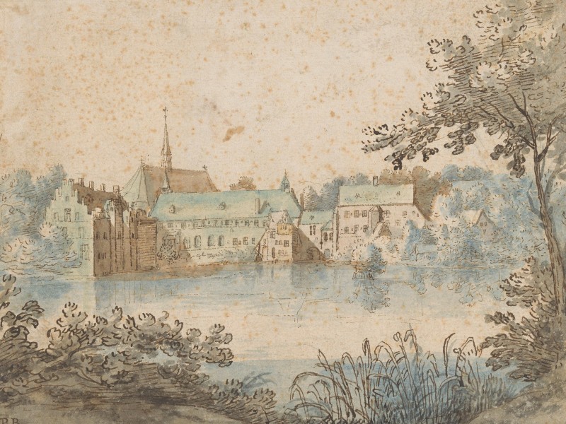
The monastery was most likely the thirteenth-century Cistercian Monastery Complex in Heinrichau (Henryków).
In the afternoon, the travellers continued and arrived at a nobleman’s estate that evening. Hans Haas, Kiechel’s companion, knew the nobleman, who went by the same name. The place was called Clambach (?), and they spent the night there.
The following day, the three men stopped at lunchtime in Neisse (Nysa) in Silesia. The weather was awful, so the travellers decided not to drive further. They also wanted to give the horses some time to rest. Kiechel wrote that Neisse was not large but heavily fortified, with pleasant houses. It was a bishopric. The Nysa River (Nysa Kłodzka) flowed through the town.2
Neisse (Nysa)
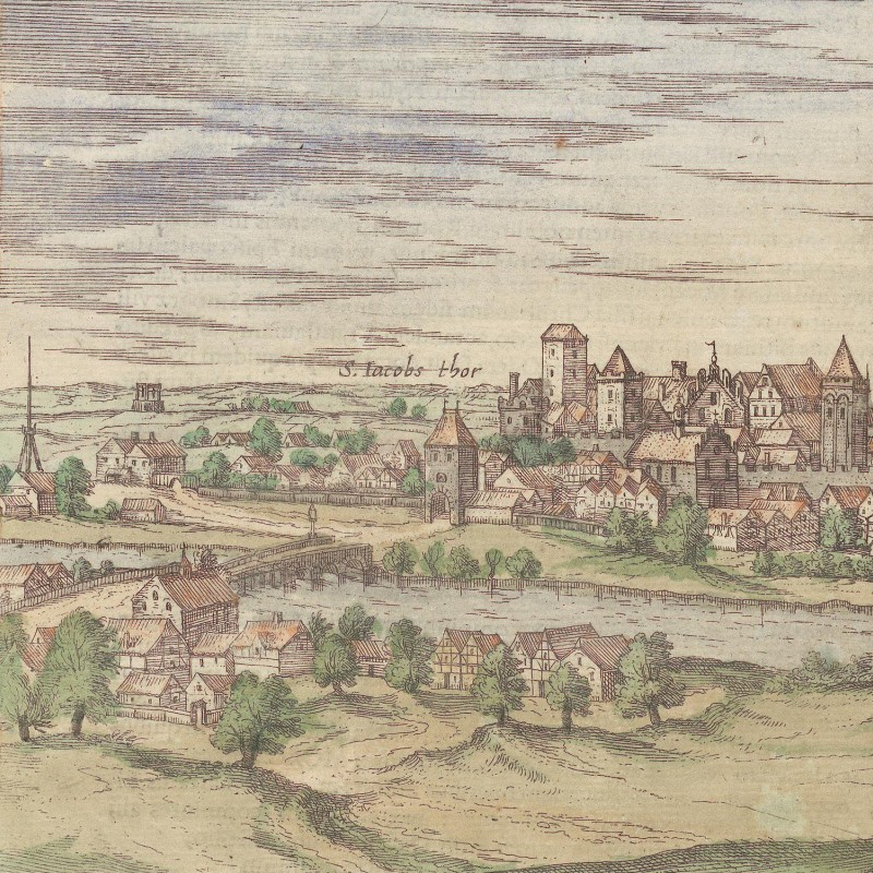
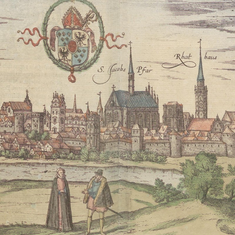
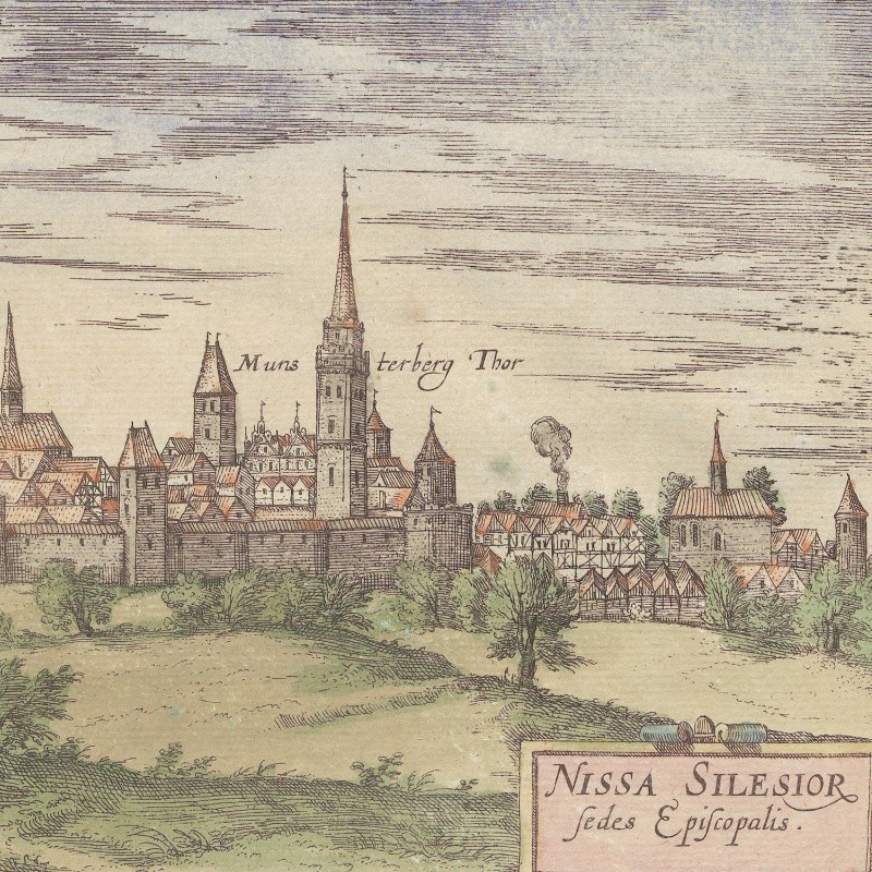
Neisse, 1618
Neisse is one of the oldest towns in Silesia and was part of the realm of Mieszko I, the first documented Polish ruler in the tenth century. Early Polish kings had the unfortunate habit of dividing their realm among their sons. This weakened royal power and left the kingdom fragmented in the twelfth and thirteenth centuries. During this period, Neisse and the surrounding land became a duchy.
Neisse grew in significance and prosperity thanks to its location. To its southeast lay the Sudeten Mountains, a massive range along the border between modern Poland and the Czech Republic. In the medieval and early modern periods, such mountain ranges were formidable obstacles. They formed a natural barrier, offering protection and economic resources through mining and forestry.
In addition, the town lay near the Moravian Gate, a lowland corridor between the Sudeten and Carpathian Mountains. Since ancient times, the Gate had been a major north-south thoroughfare. Trade routes converged at the Moravian Gate and, after passing through the mountains, fanned out again. Such passes were used not only by travellers and merchants but also by invading armies. South of the Sudeten Mountains lay the Kingdom of Bohemia, and for centuries Bohemia and Poland fought over control of Silesia. Neisse was therefore not only an economic hub but also strategically significant, and it was fortified.
The town’s importance is evident in its appearance in the Nuremberg Chronicle (1493) and volume six of the Civitates Orbis Terrarum (1618). The view in the Civitates (see above) presents it as small but prosperous, with many large and impressive buildings.
Samuel Kiechel wrote that Neisse was a bishopric, but he was mistaken. It was the capital of an ecclesiastical duchy, ruled by the prince-bishop of Breslau. The bishops had built a residence for themselves in the town, and Kiechel may have seen this palace and drawn the wrong conclusions.
Across the Mountains
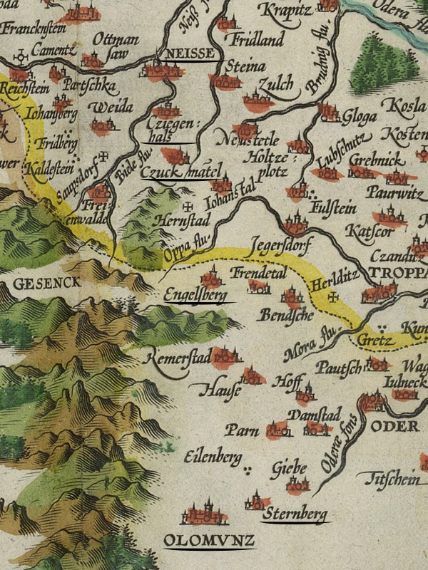
Map of Lower Silesia and the Eastern Sudeten Mountains showing Samuel Kiechel’s route from Neisse via Ziegenhals (Cziegenhals), Zuckmantel (Czuckmatel), Engelberg and Sternberg to Olmütz (Olomvnz), 1608
Samuel Kiechel and his companions left Neisse the following day. The road was awful. It was rough and rocky, leading into the mountains (the foothills of the Sudeten Mountains). The travellers stopped in the town of Zuckmantel (Zlaté Hory), three miles from Neisse. They took the opportunity to get two more horses and have them harnessed to the carriage, as the surrounding mountains were quite high and the road was rough and steep.
In the town, Kiechel heard that the road through the mountains was very dangerous. Many murders had occurred in the area. The land was ideal for banditry, and Kiechel described dense forests and roads so narrow that a cart could not get out of the way of another coming from the opposite direction. They saw no settlement for three miles.
The travellers drove past a mine surrounded by dilapidated houses and shacks. They passed a well, which our traveller wrote one would have to kneel or lie down to drink, and mused that he would have to be very thirsty before doing so. They also saw miners who did not look very trustworthy. But the travellers were armed. According to Kiechel, each of them had a long gun. They drove on past nightfall until they had crossed the mountains and reached the town of Engelberg (Andělská Hora), where they spent the night.
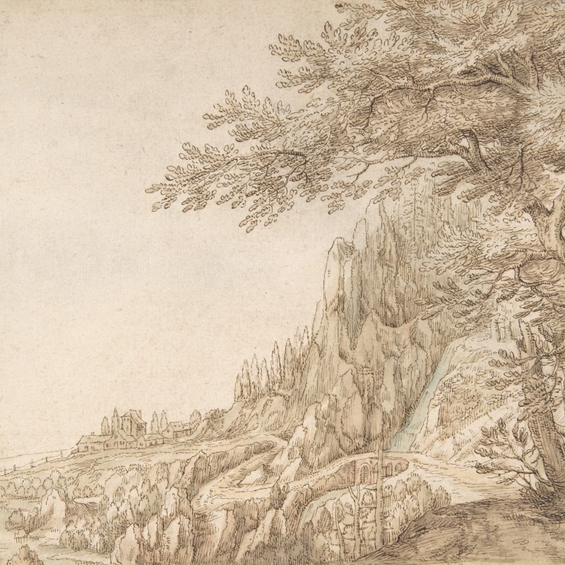
Samuel and his companions left Engelberg the next morning. The road was still poor, and the surrounding forests were dense. They drove for seven hours and arrived in Sternberg (Šternberk) in Moravia that afternoon. Kiechel wrote that the town was on the other side of the mountains and belonged to Herr von Oels (Karl II von Münsterberg-Oels, 1545-1617). From there they drove through a pleasant and fertile valley and arrived in the evening in Olmütz (Olomouc), the capital of Moravia.3
The Eastern Sudeten Mountains
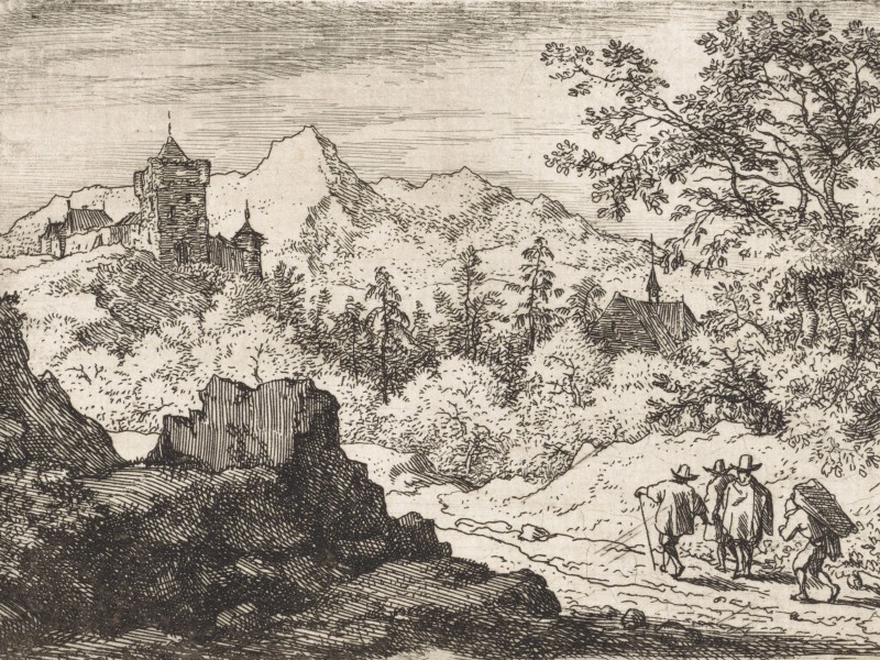
The mountains our traveller crossed were the Opawskie Mountains and the Nízký Jeseník, two low mountain ranges within the Eastern Sudeten Mountains. From Zuckmantel to Engelberg, they travelled through the Opawskie Mountains. On a modern physical map, the landscape consists of low mountains and deep valleys. The road likely followed the valleys connecting the settlements. Kiechel’s description of dark forests and narrow roads fits that region, and travel must have been difficult and exhausting. From Engelberg to Sternberg, the route became somewhat easier, as the Nízký Jeseník is a range of moderate hills and flat highland that descends into the Moravian Gate, the stretch of lowland between the Sudeten and the Carpathian Mountains that had been part of all major north-south trade and travel routes in the region since ancient times. Sternberg marked the end of the mountain ranges, and travellers entered the flat plain of the Morava River, which flows south towards the Danube.
Samuel Kiechel noted that they drove past mining settlements. Lower Silesia was an important mining centre in the sixteenth century. In the twelfth and thirteenth centuries, German miners, attracted by gold and iron deposits in the area, settled there. Kiechel and his companions stopped in Zuckmantel (Zlaté Hory) and, on the route from Neisse, must also have passed through Ziegenhals (Głuchołazy), two important mining towns.
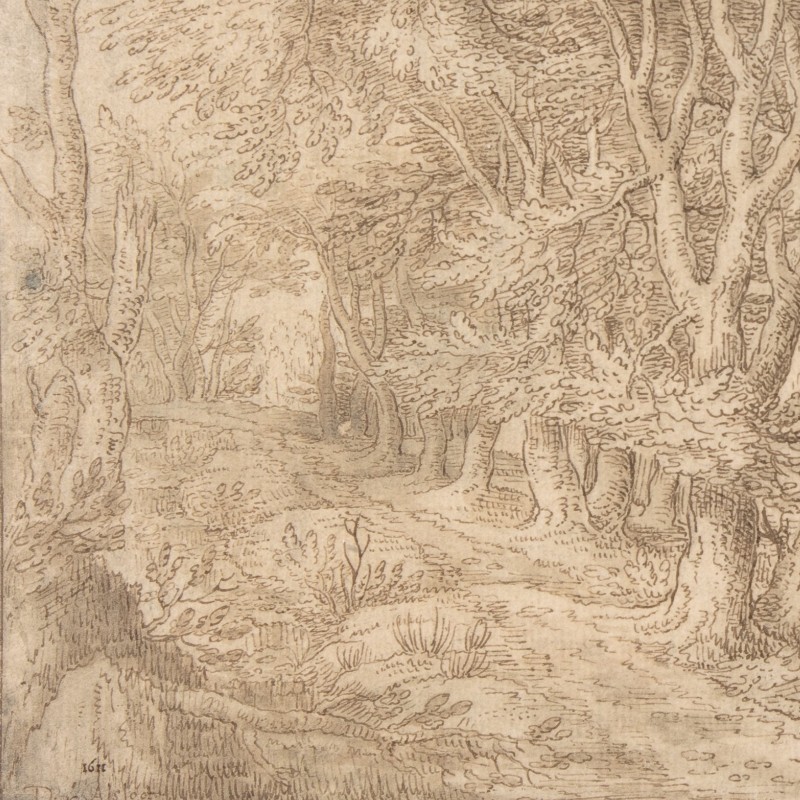
Samuel Kiechel’s description of the route across the mountains is rather dour. Dense, dark forests in thinly inhabited regions might have been ideal for bandits, or it might have been a common stereotype about such places. The impression of the mining settlement’s ramshackle character and the apparent untrustworthiness of miners could just as well result from Kiechel’s anxiety and unfamiliarity with the place. His experiences in Livonia have shown that travellers can be influenced by what they witnessed, heard or imagined.
Olmütz (Olomouc)
After an arduous journey, the travellers arrived in Olmütz. Kiechel wrote that the city was small, pleasant and well-built. The market square was large and surrounded by painted houses. He also mentioned a clock with an ingenious mechanism. The Morava River flowed through the city.4
Because of its strategic and economic value at the southern end of the Moravian Gate, the location had been settled and fortified at least since the early Middle Ages. In 1063, the Bishopric of Olmütz was established, and the town became the foremost settlement of the province of Moravia under the Bohemian Přemyslid dynasty.
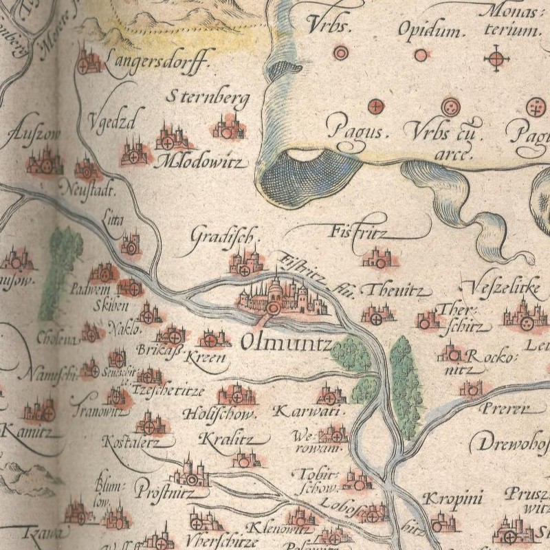
Olmütz developed into an important economic and administrative centre in the fifteenth and sixteenth centuries. The well-built, painted houses Kiechel saw reflected the economic prosperity of the city’s inhabitants, as did the clock he mentioned.
The clock was an astronomical clock on the town hall’s north-eastern facade. Constructed in the early fifteenth century, it still exists but has been repaired and reconstructed multiple times in the intervening centuries. At the time of Samuel Kiechel’s visit, it likely presented a medieval understanding of astronomy, with the Earth at the centre and other heavenly spheres in a hierarchical, divinely ordained order around it. It featured sculptures, painted wood panels and moving figurines.
Through Moravia
The travellers spent 24 October in Olmütz to give the horses time to rest after the rough trek across the mountains. The following day, they drove to Wischau (Vyškov) and continued on 26 October to Wisternitz (Dolní Věstonice).
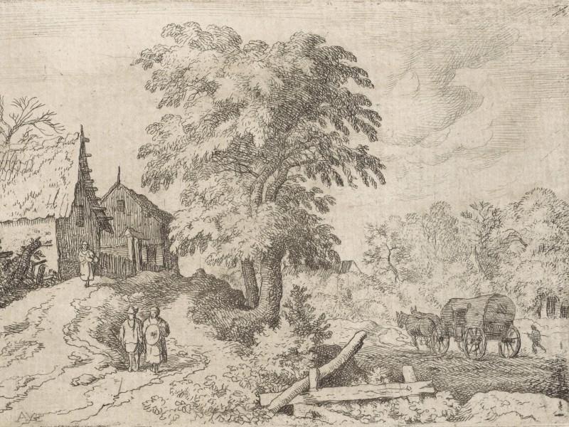
The next day, the three men continued past Nikolsburg (Mikulov), a well-built palace. According to Kiechel, it belonged to Herr von Dietrichstein (Adam von Dietrichstein, 1527-1590). The palace stood on a high hill, surrounded by houses. At the foot of the hill lay a pleasant village set within a fine landscape where much wine was grown. But the travellers did not stop and drove on. They arrived after nightfall in Gamersdorf (Gänserndorf?), a small market town in Austria.
It appears to have been an uneventful journey from Olmütz, as Kiechel only noted that the landscape was pleasant, fertile and well populated. On 28 October, he and his companions drove on and arrived at the gates of Vienna at lunchtime.5
Illustrations & References
All images are in order of appearance with links to sources on external websites:
- of Lucas van Doetechum, Johannes Alpenlandschap, 1553 – 1558; Rijksmuseum Amsterdam.
- Ortelius, Abraham, Theatrum orbis terrarum, 1608, fol. 61v; Folger Shakespeare Library.
- Anonymous, Gezicht op de priorij van Groenendaal bij Brussel, 1600 – 1650; Rijksmuseum Amsterdam.
- Nysa, in: Braun, Georg, Hogenberg, Frans, Civitates Orbis Terrarum (6), Cologne 1618, fol. 18v; Heidelberg University.
- van Alsloot, Denijs, Mountainous Landscape, ca. 1608–11; Metropolitan Museum of Art, New York.
- van Everdingen, Allaert, Berglandschap met drie wandelaars en een kruier, 1631 – 1675; Rijksmuseum Amsterdam.
- van Alsloot, Denijs, Wooded Landscape with a River, Castle, and Town Beyond, 1611; Metropolitan Museum of Art, New York.
- Ortelius, Abraham, Theatre of the World, Antwerp 1587, fol. 55v; Library of Congress.
- van Everdingen, Allaert, Landschap met koets, 1631 – 1675; Rijksmuseum Amsterdam.
- For Kiechel’s journey to Vienna, I will continue to use the German names as found in the journal and add the modern names in parentheses. The Polish and Czech names can differ significantly from the German names, and I want to avoid unnecessary confusion. ↩︎
- Die Reisen des Samuel Kiechel aus drei Handschriften, K. D. Haszler (ed.), Stuttgart 1866, p. 139f; Bayerische Staatsbibliothek. ↩︎
- Ibid., p. 140. ↩︎
- Ibid. ↩︎
- Ibid., p. 141. ↩︎