Journal of Samuel Kiechel
25 May – 5 June 1586
In Danzig
“Danzig has such a flourishing grain trade that you won’t find another city where similar amounts of grain arrive. It is brought down the Vistula from Poland. On some days, 50 to 60 ships from Holland arrive with a fair wind to load grain.”
Die Reisen des Samuel Kiechel aus drei Handschriften, K. D. Haszler (ed.), Stuttgart 1866, p. 95; Bayerische Staatsbibliothek.
Arrival and Accommodation
Danzig, 1625
Having left Rostock, Samuel Kiechel had travelled along the Baltic coast through Pomerania and arrived in Danzig (Gdańsk1). Part of the way, he rode in a coach with two Dutchmen, among other passengers. Apparently, he got along well with them, and they decided to help Samuel with accommodation in the city.
Kiechel wrote that he stayed at the house of Johannes de Rad, a Dutchman originally from Deventer who had become a citizen of Danzig. De Rad was a merchant, and his house was not an inn but private accommodation; he opened it only to friends and good acquaintances. Kiechel’s companions knew de Rad and took our traveller along to his house. Samuel appreciated it and noted that his host was a pleasant and accommodating man, that his house was clean, that the food was good, and that the place was well worth the money.2
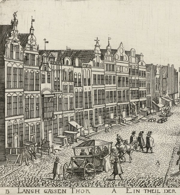
St. Mary’s Church and the town hall of Danzig, 1615
The journal hints that Johannes de Rad’s house was near St. Mary’s Church. Kiechel mentioned that a new, beautiful organ had just been installed in a church opposite his accommodation and was being played for the first time.3 In 1585, construction of a new organ in St. Mary’s Church had just finished. At the time, it was one of the largest organs in the Baltic Sea area.
About Danzig
Danzig is one of Poland’s oldest cities and has long been a centre of trade and commerce thanks to its location at the mouth of the Vistula River. The city was a member of the Hanseatic League and a major Baltic port. Politically, Danzig came under the rule of the Teutonic Order in 1308. Founded in 1190 in Acre, the Teutonic Knights established themselves in Prussia on the southeastern shore of the Baltic Sea after the loss of the Holy Land. The Order’s rule led to repeated political tensions and revolts in the city. The citizens resented the lack of political autonomy and increasing tax burdens, especially in the fifteenth century, when the Teutonic Order was in decline and consistently needed money to pay its mercenaries. The Order also sought to curtail Danzig’s trade and to establish itself as a commercial power.
In 1440, Danzig and other Prussian cities, backed by noble families, formed the Prussian Confederation to oppose the Knights’ oppressive and arbitrary rule. The Confederation sought the protection of the King of Poland. This confrontation led to the Thirteen Years’ War (1454–1466) and the Order’s defeat. In the Second Peace of Thorn in 1466, the Teutonic Order was compelled to relinquish its western territories: part of Pomerania with Danzig, the Kulmerland (Chełmno Land) and Ermland (Warmia). Danzig became part of the Kingdom of Poland and, having supported the Polish Crown during the war, received far-reaching privileges. Apart from acknowledging the Polish king as its sovereign, the city finally achieved autonomy comparable to that of a free city in the Holy Roman Empire.
The Protestant Reformation first took hold in Danzig in 1518, but attempts to establish the new creed were halted by King Sigismund I (1467-1548) in 1526. Only gradually did Protestants receive permission to establish their own parishes. In 1557, St. Mary’s and the other churches stopped celebrating Catholic masses and became Protestant (St. Mary’s became a Catholic church again after 1945).
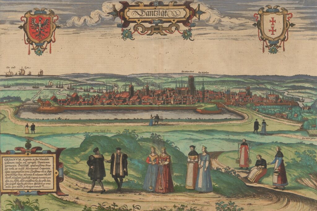
Danzig, 1575
A view of Danzig appears in volume two of the Civitates Orbis Terrarum. The city is shown in a low-profile view within its surrounding landscape. In the foreground, various people are dressed in local attire, while in the background, on the left, the Vistula flows into the Baltic Sea. Many ships are depicted at sea and on the river. Danzig itself is presented as a large and impressive city. The churches and gates are named on the map. St. Mary’s Church stands out. It is the largest brick church in Europe and is still a popular destination for visitors today.
However, because the view has a broad scope that encompasses much of the surrounding landscape, the city itself is somewhat indistinct. In addition, the depictions of people in local dress occupy almost half of the lower part of the image, so Danzig becomes more of a backdrop than the actual focus.
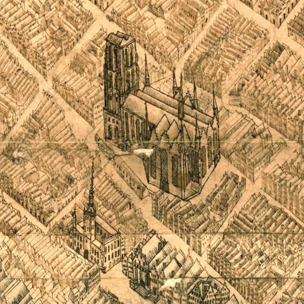
A more intriguing depiction of the city is a 1615 bird’s-eye view held by the National Archives of Sweden. The view appears to be a preliminary sketch, as it is in pen and ink and has two empty cartouches in the upper corners where the title, artist or a legend would have been added later. The view is an exceptionally detailed depiction of the city. St. Mary’s Church and the town hall are easy to pick out, as is the busy harbour with many ships of different sizes. The large, square complex of buildings just north of St. Mary’s is the Basilica of St. Nicolas and the connected Dominican monastery. The large church to the east of both, close to the harbour, is St. John’s.
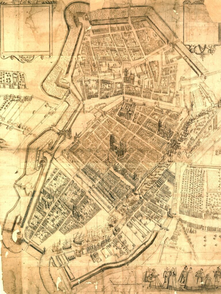
Danzig, 1615
Observations
Samuel Kiechel wrote that Danzig is the capital of Prussia, but under the protection of the King of Poland.
The city is actually in the historic province of Pomerania. However, following the Second Peace of Thorn in 1466 (see above), the territories the Teutonic Knights had to surrender to Poland became the new province of Royal Prussia. Danzig was the largest, wealthiest and most powerful city in this new province.
Kiechel further noted: Danzig is heavily fortified. Outside the walls are two high hills, and from their summits, the whole city can be observed. The hills are called Hagelsberg and Bischofsberg. King Stephan of Poland and his troops occupied both hills during their siege of the city. Danzig was bombarded by cannon fire from the hills, but the shots either passed over the city or struck its walls. Kiechel mentioned that he had not seen walls of similar height and thickness anywhere else. The walls were especially sturdy towards the two hills.4
Our traveller continued: On the opposite side of Danzig are two rivers. The Motława flows through the city, and the Vistula passes nearby. The Vistula is an impressive river that flows through Poland. The Motława flows into the Vistula just outside Danzig. About an hour downriver, the Vistula in turn flows into the Baltic Sea. At the point where the river meets the sea stands a small, round house. The house is garrisoned by soldiers from Danzig and protects access to the Vistula and the city’s harbour. The King of Poland attempted to take this house during the siege but was unsuccessful; otherwise, the siege would have ended badly for Danzig.5
Kiechel further observed that Danzig has three suburbs. One lies close to the city wall, towards Königsberg (east). The other two are a short distance from the walls. One is called Schottland and the other Schidlitz. Both have been rebuilt recently because Polish troops burned them down during the siege. Craftsmen, mostly Dutch shoemakers, inhabit Schottland. A narrow stream runs through this suburb towards the city. Schidlitz is also mostly inhabited by Dutch people. It is surrounded by pleasant gardens and lovely summer houses belonging to the citizens of Danzig.6
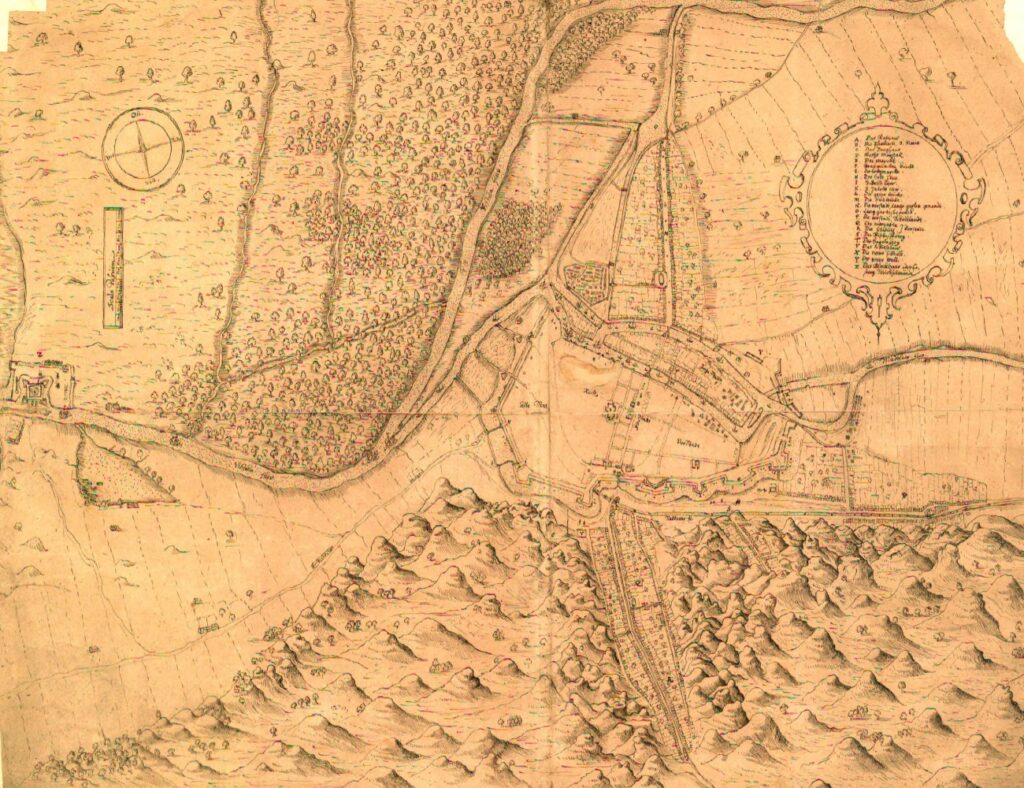
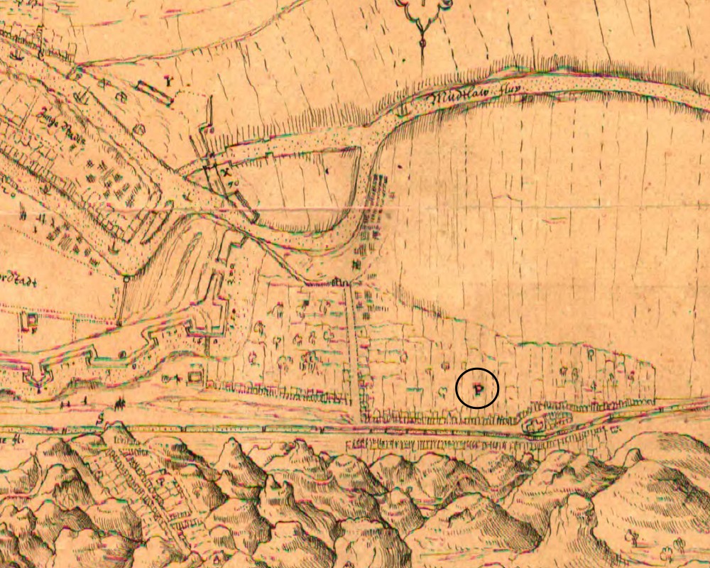
Danzig and its surrounding area, 1629
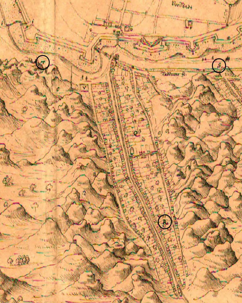
This map from 1625 shows Danzig and its surroundings, including all the places Samuel Kiechel mentioned. The map is oriented towards the east. In the upper-right corner is a legend identifying various places around the city. On the left edge of the map is the mouth of the Vistula into the Baltic Sea, with the fortified tower that protects it. In the bottom centre is the suburb of Schottland (Stare Szkoty). The suburb was named after Scottish migrants who settled there. It stretches along a valley between two lines of hills. Among the hills are the Bischofsberg (Biskupia Górka) and the Hagelsberg (Grodzisko), from which Danzig was bombarded during the siege. Schottland is marked with the letter R on the map, the Bischofsberg with an S, and the Hagelsberg with a T. On the right side of the map is the suburb of Schidlitz (Siedlce), marked with a P.
The Siege of Danzig
The siege Kiechel mentioned took place in 1577. Stephen Báthory (1533-1586) had been elected King of Poland in 1576. But Danzig had supported his rival, Emperor Maximilian II, and now refused to acknowledge Báthory as its new King.
The Polish-Lithuanian Commonwealth was established by the Treaty of Lublin in 1569. It was an elective monarchy, with the nobility of both Poland and Lithuania selecting their next king. The first elected king of the Commonwealth was Henry of Valois (1551-1589), the brother of Charles IX, King of France. He arrived in Poland in 1574 but left the same year again upon hearing that his brother had died. For Henry, the crown of France was far more prestigious, and his power as king of France was not tied to noble approval. A pro-Habsburg faction in the Commonwealth suggested Emperor Maximilian II (1527-1576) as the new king. But many other nobles feared that picking such a powerful monarch might end the Commonwealth. Instead, Stephen Báthory, the Voivode of Transylvania, was elected and crowned in 1576.
However, Báthory’s position was not safe, and he needed to establish his power quickly. Within the Commonwealth were still many who sympathised with Maximilian and even after his death later the same year, refused to accept Báthory as king, Danzig, for example.
To force Danzig into submission, Stephen Báthory assembled an army and marched north. His Polish-Hungarian troops defeated Danzig’s forces and besieged the city. However, despite heavy bombardment, the fortifications proved too strong, and Báthory’s army failed to capture it.
A contributing factor to the siege’s failure was the inability of the Polish army to seal off the city’s access to the sea. The defensive structure at the mouth of the Vistula, which Kiechel mentioned, was a stone tower fortified with gun positions. As our traveller noted, its role was to guard access to Danzig’s harbour, but the tower also served as a lighthouse to guide ships into the river. Between 1562 and the beginning of the siege in 1577, the towers’ fortifications were extended, and new bulwarks and gun emplacements were added. During the siege, it was badly damaged, but the Polish troops could not take the tower and thereby failed to gain control of the Vistula.7 As with many other sieges, a failure to cut off its supply lines meant that the city could not be starved into submission.
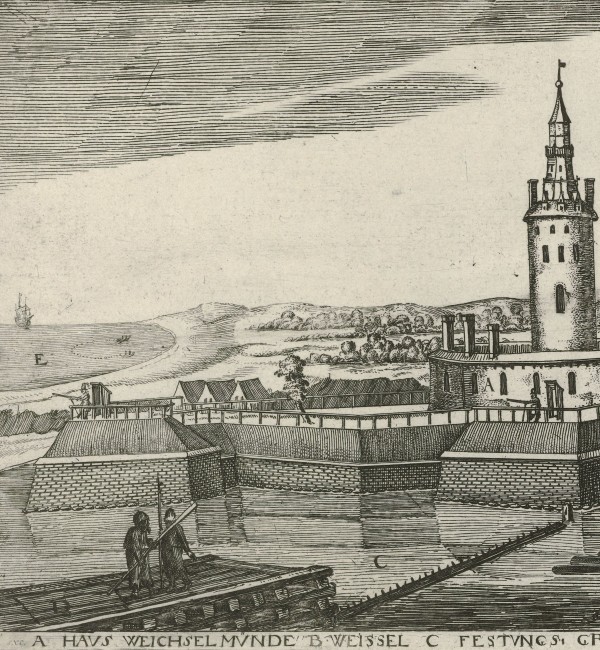
The tower at the mouth of the Vistula River, 1625
A compromise to resolve the conflict was reached fairly quickly in December 1577. The citizens of Danzig acknowledged Báthory as king and paid reparations. At the same time, Stephen Báthory agreed to restore the city’s many privileges, thereby granting it the quasi-autonomous status it had held since 1466.
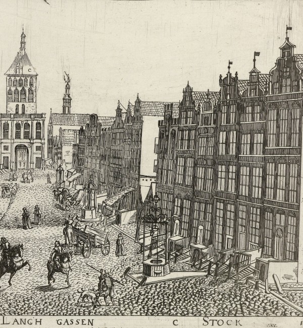
Danzig’s Grain Trade
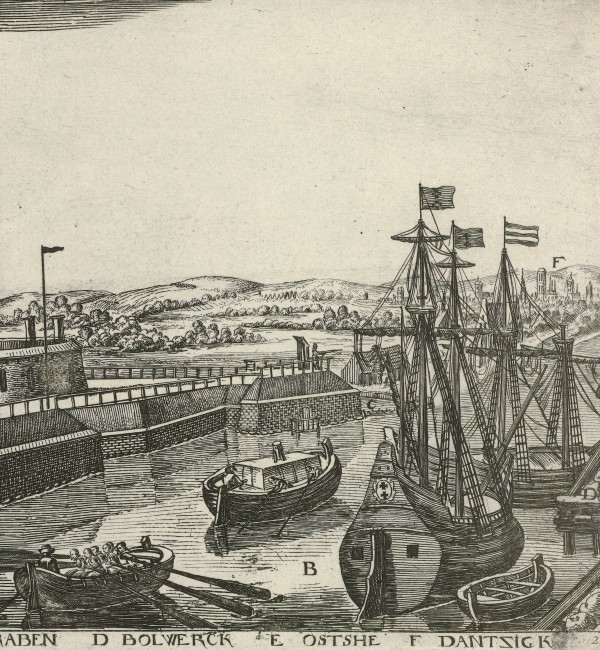
Regarding Danzig’s economy, Samuel Kiechel wrote: The city’s main commodity is grain arriving along the Vistula River from Poland. No other city trades such large amounts of grain. Sometimes, fifty to sixty ships from Holland arrive in a single day to load grain in Danzig. No foreigners are allowed to buy grain directly from Poles. It must first be sold to a citizen of Danzig, who, in turn, must store it in one of the city’s granaries before exporting it.8
Kiechel continued: Many such granaries stand on one side of the Motława River. Some are seven, eight, or even nine storeys high and can hold huge amounts of grain. Ships sail up the river and moor right beside the granaries. However, a few of the very largest ships can only be partially loaded there because of the shallow water. They have to be fully loaded at sea. Such ships sail to Spain and Portugal.9
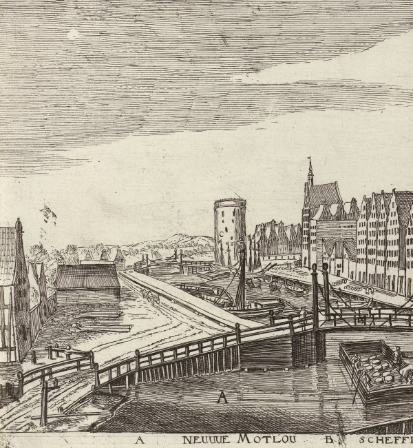
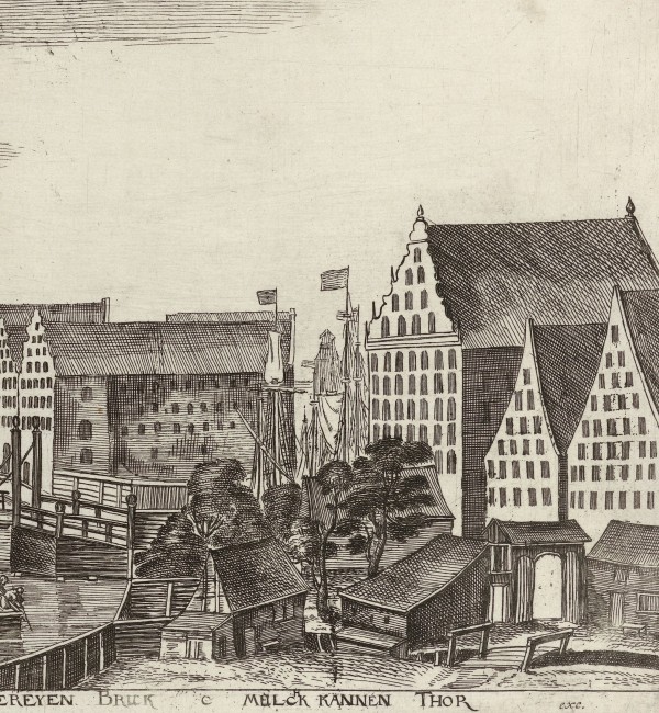
The granaries along the Motława River, 1625
Danzig was the major port of the Kingdom of Poland. As Kiechel noted, grain was grown in Poland and Prussia and transported along the Vistula to Danzig. The city held a privilege called the “Stapelrecht” (staple right). All goods passing through had to be unloaded and offered for sale to citizens. In the case of grain, it had to be transferred into the city’s granaries. Many of Danzig’s impressive granaries along the Motława remain today.
Spending Time in Danzig
It appears that Samuel Kiechel enjoyed his time in the city. He noted that Danzig is an entertaining and pleasant place. It is set in a nice landscape, with summer houses and fine estates nearby. Of the population of Danzig, the men are brave, and the women wear graceful clothing in keeping with current fashion. Ships arrive daily in the summer months, always bringing news and stories.10
Furthermore, our traveller wrote that Danzig has a splendid fraternity that meets daily in a place called “der hoof” (the yard), a building beside the market square with a large, beautiful hall. Membership in this fraternity can be acquired for a Gulden (gold coin, Guilder) by any man, whether a citizen or foreigner, young or old, provided he is an honest man. In the fraternity hall, various benches are named after specific places, such as the Lübeck Bench, the Hamburg Bench and others.
When someone becomes a member of the fraternity, they can go there every day and sit where they like. Drinks are served from two o’clock in the afternoon until six o’clock in the evening, and again after dinner from eight to ten. Everyone can drink as much beer as they want and pay two Polish Groschen (small silver coin), which is equivalent to about four Kreuzer (a small coin in southern Germany). When a member of the fraternity dies but does not leave enough money for an appropriate funeral, the fraternity will pay for it.11
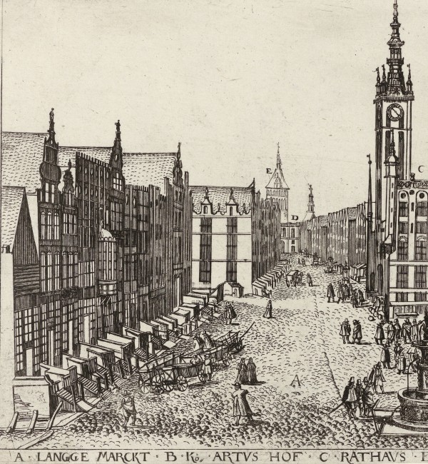
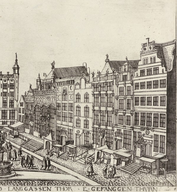
The market square with the town hall (C) and the Artus Court (B), 1625
The place Kiechel described was the Artus Court (Artushof, Dwór Artusa), a building still open to visitors today. At the Artus Court, nobles, wealthy merchants and foreign guests met and spent their time. As was the custom at the time, members had to be male and, as Kiechel indicated, possess a certain social rank or wealth to be admitted. A gold coin was not an amount of money everyone could afford. Many cities in the Baltic Sea region had an Artus Court or a similar meeting place (such as the House of the Blackheads in Riga).
However, in contrast to Kiechel’s description, the Artus Court was not home to a single fraternity but rather the meeting place for members of several local fraternities. Fraternities in the Middle Ages and early modern period were initially religiously inspired societies of men from certain professional backgrounds, e.g. merchants or ship owners. With the dangers involved in long-distance trade, the fraternities offered a form of social security, a community away from home and salvation. Kiechel mentioned that the fraternity would cover the funeral costs of fraternity members. But with membership strictly limited to aristocrats, wealthy merchants and the occasional visitor, they also held considerable political influence.
The names of the benches in the main hall of the Artus Court in Danzig, Kiechel mentioned, were tied to the various fraternities that met there. The names indicate that they were merchant fraternities engaged in trade with the particular place their bench was named after.
Kiechel seemed to have been able to afford the admission fee, as he wrote about drinking in the Artus Court. Since we are on the topic of alcoholic beverages, Samuel also noted that the beer brewed in Danzig was the best among the Hanseatic cities. In particular, he liked a type of Altbier (old beer) sold in the city. It was many years old, thick and sticky, and called “preüssen” (Prussia). But there was also a wide variety of imported beers available in the city during the summer. Kiechel’s host told him that about twenty different varieties of beer would then be for sale.12
After exploring Danzig for twelve days and drinking in the Artus Court, Samuel Kiechel left the city on 6 June, continuing his journey eastward.
Illustrations & References
All images are in order of appearance with links to sources on external websites:
- Dickmann, Aegidius, Gezicht op de binnenstad van Danzig, gezien vanaf de Mottlau, 1625; Rijksmuseum Amsterdam.
- Dickmann, Aegidius, Gezicht op de Gouden Poort aan het einde van de Langstraat in Danzig, 1625; Rijksmuseum Amsterdam.
- Anonymous, Danzig/Gdansk, 1615; Riksarkivet Stockholm.
- Danzig, in: Braun, Georg, Hogenberg, Frans: Civitates Orbis Terrarum (2), Cologne 1575, fol. 46v; Heidelberg University.
- Anonymous, Danzig /Gdansk, 1629; Riksarkivet Stockholm.
- Dickmann, Aegidius, Gezicht op fort Weichselmünde, 1625; Rijksmuseum Amsterdam.
- Dickmann, Aegidius, Gezicht op Danzig vanaf de Nieuwe Mottlau, met in de verte de Melkkan-toren, 1625; Rijksmuseum Amsterdam.
- Dickmann, Aegidius, Gezicht op het marktplein, met aangrenzend het stadhuis, 1625; Rijksmuseum Amsterdam.
- Many placenames in northeastern Europe changed significantly. In contrast to my previous approach of using modern names, I will therefore use the common sixteenth-century names and add the modern names in brackets on the first mention in a post, for example: Stettin (Szczecin) or Reval (Tallinn). ↩︎
- Die Reisen des Samuel Kiechel aus drei Handschriften, K. D. Haszler (ed.), Stuttgart 1866, p. 96; Bayerische Staatsbibliothek. ↩︎
- Ibid. ↩︎
- Ibid., p. 94. ↩︎
- Ibid., pp. 94f. ↩︎
- Ibid., p. 96 ↩︎
- Mossakowski, Stanislaw, The Sea Fortress at Wisloujscie Near Gdansk, in: Europa Nostra Scientific Bulletin, 51 (1999), pp. 77-80; University of Heidelberg. ↩︎
- Reisen des Samuel Kiechel, p. 95. ↩︎
- Ibid., p. 95. ↩︎
- Ibid., p. 96. ↩︎
- Ibid., pp. 95f. ↩︎
- Ibid., pp. 95 & 97. ↩︎