Journal of Samuel Kiechel
5 – 24 May 1586
From Rostock to Gdańsk
“We stopped in the afternoon in a town called Köslin, where Duke Kasimir of Pomerania had his court — an unpleasant place. Just outside the town stood a high hill visible from far out at sea; some time ago, many murderers and bandits roamed the area because of its thickets, trees and hollow ways.”
Die Reisen des Samuel Kiechel aus drei Handschriften, K. D. Haszler (ed.), Stuttgart 1866, p. 93; Bayerische Staatsbibliothek.
Where To?
Samuel Kiechel left Rostock on 5 May in a carriage with three merchants from Hamburg and a woman from Lübeck. His route would take him along the Baltic Sea through northern Poland and Lithuania to Livonia. Kiechel did not indicate whether he had planned to visit northeastern Europe or whether a series of spur-of-the-moment decisions led him farther and farther east. What we know from other travellers’ accounts is that Livonia was not a typical destination. People travelled there for a reason, be it for trade, to seek work as teachers on the country estates of German settlers, or as mercenaries. Those who travelled for educational purposes, and Kiechel broadly fits this category, went instead to Italy, France or England.
But Samuel Kiechel was, by the standards of the time, an oddball, and that’s why I prefer to compare him more to a modern backpacker than to other sixteenth-century travellers. Sparse as they are, his descriptions of Scandinavia, Lithuania and Livonia are quite unique in the travel literature of the time and, at least for me, an outstanding part of the journal.
So, onward, I will follow Samuel Kiechel to the majestic cities of Danzig (Gdańsk1) and Riga, travelling with Tatars, getting scared of werewolves and stealing a horse.
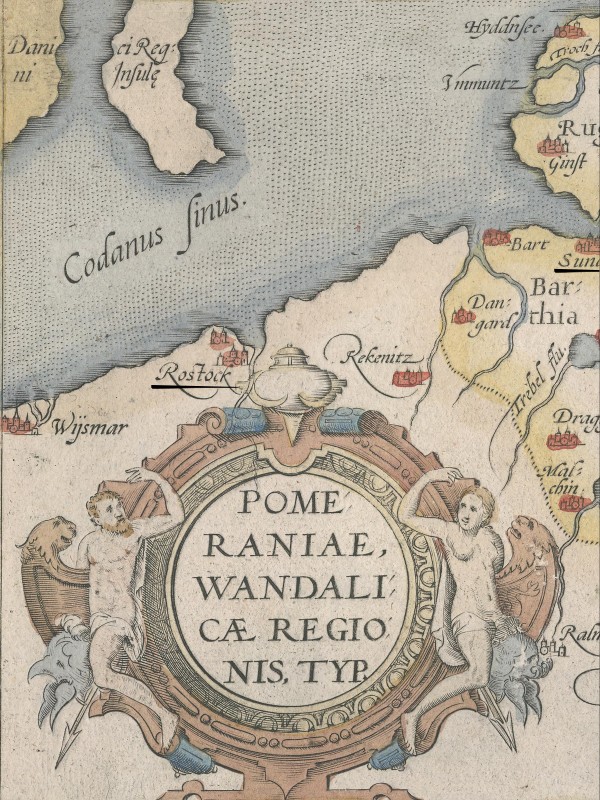
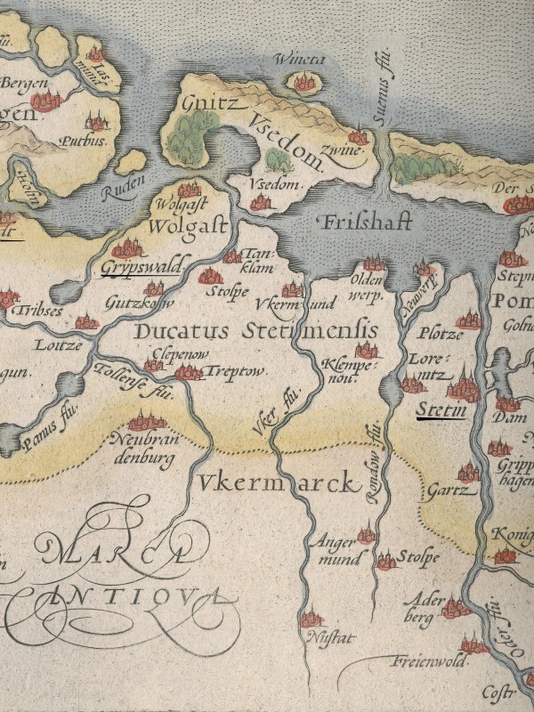
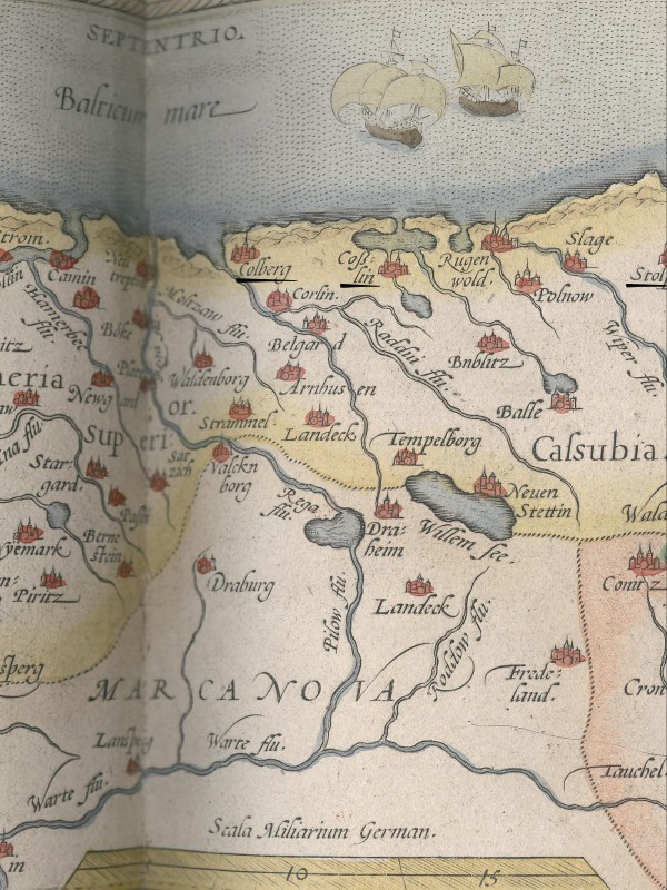
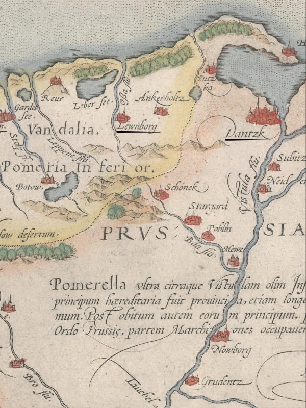
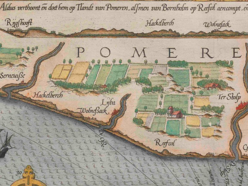
Map of Pomerania from 1587 showing the places Samuel Kiechel visited on his eastward journey
Stralsund
The coach carrying Kiechel and the other passengers arrived in the village of Carimi (Karnin?) in Pomerania in the evening, where they spent the night. The following morning, they continued eastward and reached Stralsund at lunchtime.
Kiechel wrote that Stralsund is a port city under the rule of Ernst Ludwig (1545-1592), Duke of Pomerania. The Duke has his court in the nearby town of Wolgast. Stralsund is large, well-fortified, abundant in water, and set within a beautiful landscape. Fish is sold in the city at reasonable prices. A pike weighing three pounds can be bought for a little more than two Kreuzer. Except for wine, food and drink are quite affordable in Stralsund. Kiechel noted that he spent six days in the city, and it cost him no more than one Reichsthaler.2
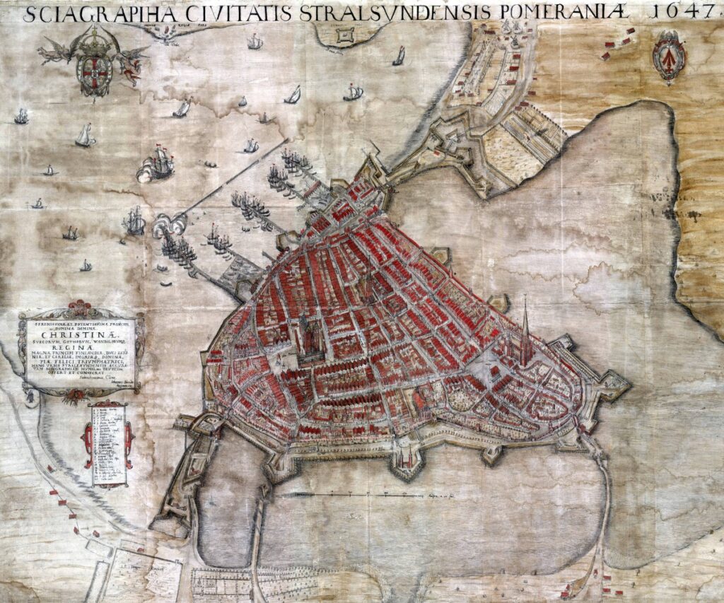
Stralsund 1647; while this view was made sixty years after Kiechel’s visit, it nevertheless conveys an impression of the city and the large lakes surrounding it. The major change in the intervening time would have been the modernisation and extension of Stralsund’s fortifications due to the Thirty Years’ War.
Stralsund lies on the southern coast of the Baltic Sea, opposite the large island of Rügen. In the Middle Ages and early modern period, the city was a member of the Hanseatic League and a major trading port. Its main exports were agricultural products from the surrounding area and beer. Stralsund’s merchants also engaged in intermediary trade in foreign commodities, maintaining profitable connections with Scandinavian and Livonian cities, as well as with Novgorod in Russia. The Protestant Reformation took hold in the city in the early 1520s, and the first Protestant Church Order in Germany was drawn up in Stralsund in 1525.
Although never achieving the status of a free city, Stralsund had been largely autonomous, enjoying a wide range of privileges granted by the Dukes of Pomerania. However, as with other northern German cities in the sixteenth century, the increasing centralisation of territorial domains and the Hanseatic League’s waning influence and internal divisions curbed Stralsund’s ambitions for independence. At the time of Kiechel’s visit, Duke Ernst Ludwig shared rule of the Duchy of Pomerania with his brother Johann Friedrich. Ernst Ludwig ruled Pomerania-Wolgast, while his brother ruled Pomerania-Stettin.
Samuel Kiechel spent six days in Stralsund but did not explain this extended stop. Perhaps he had difficulty finding companions or was still undecided where to go next. He did, however, indicate how he spent his time in the city. Kiechel wrote that there was a beautiful stretch of woodland outside Stralsund, full of oaks and other large trees. In this woodland, many tables were placed. In summer, women and men from Stralsund came there daily for walks, to eat, or to enjoy themselves with dancing and other amusements. Roughly in the middle of the woodland stood a large, beautiful house where a man sold beer.3 The description is detailed enough to suggest that Kiechel visited this place.
We have already heard about recreational areas outside the city walls. The Haarlemer Woods were such a popular destination outside Haarlem that they became a common motif for many artists. Stralsund was, as Kiechel wrote, in a beautiful location. The city was on the sea, and to the landward side, three large lakes surrounded it. The lakes still exist today, but the woodland Kiechel described has long since disappeared.
Via Greifswald to Stettin
Samuel Kiechel left Stralsund on the evening of 11 May. He found a carter travelling east. The man was from the Mark, presumably the Margraviate of Brandenburg south of Pomerania. His cart was empty and pulled by a wretched-looking horse. The two men arrived at a roadside inn that evening. The place was called Teschenhagen. The following morning, they continued and stopped in Greifswald at lunchtime.
According to Kiechel, Greifswald was in Pomerania and located on an arm of the Baltic Sea. There, our traveller had lunch, then went to church because it was Sunday.
In church, Kiechel observed the clothing worn by the women of Greifswald at Mass. He wrote: Their clothes were unusual, as they wore long coats in the style of a Husecke. Each woman’s coat was in two colours. One had a coat half green and half blue; another wore a red-and-yellow coat; and the next wore a different colour again. Kiechel assumed that each woman wore the colours that suited her and that she considered beautiful. The arrangement of the two colours reminded Kiechel of the bailiffs’ clothing in his hometown.4
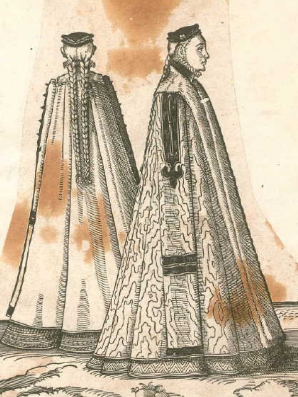
A Husecke was a fur-lined, bell-shaped cloak that reached the floor.
Kiechel and his companion left Greifswald on the same afternoon. The road east led through a beautiful landscape. The travellers arrived in the town of Anklam in Pomerania in the evening and spent the night there.
They continued the next morning, but just a short distance outside Anklam, the horse of Kiechel’s companion grew tired. In the afternoon, the animal was so exhausted that the travellers had to stop. They were in a large forest, and the carter untied his horse and let it graze for a while. Due to this delay, the two men covered only four miles that day and spent the night in a village called Manntelberg (?).
The following day, the road led them through another forest. When they were only three and a half miles from their destination, the city of Stettin (Szczecin), the horse was unwilling to continue. The carter untied the animal and led it into the forest, leaving Kiechel alone with the cart.
Our traveller waited a long time for the man to return, then began calling for him loudly. When he received no answer, he decided not to wait any longer. Kiechel wrote that the place was ideal for ambushes, and they apparently happened quite often there. He took his luggage, left the cart behind, and walked along the road until he reached the next village. There, he paid a carter to take him to Stettin, where he arrived in the evening.
Stettin
Kiechel described Stettin as the capital of Pomerania, and Duke Johann Friedrich (1542-1600) had his court here. The city is not very large but well fortified, and the Oder River flows through its centre. Seventeen miles downstream from Stettin, the Oder flows into the Baltic Sea, allowing ships to reach the city and anchor there. The houses of Stettin look well built, and the city itself is an enjoyable place to stay and not too expensive.5
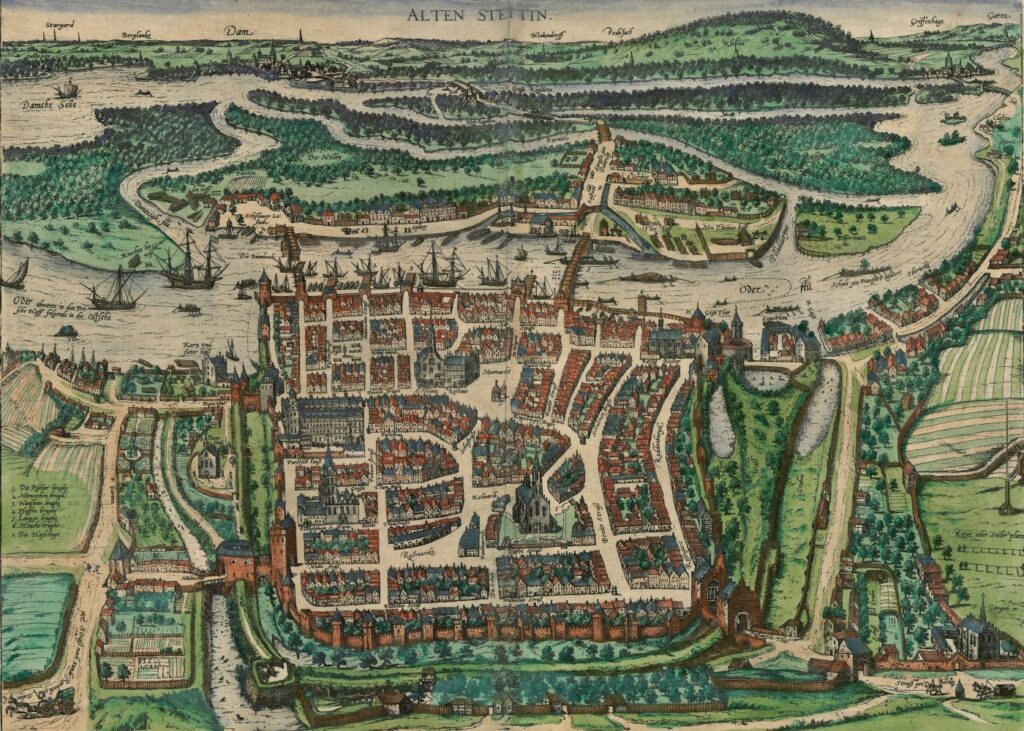
Stettin, 1588
A brilliant bird’s-eye view of Stettin appears in volume four of the Civitates Orbis Terrarum. The city is presented from the west. Stettin is indeed not very large, but well fortified by walls and a moat. The street grid is visible, and various streets, squares and important buildings are named. The Duke’s palace is on the left side of the city (north), right beside the walls.
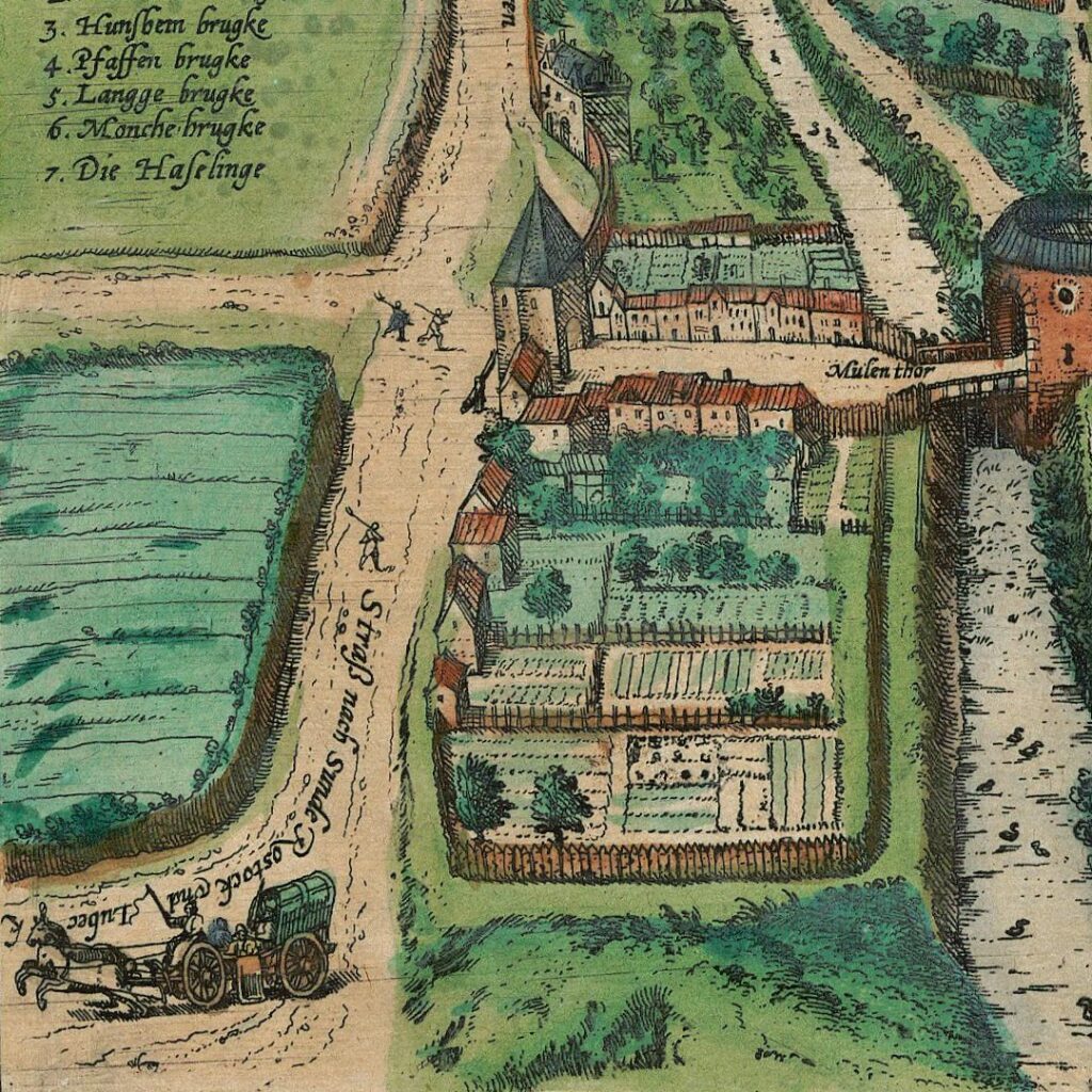
The road from Rostock and Stralsund to Stettin (“Straß nach Sunde, Rostock, Lubeck”). Samuel Kiechel travelled along this road.
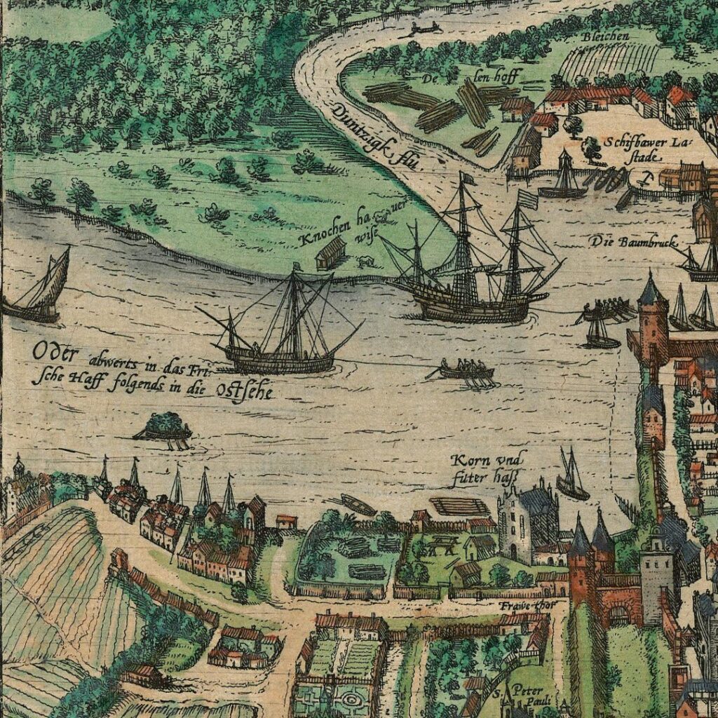
The Oder River north of Stettin towards the sea. The text says: “Down the Oder to the Vistula Lagoon and afterwards into the Baltic Sea” (“Oder abwerts in das Frische Haff folgends in die Ostsehe”). The engravers made a minor mistake here: the Vistula Lagoon is downriver from Gdańsk. The Oder flows into the Oder Lagoon (also known as the Szczecin Lagoon or the Pomeranian Lagoon).
The Oder River is prominently visible. It runs through the centre of the view, and various large ships confirm Kiechel’s remark that large vessels can reach the city and anchor there. The large ships are visible on the left side of the image, and a short text informs the viewer that the river flows in this direction into the Baltic Sea. On the right side of the image (south), smaller boats are depicted travelling on the river. Again, a short text states that the Oder comes from the direction of the city of Frankfurt.
The Oder River was a major economic contributor to the city’s wealth. Like Stralsund and Danzig, Stettin’s major exports were agricultural products, in particular, grain. The Oder was not just a connection to the sea but also inland. Along the river, trade goods arrived in the city, where they were loaded onto merchant ships for export to western Europe.
In contrast to Kiechel’s remarks, the Oder does not flow through the middle of Stettin. The city lies mostly on its western bank, with a wooden bridge spanning the river. The upper half of the view depicts the landscape on the river’s eastern bank and names various villages and towns. The road on the other side of the river even has directions written on it: “Straße gen Dantzig” (road to Gdańsk). This would be the road Kiechel followed when he left Stettin.
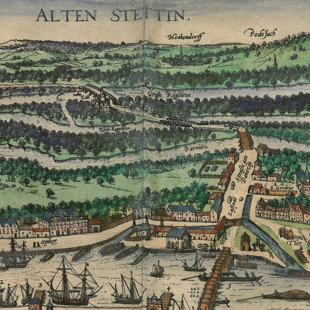
The land east of Stettin, including the bridge over the Oder River and the road to Danzig (“Straße gen Dantzig”)
Along the Road to Danzig
Samuel Kiechel spent four days in Stettin seeking companions to continue his journey. He departed on 19 May in a carriage with a pastor from Prussia, a man from Cologne, and one or possibly two Dutchmen. Kiechel’s account is unclear here. He wrote that there were five people in the carriage. The road outside Stettin was cobbled, and the landscape on both sides was wet and mossy (as seen in the view of Stettin). The group spent the night in a village called Küdorf (?). Kiechel noted that the travellers had been careful to buy provisions in Stettin because the inn offered little to eat.
The following day, the coach continued through a beautiful landscape to the town of Kolberg (Kołobrzeg) in Pomerania. The town was by the sea, and the group spent the night there. They continued the next day and arrived in Köslin (Koszalin) at lunchtime. Duke Kasimir of Pomerania had his court in the town.6
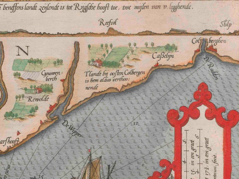
Naval chart of the Pomeranian coast from the north with a coastal profile above (1585). Kolberg (“Colberghen”) and Köslin (“Caßelijn”) are on the right side and Stolp (“Ter Stolp”) in the centre of the map.
Kasimir VI (1557-1605) was another Duke of Pomerania and the younger brother of the above-mentioned Dukes Johann Friedrich and Ernst Ludwig. He was the administrator of the Prince-Bishopric of Cammin.
Samuel Kiechel thought Köslin was not a very pleasant place. Outside the town stood a high hill visible from far out at sea. The traveller heard that many murderers and bandits had once prowled the hill because of its dense thickets, many trees and sunken lanes. Atop the hill stood the ruins of a church where a market had been held every year at a certain time.7
The hill is Góra Chełmska (Germ.: Gollenberg), and at its summit stood a chapel dedicated to St. Mary. The chapel tower also served as a beacon for ships approaching Köslin. The chapel was destroyed around 1530. The rumour Kiechel heard about murderers and bandits on the hill sounds more like a stereotypical view of the time, which associated dense woodland and thickets with outlaws. Our traveller voiced similar fears at various points earlier in his journey.
The travellers left Köslin and arrived in the evening at a village called Malchow (Malechowo), eight miles from Kolberg. The following day (22 May) was the day of Pentecost. Kiechel and his companions travelled to the town of Stolp (Słupsk) in Pomerania. They arrived at noon, had something to eat, and then went to church.
Kiechel noted that Stolp lay beside a small river leading to the Baltic Sea. He witnessed a citizen buying two freshly caught salmon for half a Reichsthaler and considered the price very reasonable.
After church, the group continued their journey and stopped for the night in the village of Rüzekrug (?) in Kashubia. The next morning, they arrived in the town of Lauenburg (Lębork).
Kiechel wrote that Lauenburg was an old and unpleasant place. It was the capital of Kashubia. The people of this land spoke their own language (Kashubian), and they were wicked. Kashubia had many forests but little cultivated land. Among the Kashubians were many noblemen, but most were poor and even had to work their own land. It was not very safe to travel there, and many stone crosses and cairns along the road marked places where someone had been killed. The area was well-suited for theft and robbery because of the many forests.8
Compared with other parts of the journal where Kiechel mentioned banditry or other unpleasant circumstances, this is a rare condemnation of an entire region. The Kashubians are a West Slavic ethnic group with their own language and culture who historically lived in eastern Pomerania. The region Kiechel refers to, Kashubia, was not a territorial domain or province but rather the native land of the Kashubians, defined by language. In the Middle Ages, German settlers moved eastward into Slavic and Baltic lands as far as northeastern Poland and Livonia. The German expansion led to a process of Germanisation in the provinces along the southern and southeastern Baltic coast. But this process was gradual, and, unlike in the twentieth century, there was neither the intention nor the ability to displace or destroy the native population systematically. Therefore, in the sixteenth century, the Kashubians, with their language and culture, still lived in their native lands (and still do today). But, as Kiechel demonstrated, cultural prejudices towards them existed.
The travellers did not stay in Lauenburg. They continued their journey and stopped in the village of Gostantin (Gościcino?) in the evening. The village was in Prussia, which was under the rule of the King of Poland. The group left the following morning (24 May) and drove past the monastery of Oliwa. Kiechel noted that the monastery was set in a beautiful landscape and had an impressive entrance. But they did not stop and arrived in Danzig (Gdańsk) a little while later.
Illustrations & References
All images are in order of appearance with links to sources on external websites:
- Ortelius, Abraham, Theatre of the World, Antwerp 1587, fol. 88v; Library of Congress.
- Anonymous, Sciagrapia Civitatis Stralsundensis Pomeranie, 1647; Riksarkivet Stockholm.
- Anonymous, Landelijke woning tussen geboomte, 1600 – 1699; Rijksmuseum Amsterdam.
- Weigel, Hans, Habitus Praecipuorum Populorum tam Virorum, quam Foeminarum, … Trachtenbuch, Darin fast allerley und der fürnembsten Nationen, die heutiges tages bekand seyn, Kleidungen, …, Nürnberg 1639, fol. XVIII; Bayerische Staatsbibliothek.
- Saftleven, Cornelis, Boer met paardenkar op een landweg, 1666; Rijksmuseum Amsterdam.
- Stettin, in: Braun, Georg, Hogenberg, Frans: Civitates Orbis Terrarum (4), Cologne 1594, fol. 41v; Heidelberg University.
- Waghenaer, Lucas Jansz., Teerste [-tweede] deel vande Spieghel der zeevaerdt, Leiden 1585, pt. 2, fol. 16f; Utrecht University Repository.
- Many placenames in northeastern Europe changed significantly. In contrast to my previous approach of using modern names, I will therefore use the common sixteenth-century names and add the modern names in brackets on the first mention in a post, for example: Stettin (Szczecin) or Reval (Tallinn). ↩︎
- Die Reisen des Samuel Kiechel aus drei Handschriften, K. D. Haszler (ed.), Stuttgart 1866, p. 91; Bayerische Staatsbibliothek. ↩︎
- Ibid. ↩︎
- Ibid., pp. 91f. ↩︎
- Ibid., p. 92. ↩︎
- Ibid., p. 93. ↩︎
- Ibid. ↩︎
- Ibid., pp. 93f. ↩︎