Journal of Samuel Kiechel
7 – 9 June 1585
From Prague to Dresden
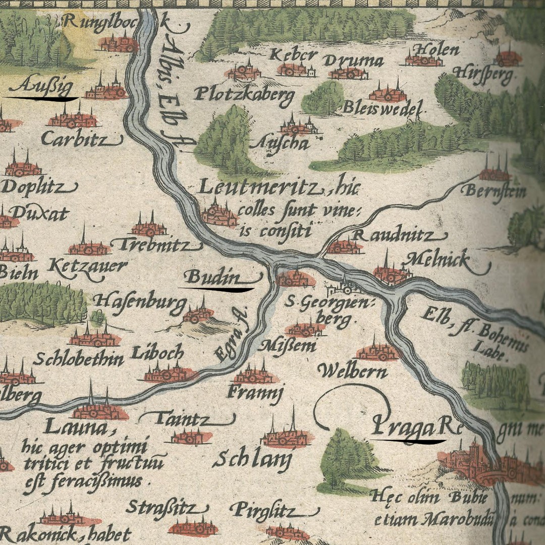
“We left early in the morning and arrived at lunchtime in a town called Aussig on the Elbe. Excellent wine grows there, and in a vineyard on a hill on the Elbe, the best wine in Bohemia is produced and delivered to the court of His Majesty every year.“
Die Reisen des Samuel Kiechel aus drei Handschriften, K. D. Haszler (ed.), Stuttgart 1866, p. 4; Bayerische Staatsbibliothek.
Leaving Prague
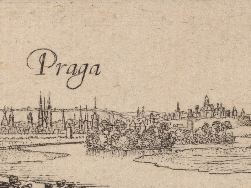
Samuel Kiechel departed Prague in the afternoon of 7 June. He had paid for passage in a carriage to Dresden. With him were two more passengers in the vehicle — a Dutch painter and a chef. Kiechel does not explicitly mention it, but he used a postal carriage for this part of his journey. Our traveller would have noted if he had been invited to travel in a private coach.
The postal carriage carrying our traveller followed a frequently used route mentioned in Daniel Wintzenberger’s itinerary. Prague was the residence of the Emperor, and Dresden the residence of the Prince-elector of Saxony. Kiechel’s coach drove from Prague to Budin (Budyně nad Ohří), where he spent the night. The following morning, it continued and arrived in the small town of Aussig (Usti nad Labem) at lunchtime.
Samuel noted that Aussig, situated on the river Elbe (Czech: Labe), was surrounded by a countryside that produced excellent wine. A hill near the river was home to a renowned vineyard where the best wine in the Kingdom of Bohemia was cultivated. This vineyard supplied the Emperor’s court in Prague.
In the sixteenth century, the region along the Elbe was so renowned for its vineyards that it was even marked on maps. In this map segment, the town of Leutmeritz (Litoměřice) on the opposite side of the river from Budin and Aussig is described as “hic colles sunt vineis consiti” — where hills are covered with vineyards.
The carriage with Kiechel and the other two passengers stopped for the night in Peterswald (Petrovice), a village at the border between the Kingdom of Bohemia and the Duchy of Saxony.
Across the Ore Mountains
The Ore Mountains (Germ.: Erzgebirge) are a mountain range on the border between Saxony (Germany) and Bohemia (the Czech Republic). As the name suggests, the mountains were rich in ore. In particular, tin, silver, copper and iron were mined in the region. The river Elbe had cut a path through the Ore Mountains, and various roads led across their passes.
Samuel Kiechel’s journey from Prague to Dresden followed one of the major transit routes through the mountains — the Kulmer Steig. Kulm (Chlumec) is a town on the Bohemian side of the Mountains, and ‘Steig’ is an old German word for a narrow and steep path. However, the name did not mark a single road but various routes across the eastern part of the Ore Mountains.
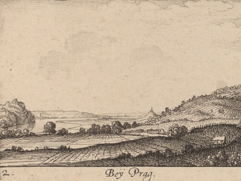
Daniel Wintzenberger’s Reyse Büchlein from 1578 describes the same route Samuel Kiechel took. Wintzenberger mentions the towns of Welbern (Velvary), Budin (Budyně nad Ohří), Labositz (Lovosice), Außig (Usti nad Labem), Peterswald (Petrovice) and Pirna along this route.1
The road from Usti nad Labem to Petrovice led through the Nollendorfer Pass (Nakléřov Pass) and was the easternmost crossing of the Kulmer Steig over the Ore Mountains.
The distance between Petrovice and Dresden was five miles. Kiechel’s carriage covered it in half a day and arrived in the city at lunchtime on 9 June.
Mapping Saxony
A set of regional maps from the late sixteenth and early seventeenth centuries shows the countryside of Saxony. Inspired by the Bairische Landtafeln, the Elector of Saxony, August I (1526 – 1586), commissioned the surveyor Matthias Oeder in 1586 to make a similar set of maps of Saxony. Oeder’s successors finished the maps in the 1630s. Unlike their Bavarian counterparts, the maps of Saxony were never printed and published.2
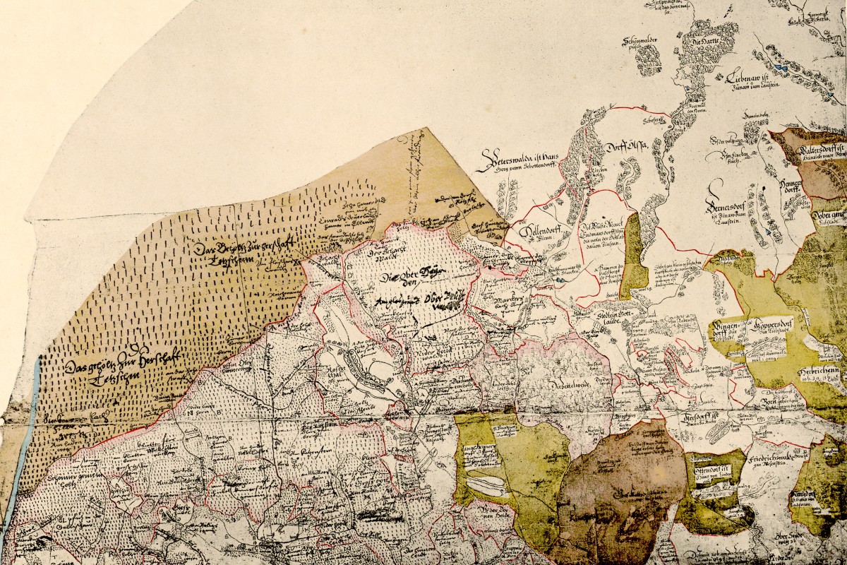
Ore Mountains around Petrovice on the Oeder-Map
Mapmaking in the Sixteenth Century
Compared to previous centuries, mapmaking had evolved rapidly in the sixteenth century. New surveying techniques and improved instruments for measuring distances and angles have been developed. The Dutch physician, mathematician and astronomer Gemma Frisius published Libellus de locorum describendorum ratione in 1533 — a book on the method of triangulation. Geographic accuracy grew in importance and supplanted the religious motifs of medieval cartography. With the help of the printing press, local and regional maps began to be produced and published in large numbers.3
However, despite these developments, no global maps and very few regional or local maps were produced from large-scale surveys. In contrast to measuring fields or local borders, surveying a large area requires a systematic approach. The available instruments for measuring distances were still inaccurate, the mathematical calculations for distances and angles were complicated, and the cost of a large-scale survey was far too high for the individual mapmaker or surveyor.
The Cassini Map of the Kingdom of France was the first map of a whole country made by triangulation and is a good example of the efforts and expenses involved. King Louis XIV commissioned the map and financed its production. Initial surveys began in 1669, but work was interrupted between 1683 and 1700 due to the death of Jean-Baptiste Colbert. Colbert was the First Minister of State under Louis and a major supporter of the endeavour. Louis XIV ordered the work to continue in 1700. The first map was published in 1744. It showed only the borders of France and the triangles used to measure and survey the kingdom. Work continued, and the map was divided into regional and local segments to allow for a larger scale and more detail (landscape, settlements, fields). The final sheets of the Cassini map were published in 1818.
The Oeder-Map
Matthias Oeder surveyed and measured parts of Saxony. However, despite the application of modern techniques, there was no systematic approach. The maps of Saxony are an amalgamation of many local surveys without an overarching framework. Despite these issues, the maps were the most accurate depictions of the region at the time.
The survey maps of Saxony are oriented towards the south. They show the landscape along the river Elbe from the Ore Mountains to Dresden, Meissen and Leipzig as a mixture of villages, small towns, fields and forests. In addition, the maps contain extensive written information about the various places. For every settlement, fortification and economic structure (e.g. mills), as well as forests and meadows, the owner is mentioned by name. Peterswald belonged to Hans Georg von Sebottendorf (on the map “Hans Gerg vonn Sebottendorff”).
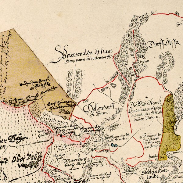
Peterswald/Petrovice (“Peterswalda ist Hans Gerg vonn Sebottendorff”)
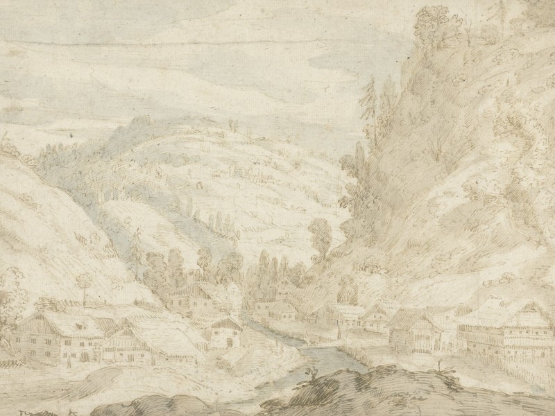
The villages in the higher reaches of the Ore Mountains are presented as elongated and stretched out. These places were along the banks of one of the many small streams of the region. The streams had cut deep valleys into the landscape, and the mountains on both sides hemmed in the settlements.
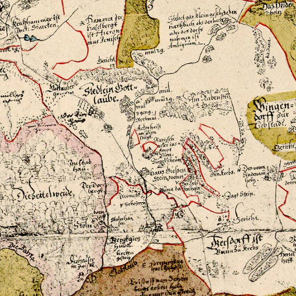
Gottleuba, Gersdorf and “Haus Giessenstein”
A few roads are visible on the maps, but because the mapmakers used no uniform set of symbols, they are difficult to distinguish from the rivers.
Samuel Kiechel’s route led from Peterswald through Gottleuba, Gersdorf and Ottendorf to Pirna on the Elbe. On the maps, a thin line connects all those places.
According to the maps, Kiechel’s carriage travelled past hammer mills and fortifications. The mills were part of the mining industry that processed the ore from the mountains. Fortifications like “Haus Giessenstein” on the river Gottleuba had been built to safeguard this transit route.
From Pirna, the road followed the Elbe to Dresden. In contrast to the many details on the survey maps, Dresden is only depicted by a circular fortification and a bridge across the Elbe. The mapmakers did not even write the name on the map.
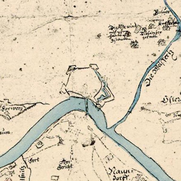
Dresden on the Oeder-Map
Illustrations & References
All images are in order of appearance with links to sources on external websites:
- Nolpe, Pieter, Pakezels op een weg, 1623 – 1653; Rijksmuseum Amsterdam.
- van Cleve, Hendrick, Dresda, 1585; Rijksmuseum Amsterdam.
- Hollar, Wenceslaus, Title Page, Amoenissimae Aliquot Locorum in Diversis Provinciis Iacientiu Effigies, 1635; National Gallery of Arts, Washington, DC.
- Hollar, Wenceslaus, Bey Prag, 1635; National Gallery of Art, Washington, DC.
- Ortelius, Abraham, Theater of the World, Antwerp 1587, fol. 53v; Library of Congress.
- van Valckenborch, Frederik, Gezicht op een dal met een dorp en een bergbeekje, 1598-99; Rijksmuseum Amsterdam.
- Die erste Landesvermessung des Kurstaates Sachsen Auf Befehl Des Kurfürsten Christian I. ausgeführt von Matthias Oeder (1586-1607). Zum 800Jährigen Regierungs-Jubiläum Des Hauses Wettin, Dresden 1889, map 3.
- Ibid, map 9.
- Wintzenberger, Daniel, Ein naw Reyse Büchlein von der Stad Dreßden aus durch gantz Deudschlandt in die andern anstossenden Königreichen und umbligenden Lendern, Dresden 1578. ↩︎
- Die erste Landesvermessung des Kurstaates Sachsen Auf Befehl Des Kurfürsten Christian I. ausgeführt von Matthias Oeder (1586-1607). Zum 800Jährigen Regierungs-Jubiläum Des Hauses Wettin, Dresden 1889. The University of Göttingen provides a digital version: http://resolver.sub.uni-goettingen.de/purl?PPN543440540 ↩︎
- Lindgren, Uta, Land Surveys, Instruments, and Practitioners in the Renaissance, in: Woodward, David (ed.), The History of Cartography, Vol. 3 (Pt. 1): Cartography in the European Renaissance, Chicago 2007, pp. 477-508. ↩︎