Journal of Samuel Kiechel
1 – 10 December 1585
From Ghent to Antwerp
“Antwerp is the capital of Brabant and is under the rule of King Philip of Spain. Before the war, no other city in Europe or the world surpassed it in trade.“
Die Reisen des Samuel Kiechel aus drei Handschriften, K. D. Haszler (ed.), Stuttgart 1866, p. 39; Bayerische Staatsbibliothek.
In Ghent
Samuel Kiechel and his two companions arrived in Ghent on the last day of November. Our traveller described the city as the capital of Flanders and noted that it was regarded as the largest in both Upper and Lower Germany. He observed that Ghent was under the rule of King Philip II of Spain (1527-1598). The father of Philip, Charles (Emperor Charles V, 1500-1558), was born there. On the northeastern side of Ghent, towards Antwerp, our traveller saw a large fortress. It was garrisoned by Spanish soldiers and surrounded by a wide moat.
Kiechel’s remark that Ghent was a German city originated from the region’s historical ties to the Holy Roman Empire and the dynastic connections of the ruling Habsburg family. The Habsburgs had gained control of the Low Countries a century earlier when Maximilian of Austria (later Emperor Maximilian I, 1459-1519) married Mary of Burgundy in 1477. Their son, Philip (1478-1506), married Joanna of Castile in 1498, thereby establishing the Habsburg dynasty in Spain. The Habsburgs now controlled large parts of central and western Europe. Philip’s son, Charles, born in Ghent’s Prinsenhof in 1500, inherited all those territories and, as the first and only ruler of his dynasty, reigned over a vast empire that also included the Spanish colonies in America. He abdicated in 1556, and the Habsburg Empire was divided between Charles’s son Philip II of Spain (1527–1598) and his brother Ferdinand (1503-1564).
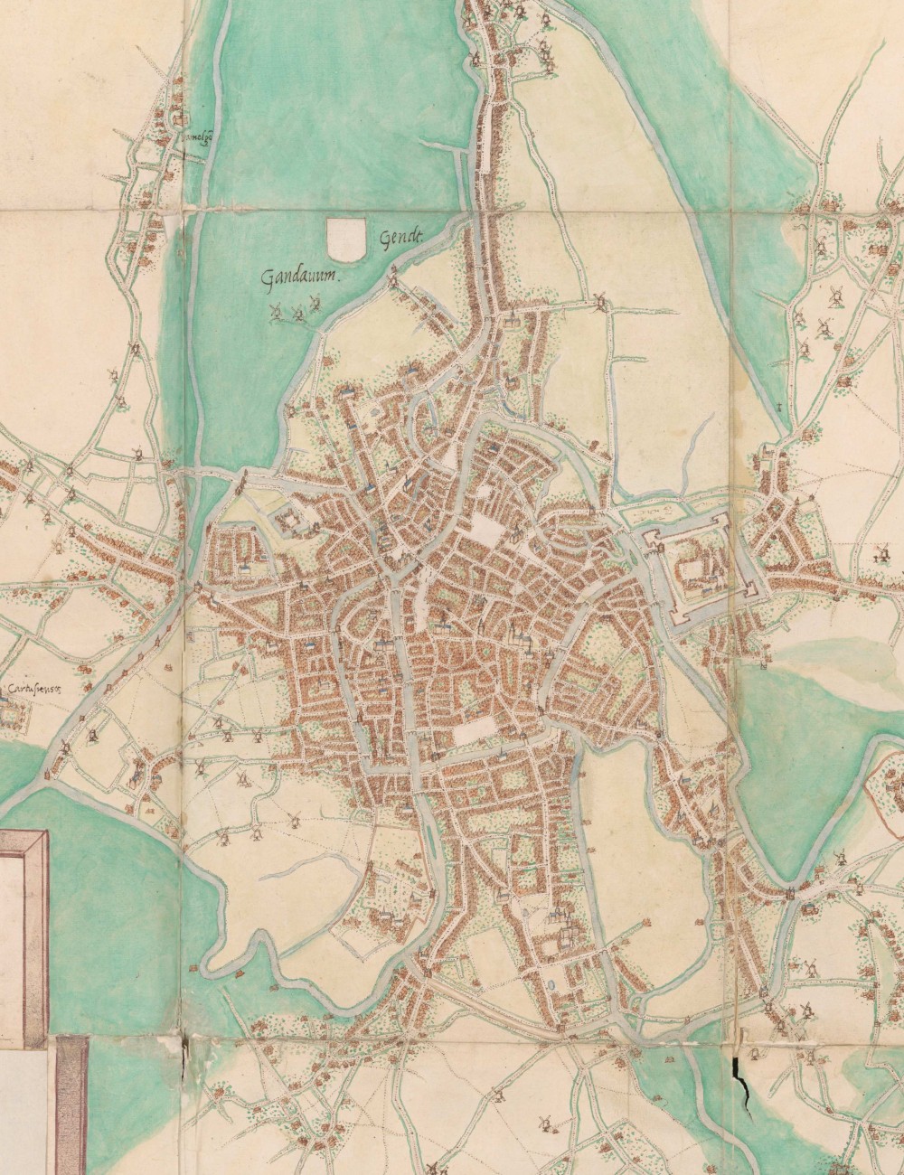
Ghent, 1545
A map of Ghent appears in the Civitates Orbis Terrarum. Similar to those of Saint-Omer, Lille and Kortrijk, it was created by Jacob van Deventer, and the original can be found in his collection of sketch maps. As is customary, the publishers of the Civitates adapted van Deventer’s map to suit their needs. However, this time, much of the surrounding landscape was not cropped away. A notable difference between the two maps is that van Deventer’s view of Ghent is oriented northward, whereas the Civitates shows the city from the west. Additionally, the image in the Civitates includes an extensive legend with 103 entries identifying various locations within the city.
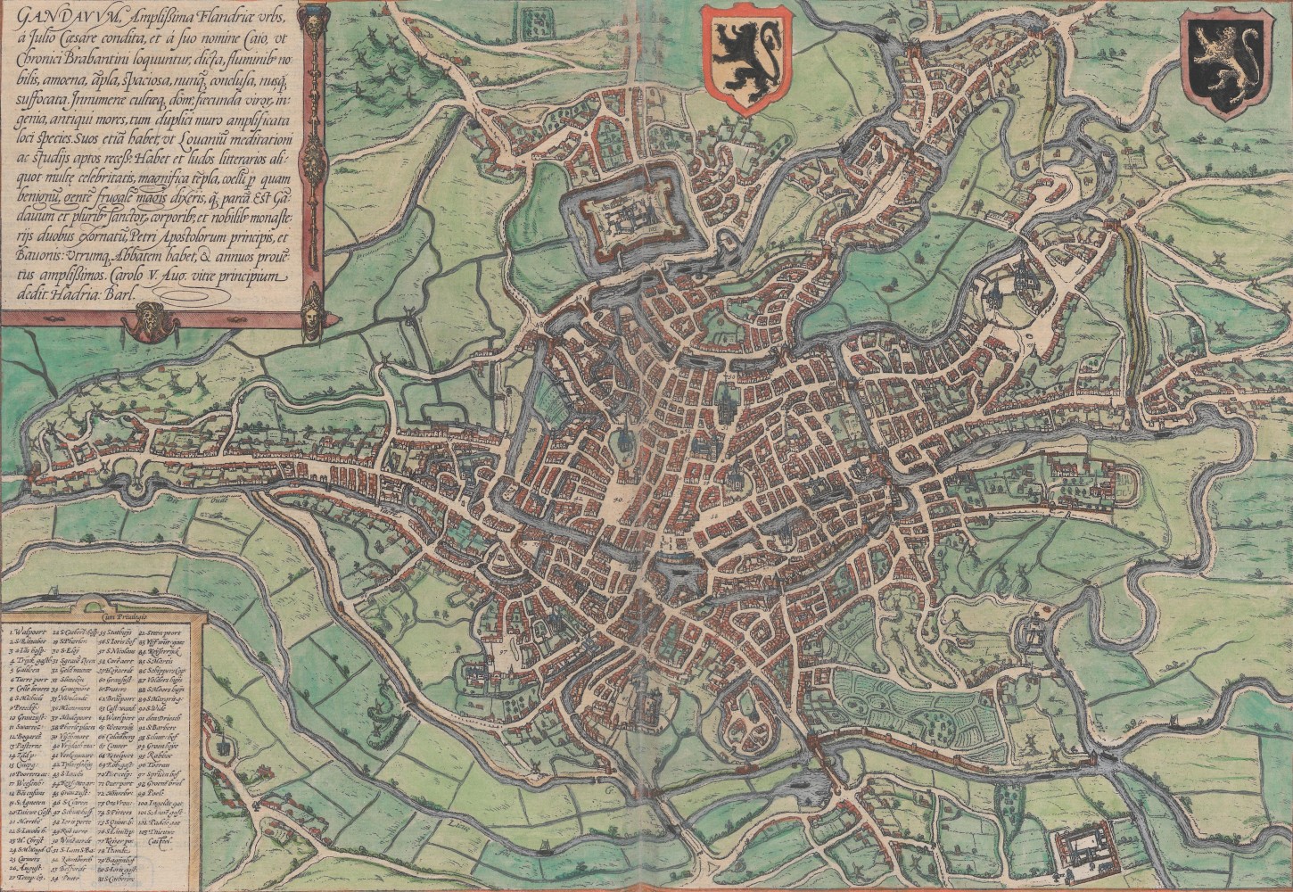
Ghent in the Civitatis Orbis Terrarum, 1572
Both maps show Ghent as a large, sprawling city with numerous canals crisscrossing it. Many windmills surround the city from all directions. A fortress is easily recognisable on the edge of the city. Kiechel mentioned it and wrote that it is garrisoned by Spanish soldiers and surrounded by a wide moat.
The fortress is not Gravensteen Castle, the medieval stronghold that was the seat of the Counts of Flanders and is now one of Ghent’s main tourist attractions. Gravensteen had fallen into decline in the sixteenth century. It is marked as no. 31 in the Civitates print and is located in the centre of the lower half of the map, near where four large canals converge.
The large fortress shown on the maps was built around 1540 under the orders of Charles V, following the citizens’ rebellion against him in the Revolt of Ghent (1539-1540). Saint Bavo’s Abbey once occupied this site, but it was demolished to make way for the fortress. Its purpose was not to defend the city but to control it. As Kiechel noted, Spanish soldiers garrisoned the fortress.
The Road to Antwerp
Samuel Kiechel and his two companions spent the night in Ghent. At the inn, a mercenary approached the group and asked to join them. They agreed and departed together the next morning (1 December).
However, after travelling five miles, the mercenary began to fall behind and eventually stopped in a village. Kiechel’s two companions, who had been with him since London, distrusted the mercenary and suspected him of being a brigand. Our traveller, either because he had his own doubts about the man or, as a foreigner unfamiliar with this insecure region, chose to trust his known companions, agreed. Our traveller added that only the lack of accomplices had prevented the mercenary from robbing them. When the man had fallen far enough behind, Samuel and his companions urged their horses on and rode off at speed.
The travellers safely arrived in the village of Haasdonk in the evening. With some relief, they put their horses in the inn’s stable and were about to take off their boots when the innkeeper rushed in and announced that her best horse had been stolen. The horse was valued at 60 Brabant guilders. Upon hearing this, the messenger was so worried that he spent the night in the stable. Kiechel and his other companion did not sleep well either. Their room had no lock and was on the ground floor facing the road. There was no bed in the room, so the two men had to sleep on benches.
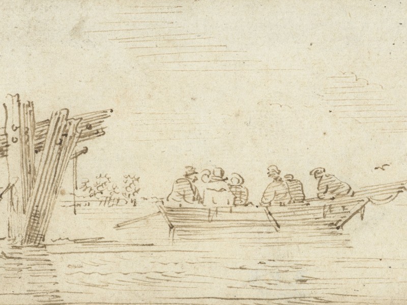
After a few sleepless hours, the travellers left the village before dawn the following morning. They rode until they reached the Scheldt River, half a mile from Antwerp. There, the three men left their horses behind and continued the journey on a small boat. The boat did not travel along the river itself but across flooded land where meadows had once been. They returned to the Scheldt just opposite Antwerp and only had to cross the river to reach the city.
The Siege of Antwerp
The submerged land along the Scheldt River was a consequence of the siege of Antwerp. Antwerp was the economic and cultural centre of the Low Countries and a commercial hub in Western Europe, with the Scheldt River acting as its gateway to international trade routes. The city had joined the Dutch rebellion against Spain in 1579 (Union of Utrecht), after mutinous Spanish soldiers had sacked it three years earlier (1576). During the ongoing war between the Dutch Republic and the Kingdom of Spain, Antwerp was besieged in July 1584 by a Spanish army led by Alessandro Farnese, Duke of Parma (1545-1592).
To defend themselves, Antwerp’s citizens employed a typical Dutch tactic suited to the landscape. They opened the dykes and flooded the surrounding countryside to stop or at least hinder the advancing Spanish troops. Frans Hogenberg, the engraver behind the Civitates Orbis Terrarum and a former resident of Antwerp, created a print of this event in the same year. The image depicts the aftermath of the action, with the area around Antwerp largely submerged.
The submerged land around Antwerp during the siege
However, the Spanish managed to maintain their siege, and by 17 August 1585, Antwerp was forced to surrender. Attempts to relieve the city with the aid of an English army arrived too late. Samuel Kiechel had witnessed the arrival of English soldiers in Vlissingen three months earlier.
After the capitulation, Alessandro Farnese stationed experienced Spanish soldiers in the city. Unlike during the 1576 siege, the Spanish did not sack Antwerp, and discipline among the troops was enforced to prevent a similar massacre. Farnese offered Antwerp’s Protestant population the choice to revert to Catholicism or to leave the city. Those who refused to convert had four years to settle their affairs. Many of Antwerp’s Protestants were merchants and craftsmen. A significant number of them relocated to the northern provinces, helping Amsterdam rise to become the economic and cultural centre of the Dutch Golden Age in the seventeenth century.
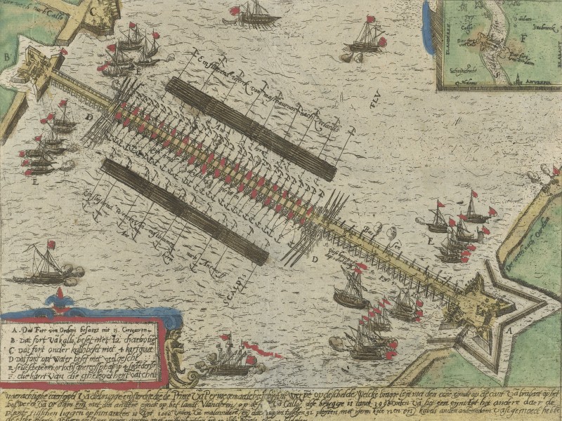
Bridge constructed over the Scheldt during the siege, 1585
Samuel Kiechel heard that Farnese had ordered a floating bridge built to block the Scheldt River and cut Antwerp off from the sea during the siege. The bridge was made of wood and crossed the river downstream of the city. Several attempts by the Dutch defenders to destroy it failed. Kiechel noted that, unfortunately, the bridge had been taken down shortly before he visited the city.
Antwerp after the Siege
Despite Antwerp having recently been besieged for a year and now under Spanish occupation, Samuel Kiechel mentioned no increased security measures or any difficulties when entering, staying in or departing the city.
Our traveller wrote that Antwerp was the capital of the province of Brabant and was under Spanish rule. Before the war, the volume of trade in Antwerp was greater than in any other city in Europe or the world. The trade was so lucrative due to the city’s location and its proximity to the sea. Multiple canals led from the river Scheldt into the city.1
According to our traveller, Antwerp was surrounded by walls, and at one end of the city was a fortress. The fortress walls had been demolished before the siege. After the fall of Antwerp, the Duke of Parma, commander of the Spanish army and governor of the Spanish Netherlands, ordered the walls rebuilt to their previous strength. Spanish troops now garrisoned the fortress, while the soldiers in the city and at the gates were Germans and Walloons. The Spanish removed all the mounted guns from Antwerp and brought them to the fortress. Kiechel went to have a look and wrote that he saw many magnificent pieces of artillery.2
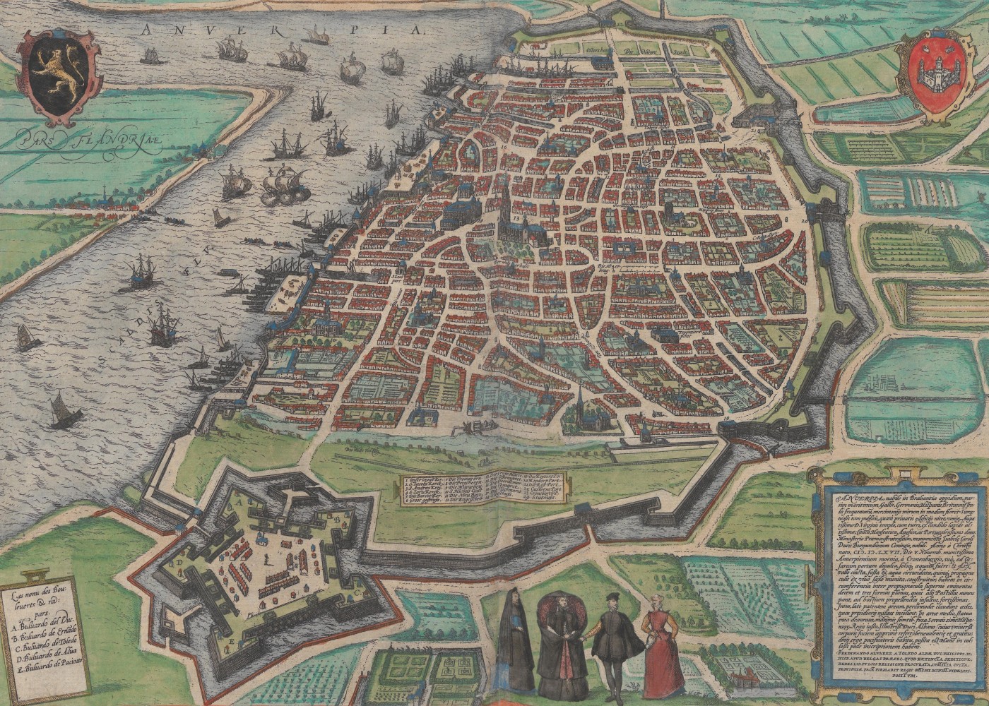
Antwerp, 1572
Two bird’s-eye views of Antwerp are found in the Civitates Orbis Terrarum. The first view depicts the city from the south and is in volume one of the Civitates. This volume was originally published in 1572, before the city was twice besieged. The second view, which presents Antwerp from the east, is found in volume five. Published in 1598, it shows the city after the sieges, when most of the Protestant population had been forced out.
Both views are fairly similar, presenting a very large, heavily fortified city. The Scheldt River is busy with large and small ships, emphasising Antwerp’s commercial success and focus on trade. The fortress, Kiechel mentioned, is also easily recognisable in both bird’s-eye views of Antwerp. It is situated on the southern edge of the city and is surrounded by a moat.
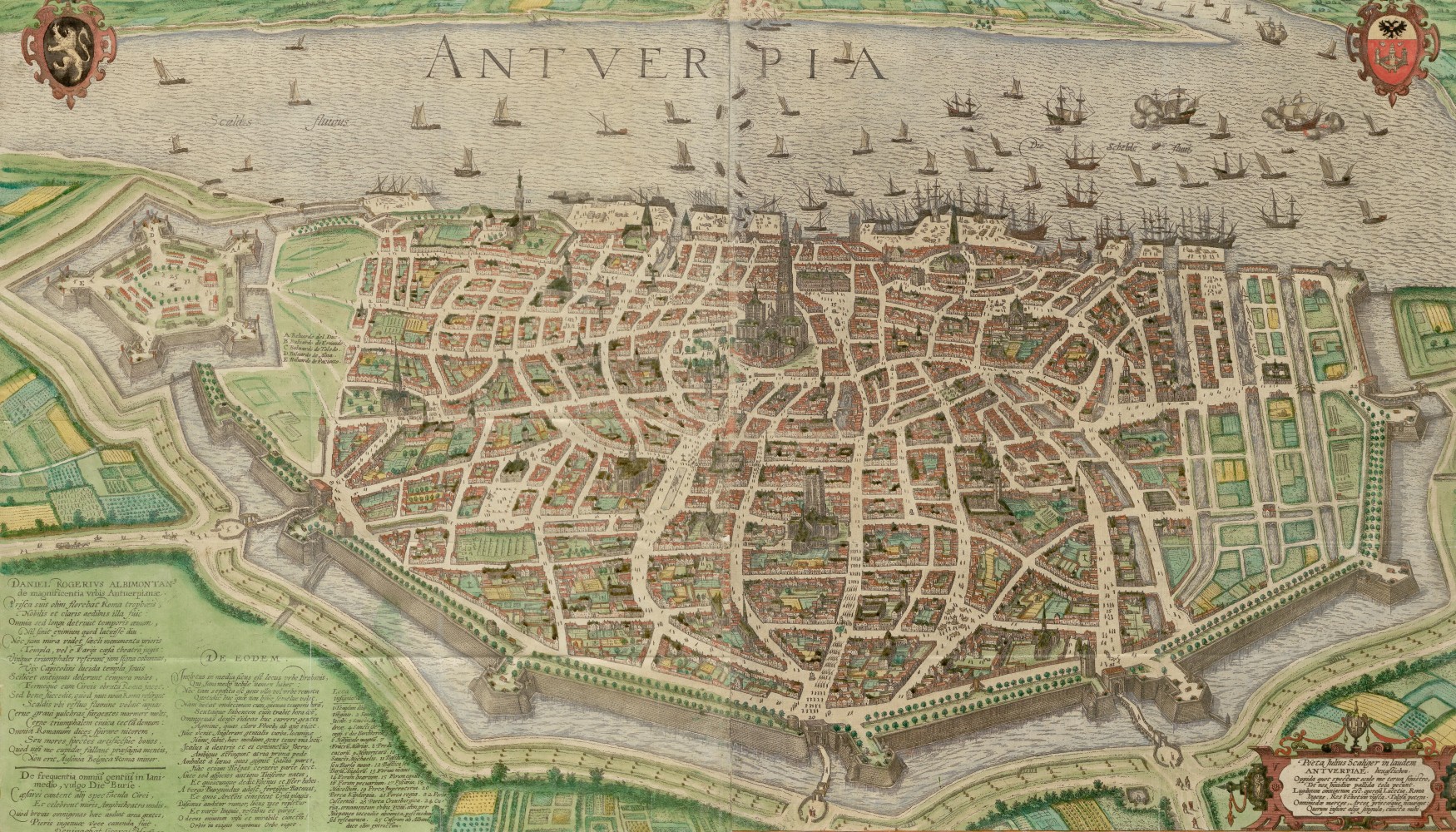
Antwerp, 1598
While the first view shows the city in the typical manner of the Civitates, the artist of the second view, Georg Hoefnagel, filled the streets with many tiny drawings of people, giving the image a lively and busy atmosphere.
Samuel Kiechel explored Antwerp and saw many well-built, tall houses around the market square. The town hall was a particularly beautiful building. Our traveller saw an impressive, high tower. The tower had a clock, and its bells played a verse from the psalter before ringing the hour. Samuel found the bells charming to listen to. The tower was the belfry of the Cathedral of Our Lady.
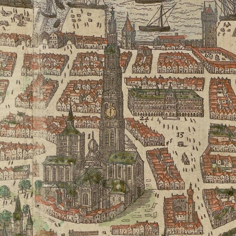
Cathedral of Our Lady and the town hall (located on the right behind the cathedral)
Kiechel also visited the harbour of Antwerp and wrote: In the harbour, each nation has a designated place to moor its ships. The English and Scottish ships have their own quays, as do those from Spain, Portugal, France, Italy and other regions. Each foreign trading nation has its own house. These houses were all well-constructed, decorated and large. Two sides of each house face the land, while the other two face the water’s edge, allowing large ships to moor at its gateway. No other buildings had been constructed around them.
The buildings Kiechel mentioned were warehouses used to store trade goods that ships loaded or unloaded. The river Scheldt and the harbour facilities of Antwerp are visible in both views of the city. The harbour is divided into several quays. In both views, the quays are busy areas with many vessels anchored and goods ready for transportation into the warehouses.
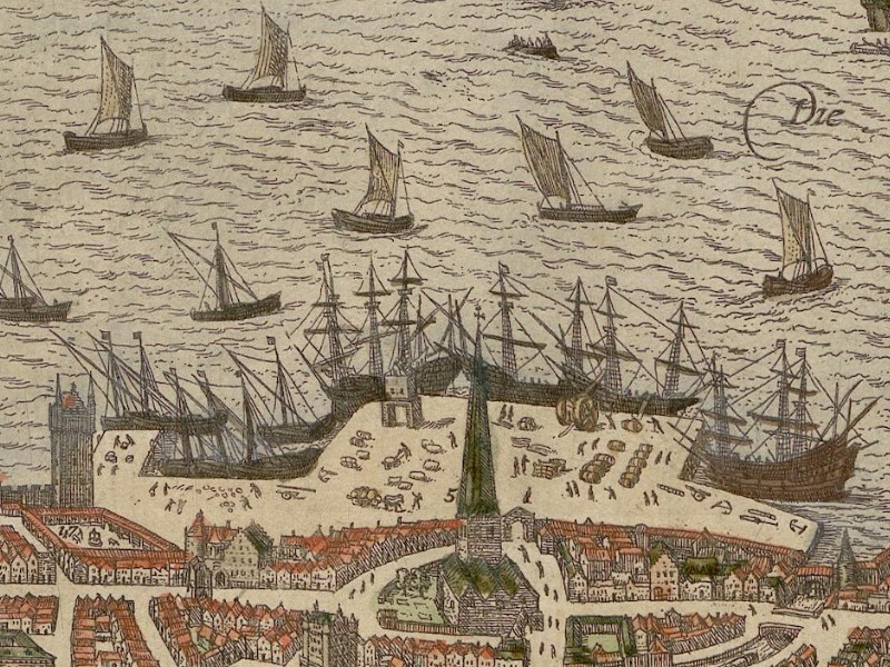
Antwerp harbour
News and Communication
Samuel Kiechel noted that it was common for the children of Antwerp’s citizens to speak three or four different languages, such as French, Italian or Spanish, in addition to their native Dutch. These children went to the city’s stock exchange, where merchants gathered daily. They would seek out large groups of merchants from various countries and listen to their conversations to learn about events elsewhere.
This little anecdote exemplifies how news was transmitted in the sixteenth century. Word of mouth remained the primary means of passing on knowledge. Although there were letters, embassies, messengers, and, thanks to the printing press, leaflets, pamphlets, and early newspapers, they were only accessible to those who could read and write. Most people still relied on oral communication to share news, with all the associated risks, not unlike the distortions in the game of ‘Chinese whispers’.
Visiting an Occupied City
For a city that had just endured a year under siege and surrendered due to famine, Samuel Kieichel did not mention any signs of destitution among the population or destruction within the city. Instead, he noted that there were ways to entertain travellers. Antwerp had schools for fencing and dancing, as well as opportunities to learn musical instruments. Kieichel also observed that the women of Brabant were more modestly dressed than those in Holland, Frisia or Zeeland.
The apparent lack of signs of the long siege might be due to the strict discipline imposed in the Spanish army to prevent sackings and massacres. This discipline meant that, in the roughly four months since its surrender, Antwerp had a chance to recover without interruption. Furthermore, the sixteenth century was a violent era, with the Reformation fuelling religious conflicts. Kiechel may have considered it wise to remain silent on specific issues. Perhaps he did not even notice anything amiss. The traveller had not seen the city before the siege and had nothing to compare it to. He had visited other places in both the Spanish Netherlands and the Dutch Republic, where he noticed damaged or destroyed houses. Witnessing such scenes in a conflict zone might have been nothing unusual for him, as was the presence of soldiers in all larger settlements.
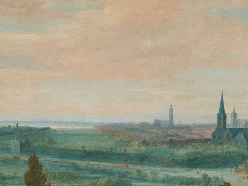
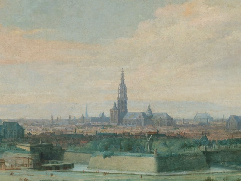
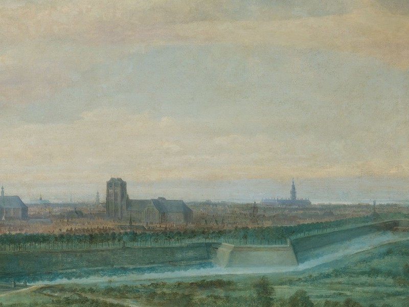
Antwerp, 1636
Our traveller stayed in Antwerp for eight days, until 10 December. He spent his time searching for a new group to travel with to Aachen and then onwards to Cologne. His previous companions, with whom he had travelled since London, had reached their destination.
Eventually, he found five travellers: a messenger, a merchant from Aachen, another merchant from Italy who had his house in Antwerp, a merchant from Cologne, and one from Frankfurt am Main. The group left Antwerp on 10 December for Mechelen.
Illustrations & References
All images are in order of appearance with links to sources on external websites:
- Wildens, Jan, Panoramic View of Antwerp from the East, 1636; Rijksmuseum Amsterdam.
- Ghent, in: van Deventer, Jacob, Planos de ciudades de los Países Bajos, Parte II [Manuscrito], fol. 40, 1545; Biblioteca Digital Hispánica.
- Ghent, in: Braun, Georg, Hogenberg Frans, Civitates Orbis Terrarum (1), Cologne 1593, fol. 15v; Heidelberg University.
- van Goyen, Jan, Veer, 1606 – 1656; Rijksmuseum Amsterdam.
- Hogenberg, Frans, Dijken doorgestoken bij Antwerpen, 1585; Rijksmuseum Amsterdam.
- Anonymous, De schipbrug van Parma over de Schelde, 1585; Rijksmuseum Amsterdam.
- Antwerp, in: Braun, Georg, Hogenberg Frans, Civitates Orbis Terrarum (1), Cologne 1593, fol. 17v; Heidelberg University.
- Antwerp, in: Braun, Georg, Hogenberg Frans, Civitates Orbis Terrarum (5), Cologne 1599, fol. 27v; Heidelberg University.
- Wildens, Jan, Panoramic View of Antwerp from the East, 1636; Rijksmuseum Amsterdam.
- Die Reisen des Samuel Kiechel aus drei Handschriften, K. D. Haszler (ed.), Stuttgart 1866, p. 38; Bayerische Staatsbibliothek. ↩︎
- Ibid., pp. 38f. ↩︎