Journal of Samuel Kiechel
24 – 30 November 1585
From Calais to Ghent
“We left Saint-Omer along a rough, frozen road. The night had been very cold. We could barely find any food for our horses, and throughout the day, we saw abandoned villages and had to be cautious of bandits in the area.“
Die Reisen des Samuel Kiechel aus drei Handschriften, K. D. Haszler (ed.), Stuttgart 1866, p. 36; Bayerische Staatsbibliothek.
Considerations
A notable difference between travelling in the sixteenth century and today is the lack of guidance and safeguards to help travellers avoid dangerous areas and find safe alternative routes. Travellers had to look after themselves, ask around to learn about the road ahead and find trustworthy guides and companions.
Samuel Kiechel’s journey to London had taken him through the Dutch Republic, the Protestant provinces that had declared independence from Spain, roughly corresponding to today’s Netherlands. For his return to Hamburg, he chose a route passing through the southern part of the Low Countries, which had remained loyal to the Spanish king.

Kiechel’s route from Calais to Antwerp (the map is oriented towards the northwest)
The difference between travelling in the Dutch Republic and the Spanish Netherlands is quite stark in Kiechel’s journal. During his passage through the independent provinces, he never mentioned any threat of banditry. At most, there was concern about privateers at sea. But even that danger could be mitigated by the traveller acquiring a passport. Kiechel even sailed on board a privateer to Dover.
However, on the journey from Calais to Antwerp and then to Cologne, our traveller would frequently worry about banditry, comment on the desolation and destruction he saw, and barely escape an ambush. His route brought him close to the front lines of the conflict. The bandits Kiechel feared were, in part, criminals, marauding mercenaries, or impoverished peasants making a living, as well as Dutch troops sent on raids to disrupt traffic and harass the Spanish garrisons in the area.

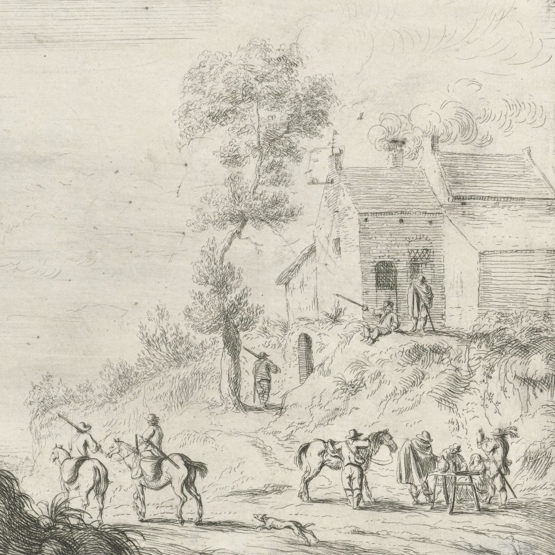
Bandits lying in ambush, 1627
The options for safe, alternative routes to avoid the region were limited. As our traveller knew, taking a ship back to Germany put him in danger from privateers prowling the Channel and North Sea Coast. More importantly, it left him dependent on the wind and weather as winter rapidly approached. Circumventing the war-torn area to the south would have meant a lengthy detour.
While in Calais, Kiechel considered his options and thought of travelling to Paris instead. However, he could not find new companions when inquiring about the route. Furthermore, Paris was not an appealing destination to him; he mentioned that he had already visited the French capital on a previous journey.
Our traveller, therefore, decided to stay with his two companions, whom he had arrived with from London, and risk the route to Antwerp.
As a sidenote, this passage in the journal is the only instance where Samuel Kiechel mentions that this endeavour was not his first journey and that he had previously spent some time in Paris. Nothing else is known about this visit to the French capital, as Samuel refers to it only briefly and provides no further details. Kiechel was twenty-three when he embarked on his four-year-long adventure, so his visit to Paris was probably just a short trip lasting a few months, maybe up to a year at most. The visit was long enough for him to learn French and was likely part of his education.
Delayed Departure
Our traveller had left London with two men from Antwerp who wished to return home. One of them was a messenger. As was often the case with Kiechel, he chose companions familiar with the region he planned to travel through and, hopefully, knew the roads. A messenger from Antwerp was therefore the perfect choice.

The three men planned to leave Calais on 24 November. In preparation, the messenger arranged for Kiechel to rent a horse. Our traveller would only need to pay for the horse’s food during their journey to Antwerp; otherwise, the messenger would look after the animal. Kiechel did not specify how much he paid for the horse, nor did he mention where the messenger obtained it. Calais was part of a postal route, and the messenger presumably traveled it regularly and had access to horses at the postal station. In the late sixteenth century, it was not uncommon for travellers to accompany postal riders and rent horses at staging posts.
Kiechel’s other companion, a young Dutchman, decided to save money and, instead of renting, bought a cheap horse in Calais.
On the morning of their scheduled departure, the travellers learnt that a group of French royal messengers had arrived at the gates of Calais. They were travelling on urgent business to Paris. The French messengers had sixteen horses and wanted to exchange them for fresh animals, so they stopped and seized all horses entering or leaving Calais.
When Kiechel’s companions heard of this, they concealed their animals. Our traveller learnt that royal messengers had the right to seize any horse if necessary. Because of this incident, the three men decided to delay their departure by another day and wait until the French messengers had left.
The authority of royal envoys to confiscate horses without compensation was common in various parts of Europe, such as Sweden and the Ottoman Empire. Travellers had to be alert and hide their animals if they wished to avoid being left as pedestrians. Kiechel would, at a later time, fall prey to this practice himself, but he also attempted to exploit this rule by claiming to be a royal messenger to secure a horse.
A Troublesome Horse
Apart from the brief journey from Gravesend to Dover, the route from Calais to Antwerp and on to Cologne marked Samuel Kiechel’s first experience of travelling long distances on horseback. The quality of the horse was vital for such a trip. Having some knowledge of the animal’s physiology and an eye for its worth proved beneficial. Samuel Kiechel’s remarks and actions suggest that he was familiar with riding and had at least a basic understanding of horses. A key lesson from travelling on horseback was not to buy the cheapest animal to save money. However, Kiechel would also find that more expensive, healthy-looking horses could still cause problems.
The importance of a good horse and the benefit of renting rather than buying became evident when our traveller left Calais. Kiechel’s other companion, the young Dutchman, had purchased a cheap horse to cut costs. The road from Calais was poor, and after about two miles, the young man’s horse showed signs of lameness. Within the following hour, the animal fell three times. On the third fall, the travellers struggled to get the horse back to its feet. After this, the young Dutchman no longer dared to ride and instead led the horse by hand.

Due to these setbacks, the messenger decided not to waste more time and continued alone. Stuck with a lame horse and perhaps feeling a little anxious, the young Dutchman asked Kiechel to stay with him until they reached a settlement. Kiechel placed the young man’s bag on his horse, and they walked for half an hour until they spotted a cottage. There, the young man paid a peasant to take the horse back to Calais, while he chose to continue on foot. Kiechel remarked that he doubted the horse would reach the city. The land was ravaged, and the population impoverished by the prolonged war. He believed the local peasantry survived mainly through theft and robbery.
Our traveller accompanied the young man for a while longer until they reached a point on the road where a footpath branched off to one side. The path was too narrow for Kiechel’s horse, and the two men parted ways. Our traveller then hurried on, as it was already late in the afternoon. His destination was still far away, and he did not know the way. Moreover, the road was particularly rough at that time of year. Christmas was just a month away.
Eventually, Kiechel arrived at an inn outside the town of Saint-Omer after dark. Inside the inn, he found his other companion, the messenger, and both men decided to reunite and continue together.
Into the Spanish Netherlands
The next morning (26 November), after the gates of Saint-Omer had been opened, Kiechel entered the town. There, our traveller had to wait for a while because the messenger had some business to attend to. Kiechel wrote: Saint-Omer is in the county of Artois, one of the seventeen provinces of the Spanish Netherlands. The town is small, but its buildings look pleasant and tidy, and its streets are neat and straight.
Kiechel’s fascination with long, straight streets is evident throughout his journal. He does not specify a reason for his preference. Presumably, the openness and apparent spaciousness of a straight, broad street offered a pleasant contrast to the tight and cramped feeling of narrow, winding streets in southern German towns.

Saint-Omer, 1545
The Dutch cartographer Jacob van Deventer produced maps of all towns in the Spanish Netherlands, including those visited by Samuel Kiechel. The map of Saint-Omer reflects van Deventer’s typical style, showing a plan view oriented to the north with the surrounding countryside also visible. The street grid of Saint-Omer is clear, with many streets appearing long and straight. Van Deventer marked churches and fortifications, while other buildings were indicated by short zigzag lines representing roofs and gables. A wall and moat fortified Saint-Omer, but the town had already expanded beyond these defences, particularly along the road to the north, where many houses had been built. Samuel Kiechel arrived from that direction, and among the houses could have been the inn where he spent the night.
Van Deventer’s map was also published in the Civitates Orbis Terrarum. To match its style, the publishers had cut the map to show only the city, excluding the surrounding countryside. Contrary to Samuel Kiechel’s comments that Saint-Omer was relatively small, the town appears fairly large, with numerous churches and other notable features.

Saint-Omer in the Civitates Orbis Terrarum
While our traveller waited in Saint-Omer for the messenger to finish his business, the young Dutchman he had left the day before arrived. The young man was accompanied by a peasant who had guided him to Saint-Omer overnight. Having learnt from his misfortune the previous day, he now also decided to rent a horse from the messenger, and together they left Saint-Omer and continued towards Antwerp.
It was already late in the year, and winter was rapidly approaching. Kiechel observed that the road outside Saint-Omer was rough and frozen. Throughout the day, the travellers struggled to find food for their horses. The settlements they passed were partly abandoned, and the three men grew concerned about the presence of bandits in the area. After nightfall, the group arrived at the town of Béthune, where they spent the night in the suburb outside the walls.

Béthune, 1545
Jacob van Deventer’s depiction shows Béthune as a fortified town. Like Saint-Omer, it had begun to expand beyond its walls. On the map, suburbs are visible to the north and south.
A profile view of Béthune is featured in the fourth volume of the Civitates Orbis Terrarum.

Béthune, 1588
Kiechel does not comment on Béthune. The group spent the night in the suburbs, and they may not even have entered the town. The three men left the following morning for Lille. According to our traveller, the journey from Béthune to Lille passed through a beautiful, pleasant landscape. The sudden shift in Kiechel’s description, from references to a devastated and bandit-infested land to a pleasant area, is noteworthy.
The travellers arrived in Lille in the evening. Lille was the capital of the county of Artois. The city was large and beautiful. Although most of its houses were constructed of wood, Kiechel found the place pleasant and clean. Lille was heavily fortified, with a well-guarded gate. The travellers had to state their names and places of origin before being allowed entry. The guards documented these details, and, as usual, the same information was requested of the travellers at the inn.

Lille, 1545
Kiechel further wrote that Lille was not garrisoned by foreign soldiers. Its citizens organised the city’s defence. The inhabitants of Lille spoke both Spanish and French. The French language was called “wallon” (Walloon). The people of Lille produced yarn, knitted stockings, and similar items.
Again, maps of Lille are in the Civitates and the collection of Jacob van Deventer.

Lille in the Civitates Orbis Terrarum
The map in the Civitates was a copy of van Deventer’s map, adapted to match the publication’s style. While van Deventer’s map has no other textual descriptions besides the city’s name, the map in the Civitates includes a legend that identifies the gates, churches and a few other buildings in Lille.
Samuel and his companions spent half a day in the city because the messenger had to collect and deliver letters. At lunchtime (29 November), they departed and headed towards Kortrijk. Their route took them through a flat and pleasant landscape. However, the area was deserted, and the villages had been destroyed. Kiechel noticed many thickets and undergrowth where bandits could hide.
The travellers crossed into Flanders and arrived in Kortrijk in the evening. In the city, Samuel observed many abandoned buildings but thought the place was still well fortified. The inhabitants mainly spoke French, but Kortrijk was under the rule of the King of Spain.

Kortrijk, 1545
The three men stayed overnight and left Kortrijk the next morning. They travelled all day through damp, moss-covered woodland. The travellers could not find any food for their horses as they rode past deserted villages and neglected fields. The messenger was very worried, as this area was perfect for an ambush. Eventually, Samuel Kiechel and his companions arrived safely in Ghent in the evening.
Illustrations & References
All images are in order of appearance with links to sources on external websites:
- Brueghel, Jan, A Woodland Road with Travelers, 1607; Metropolitan Museum of Art, New York.
- Ortelius, Abraham, Theater of the World, Antwerp 1587, fol. 30v; Library of Congress.
- Van de Velde, Esaias, Struikrovers wachtend in een hinderlaag, 1627; Rijksmuseum Amsterdam.
- Van den Hoecke, Robert, Soldaten bij een weg, 1632 – 1668; Rijksmuseum Amsterdam.
- ter Borch, Gerard, Man die het zadel van een paard verschikt, 1631; Rijksmuseum Amsterdam.
- Stoop, Dirk, Staand paard, naar links, 1628 – 1681; Rijksmuseum Amsterdam.
- Saint-Omer, in: an Deventer, Jacob, Planos de ciudades de los Países Bajos, Parte II [Manuscrito], fol. 34, 1545; Biblioteca Digital Hispánica.
- Saint-Omer, in: Braun, Georg, Hogenberg Frans, Civitates Orbis Terrarum (4), Cologne 1594, fol. 8v; Heidelberg University.
- Béthune, in: van Deventer, Jacob, Planos de ciudades de los Países Bajos, Parte II [Manuscrito], fol. 26, 1545; Biblioteca Digital Hispánica.
- Béthune, in: Braun, Georg, Hogenberg Frans, Civitates Orbis Terrarum (4), Cologne 1594, fol. 7v; Heidelberg University.
- Lille, in: van Deventer, Jacob, Planos de ciudades de los Países Bajos, Parte II [Manuscrito], fol. 52, 1545; Biblioteca Digital Hispánica.
- Lille, in: Braun, Georg, Hogenberg Frans, Civitates Orbis Terrarum (3), Cologne 1593, fol. 19v; Heidelberg University.
- Kortrijk , in: van Deventer, Jacob, Planos de ciudades de los Países Bajos, Parte II [Manuscrito], fol. 42, 1545; Biblioteca Digital Hispánica.