Journal of Samuel Kiechel
1 August 1585
From Haarlem to The Hague
“Further along the road is an open town called ‘in den Haag’. It is a pleasant place with many beautiful houses. Many noblemen live there, especially in the summer. The name of the place fits. Shrubbery and bushes surround the town like the wall of a city.“
Die Reisen des Samuel Kiechel aus drei Handschriften, K. D. Haszler (ed.), Stuttgart 1866, pp. 16-17; Bayerische Staatsbibliothek.
The Road to Leiden
After visiting Amsterdam and Haarlem, Samuel Kiechel continued his journey along the Dutch coast westward. Amsterdam was the economic centre of the young Dutch Republic. Now, our traveller would visit the political centres, The Hague and Delft.
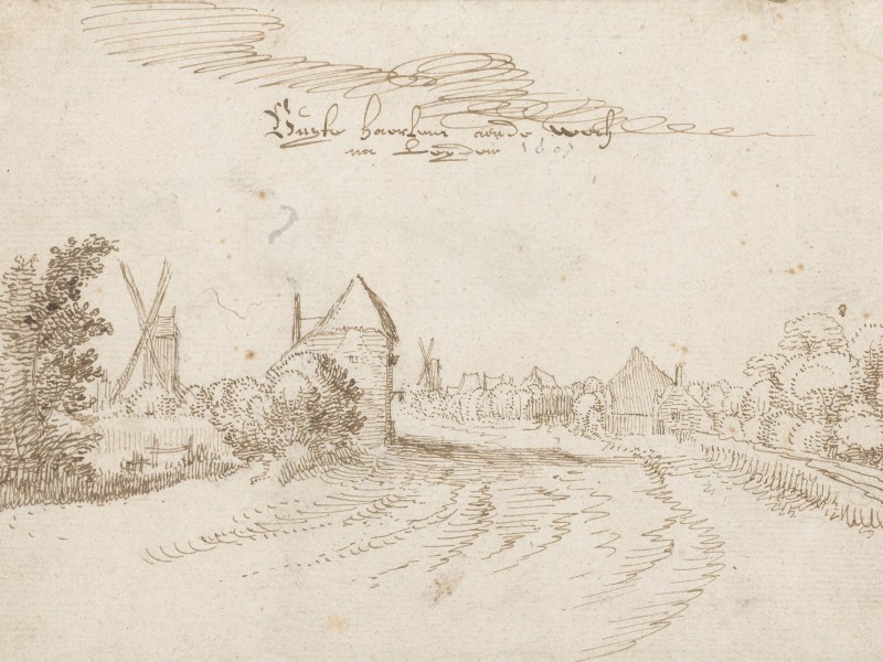
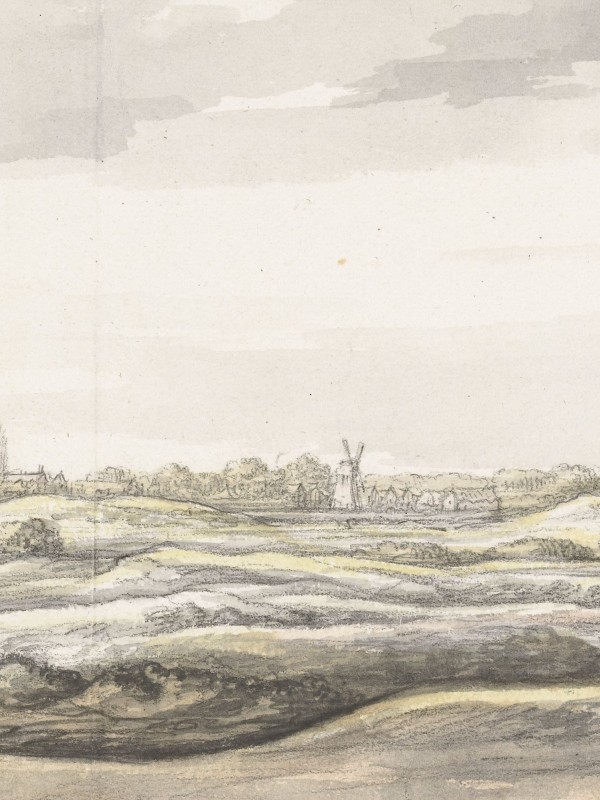
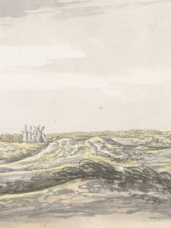
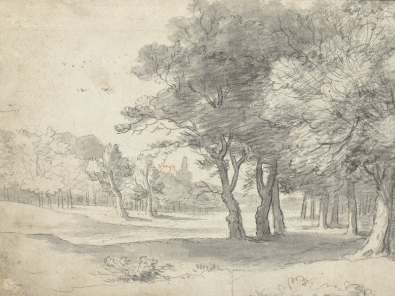
Claes Jansz. Visscher, The road to Leiden, 1607
Kiechel spent just one night in Haarlem and left the city on 1 August, travelling in the back of a cart. The cart carried a total of eleven passengers, including a young child and the driver. They travelled through a flat, sandy landscape towards Leiden.
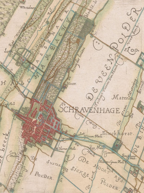
The Dutch countryside in the sixteenth century is well documented due to the flourishing of landscape art during this period. Additionally, the highly detailed map of the Hoogheemraadschap van Rijnland, the regional water authority, depicts the roads and settlements in the region.
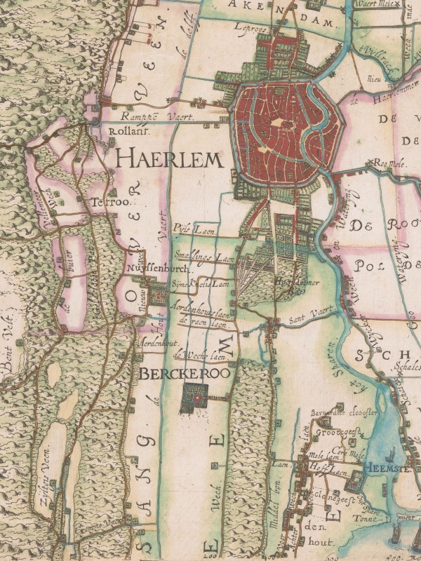
Haarlem and Haarlem Woods (south of the city). The road to Leiden passed by the Woods.
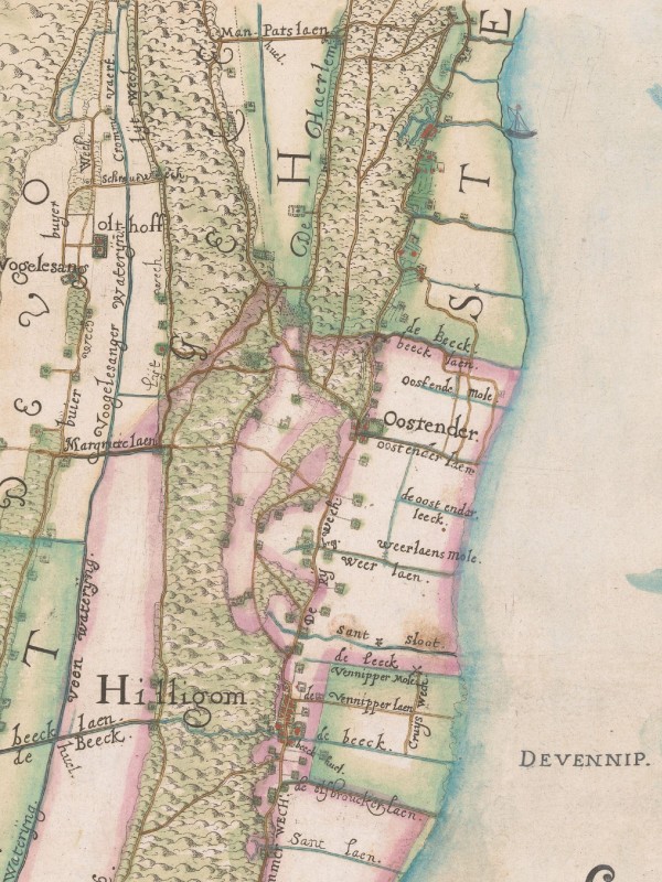
The road to Leiden runs south past the Haarlemmermeer.
Leaving Haarlem, the cart with our traveller first passed the Haarlem Woods (“Haerlemmer Bos“), a wooded area popular for day trips. The cart continued along a road labelled “De Haerlem Wech” on the map. This road runs between the large Haarlemmermeer to the east and the sandy dunes of the North Sea to the west.
South of the Haarlemmermeer, the road carried on across poldered farmland. The cart passed by farmsteads and through several villages until it reached Leiden, twenty-five kilometres south of Haarlem.
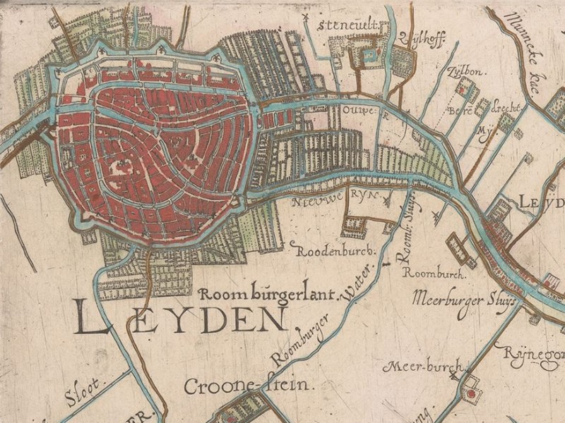
Leiden
Samuel Kiechel did not stop in Leiden. Apparently, the cart just drove past the city and maybe dropped off some passengers. Our traveller merely mentioned that Leiden has a university.
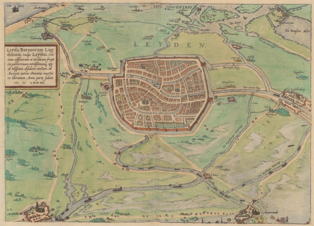
Leiden, 1575
Although our traveller passed by the city, the bird’s-eye view of Leiden remains worth examining. Unlike most other images in the Civitates Orbis Terrarum, the depiction of Leiden includes a considerable proportion of the surrounding countryside. The city is viewed from the south, with meadows, fields and light woodlands encircling it. Nearby villages such as Leiderdorp, Zoeterwoude, Voorschoten and several smaller hamlets are also visible. In the lower part of the map (to the south), warships can be seen sailing on a canal towards Voorschoten, accompanied by scenes of battle.
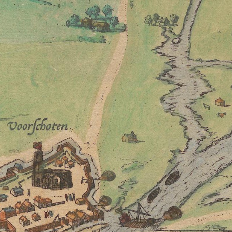
Example of the battle scenes seen in the bird’s-eye view of Leiden
Like some other images in the Civitates, the bird’s-eye view of Leiden was a reproduction. The original view was created by Pieter Bast in 1574. Bast’s map is a so-called news map.1 News maps were employed to communicate and illustrate significant events, often battles. The development of regular postal networks across Europe coincided with rising demand for more reliable and consistent news. For cartographers, merging current events with mapmaking was merely a small step. Maps already served a variety of purposes, from practical uses such as naval charts to decorative functions. In the case of Leiden, the map depicts the unsuccessful Spanish siege of the city in 1574.
The expanding suburbs outside the walls of Leiden
After the siege, during the last two decades of the sixteenth century, Leiden saw an influx of migrants from the southern, Spanish-controlled provinces and began to grow. This map segment shows the sprawling suburbs that developed outside the old city walls.
Leiden’s expansion included not only new houses but also many gardens. Unlike today, food availability was not always guaranteed, and preservation methods were limited. Wars, droughts or failed harvests could quickly impact food supplies. Since the Middle Ages, city inhabitants often had a plot of land outside the walls used as a garden or for keeping animals, which helped supplement the food available in the markets.
The Hague
The cart carrying Samuel Kiechel and the other passengers continued its journey and soon arrived in The Hague. Our traveller described the city as an unfortified, spacious and pleasant place. It features many beautiful houses that serve as the nobility’s summer residences.
Kiechel mused that the city’s name is fitting because it is surrounded by abundant shrubbery and forest, resembling a natural wall. In German, the word “Hag” refers to a place enclosed by hedges and trees. This view by Aelbert Cuyp offers an impression of how the city must have looked to our traveller:
View of The Hague
The Hague had been a residence for the Dutch nobility since the Middle Ages. The town grew into a city but never received official city privileges.
The bird’s-eye view of The Hague in the Civitates Orbis Terrarum presents it as a sprawling place. Meadows, pastures and gardens surround The Hague, and narrow canals run through it.
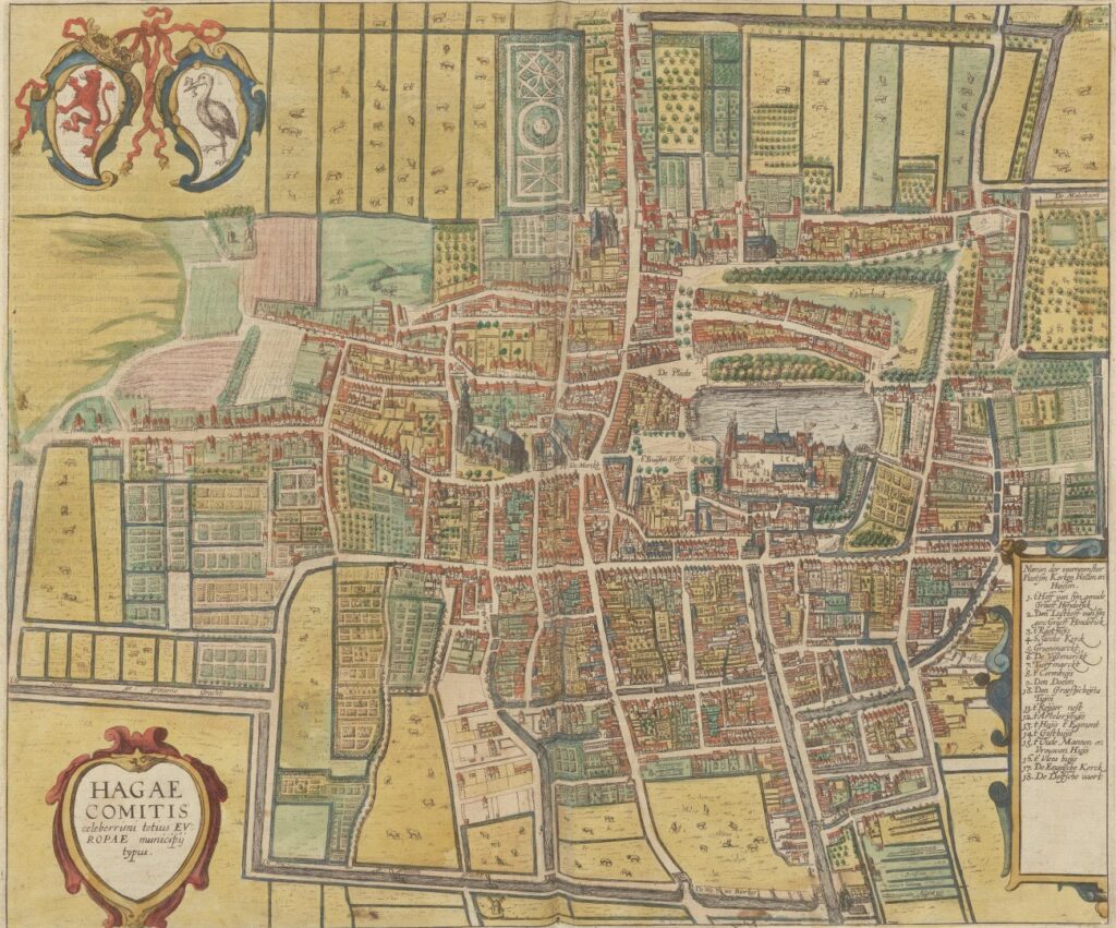
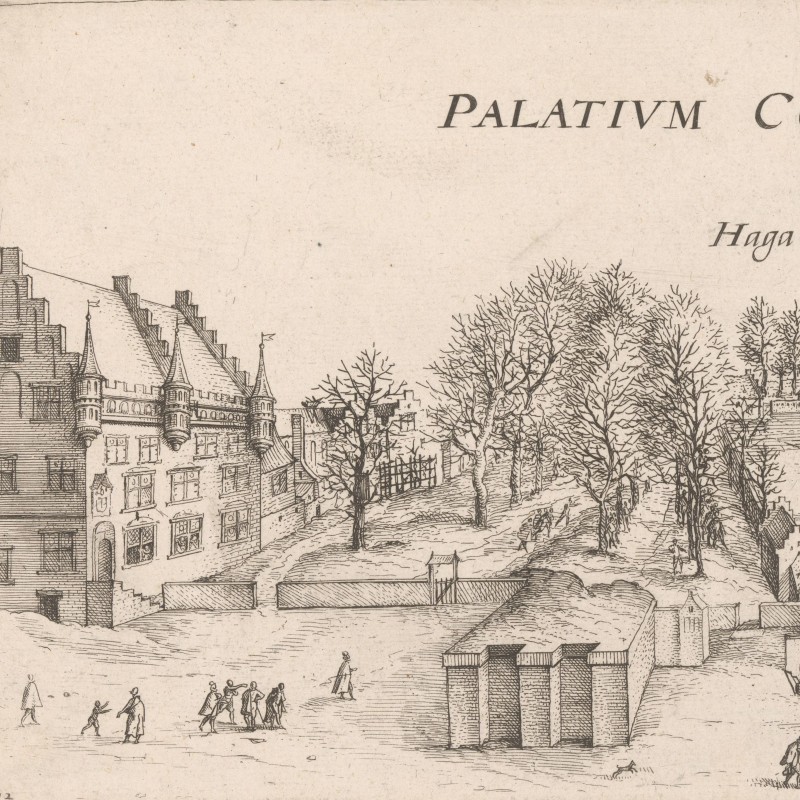
The Hague, 1618
In contrast to the compact layout of Leiden and many other central European cities, where all available space was used for houses, The Hague features parks and other open areas, with a rather generous spacing of properties in some parts of the town.
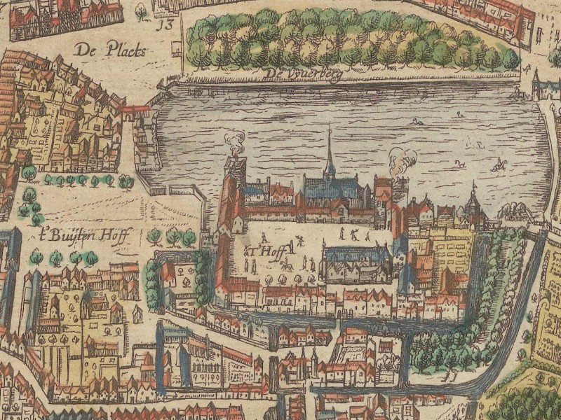
The Binnenhof-Palace in The Hague
In the centre of the view is the Binnenhof, a palace complex that initially served as the residence of the Counts of Holland. After the Dutch Republic declared their independence in 1581, the Binnenhof became the meeting place of the States General — the legislative assembly comprising representatives from each province.
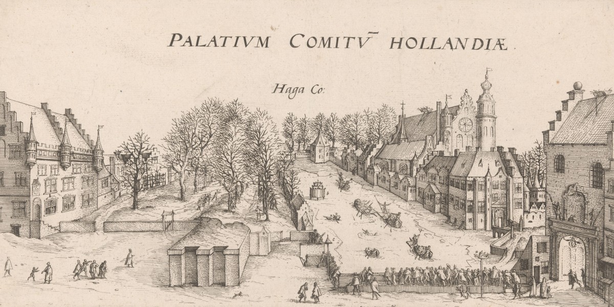
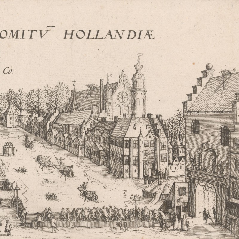
The Hague suffered during the Eighty Years’ War (1568-1648). Spanish troops captured and looted it at the beginning of the conflict due to its lack of fortifications. However, by the time Samuel Kiechel visited, the city had recovered. It left our traveller with the impression of a pleasant and prosperous place. A table on the right-hand side of the bird’s-eye view details eighteen churches and other notable sites. This high number of churches was impressive for such a small place.
The area around The Hague
To the north of the city lies the Haagse Bos, a large forested area. This area was once a hunting ground for the Counts of Holland. It eventually became a popular destination for residents of The Hague, just as the Haarlemmer Woods did. This forest, along with the parks and gardens of The Hague, probably reminded Kiechel of a “Hag”. Just like Haarlem, The Hague and its surroundings were a favourite motif for artists.
The Haagse Bos
Samuel Kiechel did not stay in The Hague but continued his journey by cart to Delft. According to our traveller, the road to Delft passed by gardens and led through a beautiful landscape.
In many travel accounts of the period, the land between the cities is often not mentioned. Although typically sparse, Kiechel’s descriptions and comments on the landscape he travelled through are detailed in comparison. But what Kiechel and his contemporaries considered beautiful differed from modern views. In the sixteenth century, a beautiful landscape was shaped by human activity, including fertile gardens, fields, orchards, meadows and mills. Natural beauty was not yet widely appreciated.
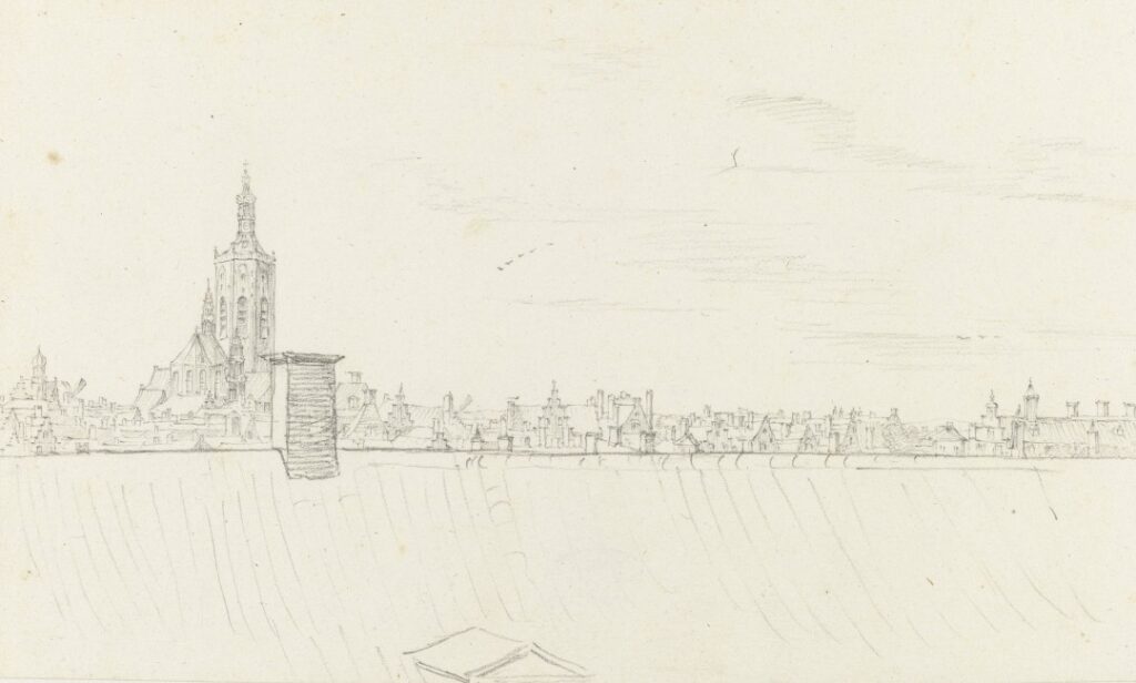
View across the roofs of The Hague
Illustrations & References
All images are in order of appearance with links to sources on external websites:
- The Hague/Den Haag, in: Braun, Georg, Hogenberg, Frans, Civitates Orbis Terrarum (6), Cologne 1618, fol. 9v; Heidelberg University.
- van Berckenrode, Floris Balthasarsz., Kaart van het Hoogheemraadschap van Rijnland, 1615; Rijksmuseum Amsterdam.
- Visscher, Claes Jansz., De weg naar Leiden buiten Haarlem, 1607; Rijksmuseum Amsterdam.
- Leiden, in: Braun, Georg, Hogenberg, Frans, Civitates Orbis Terrarum (2), Cologne 1575, fol. 25v; Heidelberg University.
- Cuyp, Aelbert, View of The Hague, 1630 – 1691; Rijksmuseum Amsterdam.
- The Hague/Den Haag, in: Braun, Georg, Hogenberg, Frans, Civitates Orbis Terrarum (6), Cologne 1618, fol. 9v; Heidelberg University.
- Savery, Jacob, Gezicht op het Buitenhof te Den Haag, 1586; Rijksmuseum Amsterdam.
- Roghman, Roelant, View in the Haagse Bos, with the Grote Kerk, The Hague, in the Distance, c. 1650; Rijksmuseum Amsterdam.
- Huygens, Constantijn, Gezicht op Den Haag, 1658; Rijksmuseum Amsterdam.