
Journal of Samuel Kiechel
9 – 15 November 1586
From Vienna to Villach
“On the 10th, in the morning, we left and arrived at lunchtime in a town on the Semmering, which we crossed in the afternoon; the landscape was similar to the mountains we crossed on the way from Neisse to Olmütz, which I wrote about. Up to this point, the road was like it was in summer, but on the Semmering we found much snow and ice, and it was frozen so hard that our horses were always in danger of falling because they had no spikes. We walked more than we rode.”
Die Reisen des Samuel Kiechel aus drei Handschriften, K. D. Haszler (ed.), Stuttgart 1866, pp. 144f; Bayerische Staatsbibliothek.
Wiener Neustadt
Samuel Kiechel and his companions left Vienna, stopped in Neudorf for the night, and then continued to Neustadt (Wiener Neustadt), arriving in the afternoon. Kiechel noted that Neustadt had a fortified palace where Prince-elector John Frederick II, Duke of Saxony (1529-1595), lived. The travellers were led into the palace, but there was nothing to see except old, dark rooms. Beside the palace and the town lay a large garden where many game animals were kept. If the Prince-elector was inclined, a corridor led from the palace to the garden, where he could shoot some animals.1
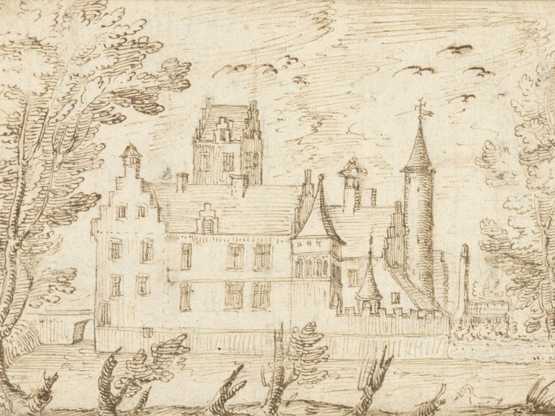
John Frederick had been Duke of Saxony but was living as a prisoner in Wiener Neustadt. Contrary to Kiechel’s observation, he was not a Prince-elector2. John Frederick’s father had been Elector, but his Protestantism and his joining the Schmalkaldic League in 1531 meant he ended up on the losing side of the subsequent war against Emperor Charles V (Schmalkaldic War, 1546-47). His father was imprisoned, and Maurice of Saxony became Elector. The ruling Wettin Dynasty had split in the fifteenth century into the Albertine and Ernestine lines. The Ernestines held the title of Elector of Saxony until this point. Maurice was from the Albertine line.
John Frederick, eager to reclaim the title he believed he should have inherited, backed a rebellious imperial knight in a feud with the Bishop of Würzburg. When the feud threatened to draw in more people and destabilise the Empire, Emperor Maximilian II (1527-1576) placed the knight under the imperial ban. John Frederick continued to support him. Maximilian placed him under the ban too and had him captured and imprisoned in Wiener Neustadt. A palace may not sound like a prison to us, but in the early modern period, a nobleman was granted certain comforts, including his own household and staff. John Frederick remained imprisoned until his death in 1595.
The Great Barrier
Leaving Neustadt, Samuel Kiechel faced a formidable obstacle on his journey. The Alps are the largest mountain range in central Europe, almost entirely blocking the Italian Peninsula from the north. In the Middle Ages, it was not uncommon to attempt a crossing only in the summer months, or to avoid the mountains entirely and opt for a sea voyage, often no less dangerous. Nevertheless, with Rome as the centre of western Christianity, Venice as a jump-off point for pilgrimages to the Holy Land, and exotic commodities from the east on offer in the markets of the Italian city-states, there was always a desire or a need to cross the Alps.
The Romans had constructed a few roads through the mountain passes to reach their northern province. Those roads were still used in the early modern period. However, as I noted earlier, the term road is generous for the kind of pathways travellers most often encountered at the time. While the Romans went to the effort of constructing paved roads and their long existence speaks to the quality of their work, maintaining such roads was costly and, in remote regions like the Alps, impossible without the centralised organisation and labour available to the ancient Empire.
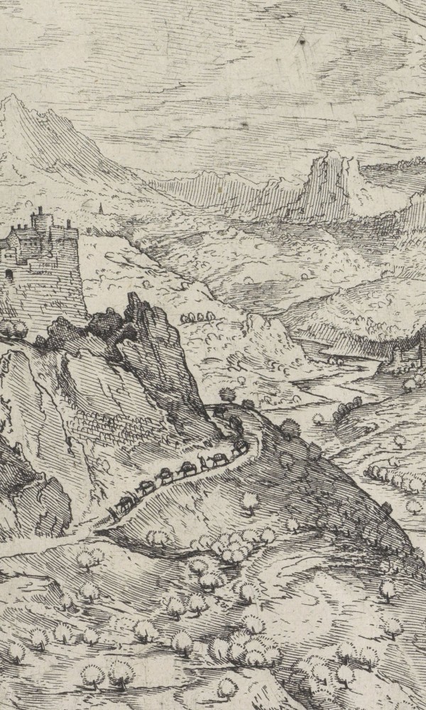
In the sixteenth century, travelling across the Alps usually meant traversing steep, rough and narrow rocky paths. Many passes lay above 2,000 metres, and snow and ice were common even in summer. Travellers had to be careful, as a sudden change in the weather could bring strong winds, freezing cold, fog and more snow. Being caught out in such weather could quickly turn deadly. It was not uncommon to wait out the winter months in one of the inns at the foot of the Alps before attempting to cross them. Individual travellers would band together or join a caravan to cross the massive mountain range. A group could provide support in case of accidents. Guides were hired, and baggage and trade goods were loaded from carts onto pack animals. A few routes across the mountains, especially in the Eastern Alps, were accessible by cart, but in general, it was better and safer to walk or ride. Rough roads took a heavy toll on early modern vehicles, and the lack of suspension meant passengers did not enjoy the ride.
The Nuremberg cartographer and physician Erhard Etzlaub produced the “Romweg” map (Roads to Rome) for German pilgrims travelling to Rome in the Catholic jubilee year of 1500. His map shows three possible routes across the Alps. More routes through the mountains existed, but Etzlaub’s aim was not to map the Alps; it was to give pilgrims from different regions of the Holy Roman Empire practical help in planning their journey.
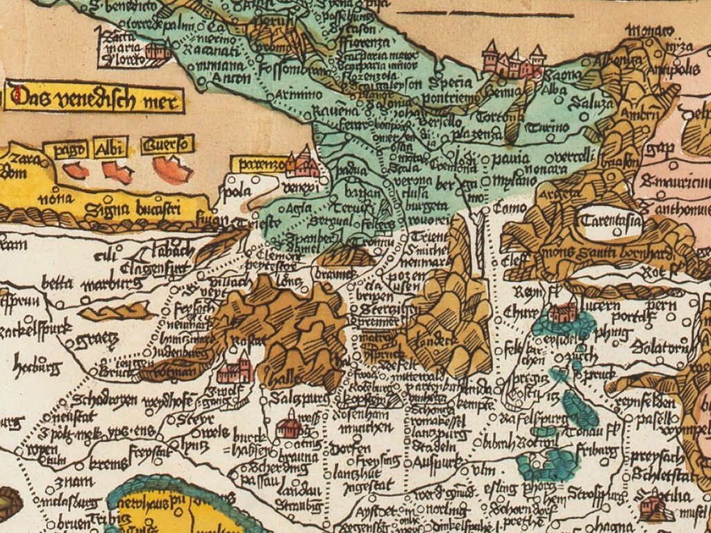
Erhard Etzlaub’s “Romweg” map (1500) shows the three suggested passes over the Alps. The map is oriented towards the south, with Italy at the top.
The westernmost route runs via the Splügen Pass (2,114 m) from Chur to Lake Como. This option would have been particularly interesting to pilgrims from the western part of the Empire travelling up the Rhine River. Samuel Kiechel’s home town of Ulm is also connected to this pass. The mountain range west of the pass is named “mons santh bernhard” — the Great St. Bernard (2,469 m) was another well-travelled pass route, although it is not marked as such on Etzlaub’s map.
To the east, the Brenner Pass (1,370 m) is marked as the second option for crossing the Alps. On Etzlaub’s map, routes from the Baltic and North Seas through the centre of the Empire, via the influential imperial cities of Regensburg and Nuremberg, converge at this pass.
The easternmost and longest of the three routes crosses the Semmering Pass (984 m) via Villach to Venice. Etzlaub recommends this approach for pilgrims from Cracow, Olomouc and Vienna. This eastern route was also part of an old trade road. Amber from the Baltic was a highly coveted commodity in ancient Rome. The Amber Road, like many other old trade roads, was not a single road but a network of routes that ran from the Baltic coast via the Moravian Gate to the Danube, then across the Eastern Alps to Italy. Probably unknowingly, Samuel Kiechel followed this old route from Gdańsk on the Baltic Sea to the Alps. The Eastern Alps were wider but lower than the western part of the mountain range. Kiechel could therefore avoid crossing one of the higher passes. Given that it was already late in the year, this was probably a wise choice.
Across the Semmering
On 10 November, the travellers left Neustadt and arrived at lunchtime in a town below the Semmering Pass. Kiechel did not name the place, but it must have been Gloggnitz, just northwest of the pass. They crossed the pass in the afternoon. The landscape around them reminded our traveller of the mountains they had crossed on the way from Neisse to Olmütz (the Sudeten Mountains).
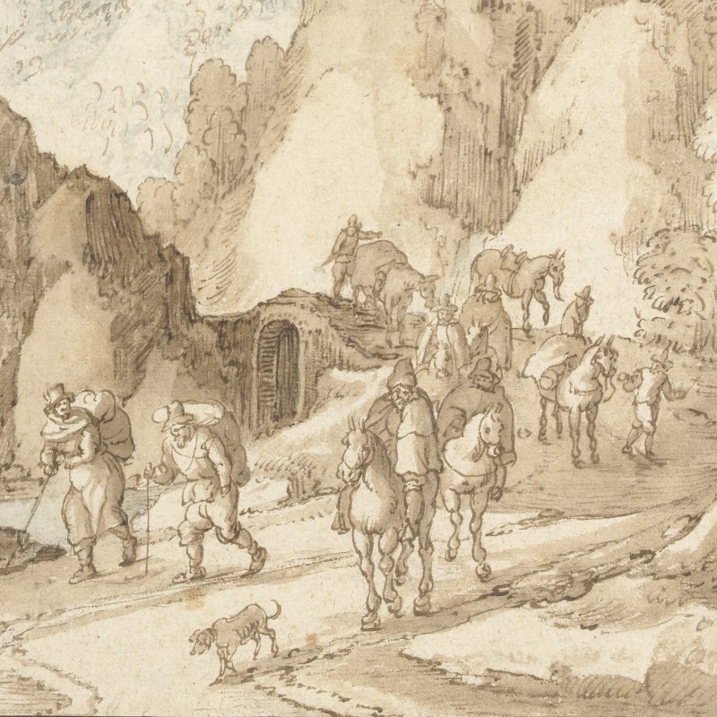
So far, the road had been dry and clear, but from then on the travellers had to contend with snow and ice so hard that their horses struggled not to slip and fall. Kiechel noted that their animals were not ‘gespitzt’. He meant that their horseshoes had no spikes or studs to give them more grip on icy surfaces in winter. To prevent accidents, Samuel and his companions walked more than they rode, which caused some delay.
They arrived in Spital (Spital am Semmering), a village in Styria, two hours after nightfall. The village belonged to Duke Charles (Charles II Francis of Austria, 1540 – 1590). In Spital, Kiechel saw that even oxen were shod like horses with spiked horseshoes. But because of their cloven feet, they wore the shoes only on the outer part of their hooves. He noted that they did this because oxen were used to carry cargo across the mountains.
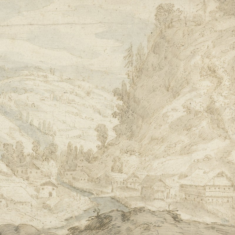
The following day, the travellers continued through the mountains. They passed hamlets and villages, and Kiechel wrote that the road was decent, heavily used, and offered few chances of getting lost or taking a wrong turn. They stopped for the night in Bruck an der Mur. Kiechel wrote that Bruck was a pleasant, unfortified town and that it also belonged to Duke Charles. The small Mur River passed through the town and flowed on towards Graz.
Graz was the town where Duke Charles had his residence. It was six miles away, and the travellers wanted to visit it. But because of a plague outbreak in Graz, they decided against it. Visiting the city would have made their journey much more difficult.3
Kiechel mentioned that they had to have their passports signed every evening at the places where they stayed for the night. This was one precaution for travellers: to document and prove they had not stopped in a place afflicted by an epidemic. Having Graz on their passports would have caused trouble later, as news of the plague spread faster than the epidemic itself.
From Lower Austria into Styria
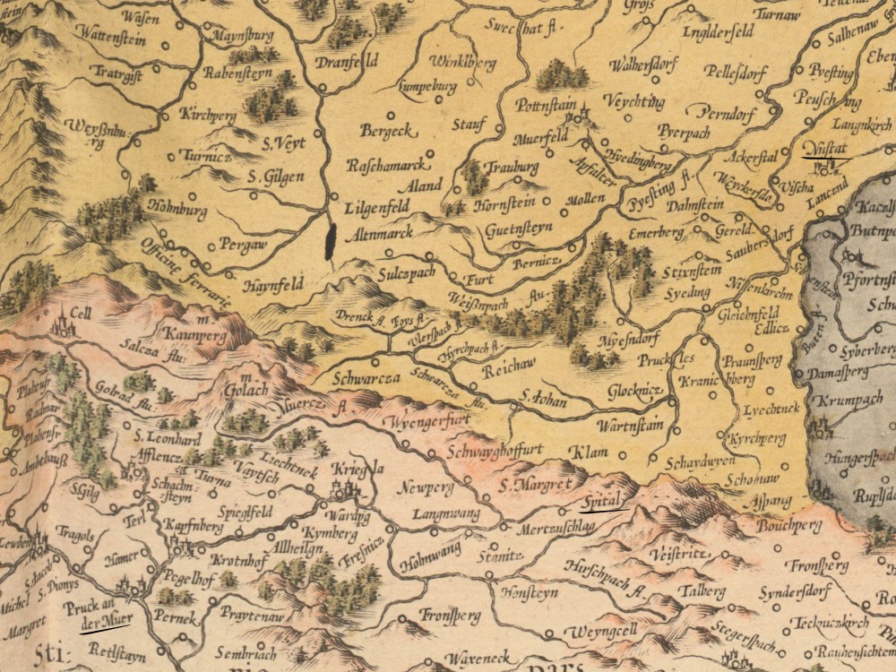
Map of Austria with Wiener Neustadt (“Nustat”), Spital and Bruck an der Mur (“Pruck an der Muer”), 1595
The Semmering Pass was relatively low compared with the passes in the western Alps. But in November, snow and ice made crossing it precarious. Spital lay on the other side of the pass, and from there Kiechel followed the valley of the Fröschnitzbach, a small stream, south-westward. The Fröschnitzbach flows into the Mürz, which in turn flows into the Mur. Because the traveller had to follow the path through the valley, he had little chance of getting lost.
Samuel mentioned that oxen were used to transport cargo across the mountains and that their hooves were shod with spiked horseshoes. On the narrow, steep mountain paths, pack animals were a common sight. People living in villages in the Alps and around access points to the pass routes made a living by transporting cargo with their animals. A ‘Saum’ was a historical unit of measurement for a pack animal’s carrying capacity. The transport of goods across the mountains was therefore called ‘Säumerei’, and the people engaged in this business were ‘Säumer’.
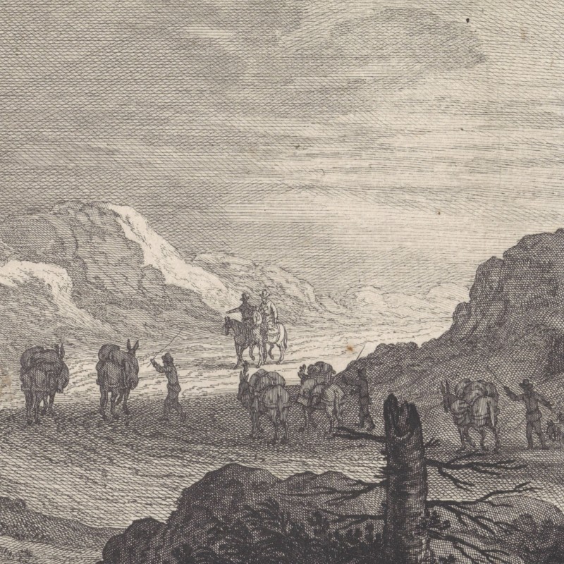
From the thirteenth century, the Säumer began forming cooperatives, gave themselves charters, and held transport monopolies along certain parts of the route. The cooperatives maintained their routes and ensured safety along them. This was especially true in Switzerland, whose loose confederate structure gave the cantons (districts) greater autonomy. In the Habsburg homeland of Austria, with its established feudal structures, the local lords along the pass routes had to be involved in the profitable transport business, preventing the establishment of any independent cooperative.
To Villach
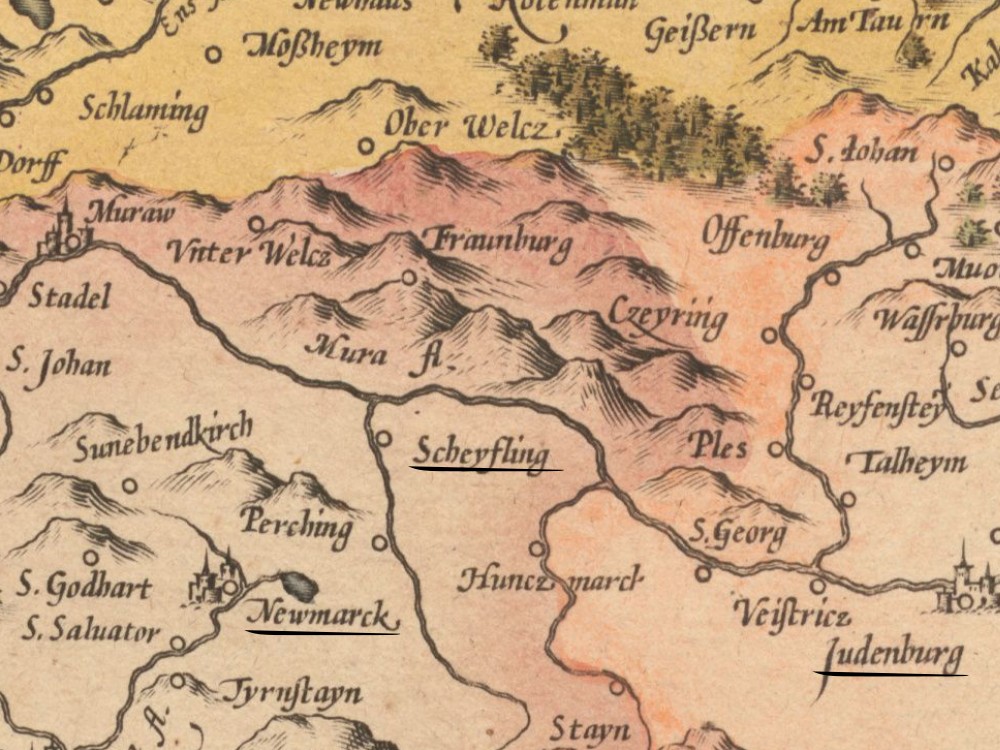
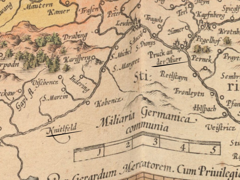
Samuel Kiechel’s route along the Mur River from Bruck (“Pruck”) via Knittelfeld (“Knitlfeld”) and Judenburg to Neumarkt (“Newmarck”)
Samuel Kiechel and his companions left Bruck early the next day, as soon as the town gates opened. The road followed the Mur River upstream. Due to the short daylight hours and the rough, snow-covered road, the travellers arrived in Knittelfeld in Styria two hours after nightfall.
Kiechel wrote that he noticed the innkeepers in this region offered meat on fasting days (Friday and Saturday), in addition to fish. One of Samuel’s companions was an Italian he had met in Vienna, and the man was a staunch Catholic. Kiechel was a bit careless, and one Saturday he also ate some meat. He wrote that from that moment the Italian kept a close eye on him. As long as they were in Austria, he held back because he did not speak German. But once they reached Venetian territory, he would begin making trouble despite all the goodwill Kiechel and his other two companions had shown him. Our traveller noted that from this moment he would have to be more careful.
On 13 November, the group left Knittelfeld along a rough road with many deep, frozen-over puddles. At lunchtime, they stopped in Judenburg. They still had a long road ahead of them that day, and the Italian was not particularly happy about it. The men continued and arrived in Neumarkt (Neumarkt in der Steiermark) three hours after nightfall. Although the town gate was already locked, the guards reopened it for the travellers. Presumably, late arrivals were common in the mountains, and, unlike in his previous experiences in Germany, the guards were allowed to reopen the gate. In Neumarkt, a fair was held; the inns were full, and the innkeepers were not happy to see more people arriving.
Kiechel and his companions wanted to continue their journey early the following morning. However, our traveller noted that he had to visit the house of Neumarkt’s town scribe three times before he could find him and have the group’s travel papers signed. Because of this back-and-forth, their departure was delayed by one hour. This does not sound like much, but given how often the travellers had to continue into the night before reaching their destination, an hour could make quite a difference on the rough, frozen roads.
The group rode that day to St. Veit in Carinthia (St. Veit an der Glan) but had to contend with large, frozen puddles on the road that broke under their horses’ hooves. Not knowing how deep the puddles were, none of them wanted to be the first to cross the ice.
The following morning, they continued through the mountains. Kiechel noted that they passed many hamlets and wondered how the people made a living. He also mentioned that many mines were in the area and that much iron and steel were produced and exported to Germany and Italy.
In the evening, the travellers stopped in Villach. They had hurried to arrive before the gate was closed, but the guards refused them entry anyway. They asked for the travellers’ papers, which they took to the mayor, who had to decide whether the group was allowed entry. After half an hour of waiting for a decision, Kiechel and his companions could finally enter Villach.4
From Styria to Carinthia
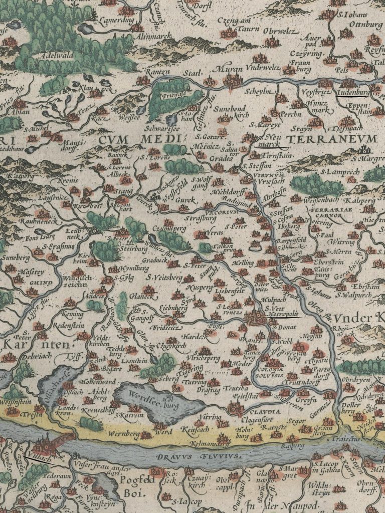
Map of Carinthia with Judenburg (“Iudenburg”), Neumarkt (“Neumarck”), St. Veit (“S. Veit Metropolis”) and Villach
From Bruck, the Mur River flows south towards Graz, but Kiechel and his fellow travellers followed it westward and upstream towards Judenburg. Further up the Mur, at the village of Scheifling, they turned south and followed a valley to Neumarkt.
From Neumarkt, Kiechel and his companions rode along the Olsa Stream south to where it flowed into the Metnitz. Our traveller wrote that they had to traverse large frozen puddles of water. South of Neumarkt, the Olsa flows through a narrow gorge, and the group may have had to cross the small, frozen and snow-covered stream repeatedly.
Further south, the mountains open towards the Klagenfurt Basin, the largest basin in the Alps. At its northern edge lay St. Veit. Samuel Kiechel noted that many mines surrounded St. Veit. The area was renowned since antiquity for its iron ore and also had some silver mines. From St. Veit, the group turned west again and rode along the edge of the basin past Lake Ossiach towards Villach.
From St. Veit, the group turned west again and rode along the basin’s edge past Lake Ossiach towards Villach. The landscape, which forced travellers to follow the valleys, makes it fairly straightforward to reconstruct Kiechel’s route. It’s even possible to estimate the distances he covered each day. Each stage of the journey from Neustadt to Villach was around fifty to fifty-five kilometres, except for Neumarkt to St. Veit, which was only forty-two kilometres. This indicates fairly steady progress despite the landscape, road conditions and early winter weather.
Illustrations & References
All images are in order of appearance with links to sources on external websites:
- van Valckenborch, Frederik, Berglandschap met meer in een dal, mogelijk het meer van Genève, 1598-99; Rijksmuseum Amsterdam.
- Anonymous, Kasteel met slotgracht, 1600 – 1699; Rijksmuseum Amsterdam.
- of Lucas van Doetechum, Johannes, Alpenlandschap, 1553 – 1558; Rijksmuseum Amsterdam.
- Etzlaub, Erhard, Das ist der Rom-Weg von meylen zu meylen …, ca. 1500; Bayerische Staatsbibliothek.
- de Momper, Joos, Landschap met reizigers, 1574 – 1635; Rijksmuseum Amsterdam.
- van Valckenborch, Frederik, Gezicht op een dal met een dorp, 1598-99; Rijksmuseum Amsterdam.
- Mercator, Gerard, Atlas Sive Cosmographicae Meditationes De Fabrica Mundi Et Fabricati Figura, 1595; Bayerische Staatsbibliothek.
- Nolpe, Pieter, Pakezels op een weg, 1623 – 1653; Rijksmuseum Amsterdam.
- Braun, Georg, Hogenberg Frans: Civitates Orbis Terrarum (5), Cologne 1599, fol. 59v; Heidelberg University.
- Ortelius, Abraham, Theatre of the World, Antwerp 1587, fol. 82v; Library of Congress.
- Die Reisen des Samuel Kiechel aus drei Handschriften, K. D. Haszler (ed.), Stuttgart 1866, p. 144; Bayerische Staatsbibliothek. ↩︎
- The Holy Roman Empire was an elective monarchy. The privilege to elect a future King and Emperor was held solely by seven Prince-electors. Established in the thirteenth century, the Prince-electors were the three Archbishops of Cologne, Mainz and Trier, the Duke of Saxony, the Margrave of Brandenburg, the King of Bohemia and the Count Palatine. ↩︎
- Reisen des Samuel Kiechel, pp. 144f. ↩︎
- Ibid., pp. 145-147. ↩︎