Journal of Samuel Kiechel
3 August – 5 September 1585
From Dordrecht to Vlissingen
“Walcheren is only twelve Dutch miles in circumference. In the summer, it is possible to ride around the island in one day. Four cities are on Walcheren: Arnemuiden, Veere, Middelburg and Vlissingen. Fort Rammekens is also on the island.“
Die Reisen des Samuel Kiechel aus drei Handschriften, K. D. Haszler (ed.), Stuttgart 1866, pp. 18-19; Bayerische Staatsbibliothek.
Sailing Through Zeeland
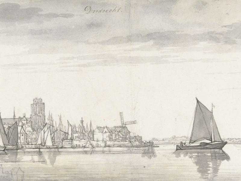
Leaving Dordrecht
Samuel Kiechel left Dordrecht by ship, heading for Walcheren, the westernmost of the Dutch islands, opposite the coast of Spanish-controlled Flanders. The journey to Walcheren took him through Zeeland, a Dutch province that includes the extensive delta of the Scheldt, Meuse and Rhine Rivers. Islands and rivers define the landscape of Zeeland.
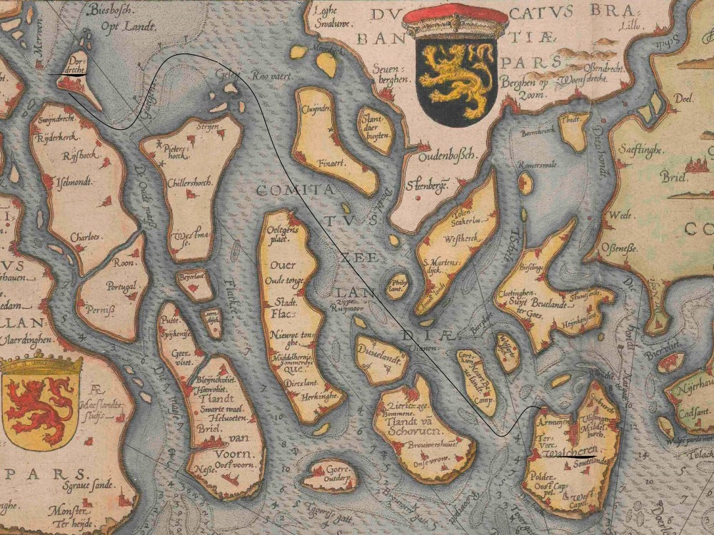
Naval chart of Zeeland from the north, showing Kiechel’s potential route.
Kiechel’s boat probably sailed along Hollands Diep around the southern tip of the island of Hoeksche Waard. It continued westward along the waterways that separate the mainland from Zeeland’s islands. Our traveller noted that he sailed past flooded lands and saw various buildings protruding above the water.
The Rhine-Meuse-Scheldt delta has always been prone to flooding. The landscape of the delta is low-lying, so heavy storms from the North Sea or damaged dykes were always a threat. As mentioned, Dordrecht became an island after a devastating flood in 1421.
Fifteen years before Samuel Kiechel’s visit, the All Saints’ Flood of 1570 struck Zeeland, causing widespread devastation. It was one of the worst natural disasters of its era, submerging large areas that would only be reclaimed centuries later. From the boat, Kiechel saw the remnants of towns and villages swallowed by water. It was not until the twentieth century, with the construction of the Delta Works, that a long-term effort to prevent such flooding was undertaken.
Travelling Around Walcheren Island

Walcheren Island in the Theatrum Orbis Terrarum, 1587
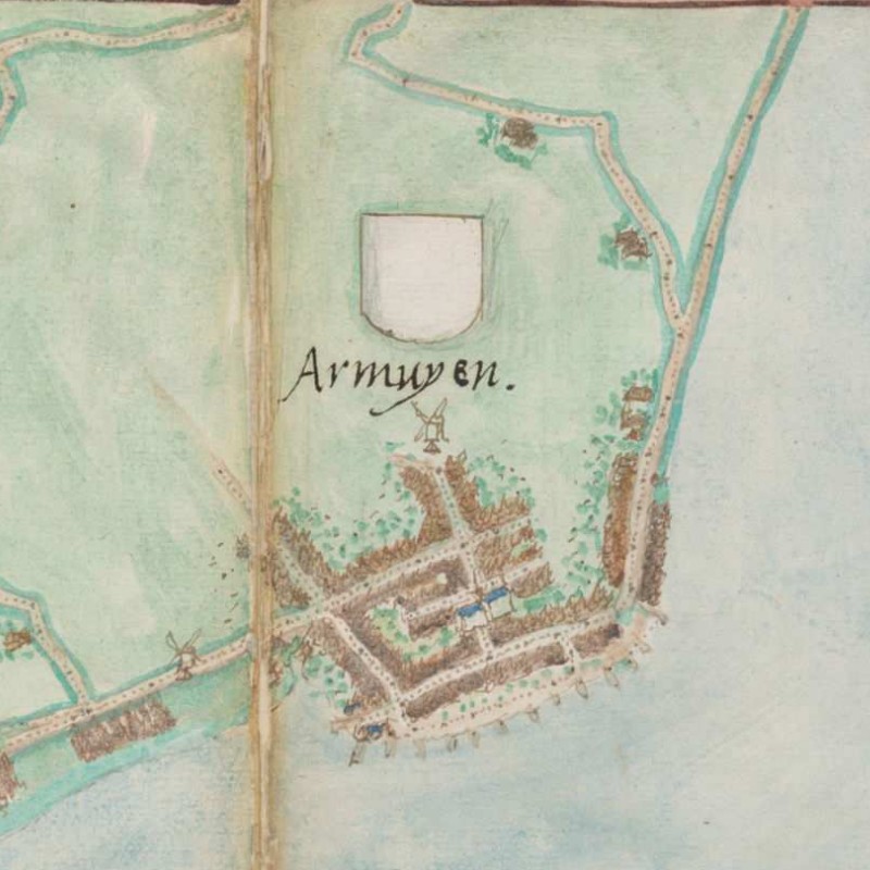
Kiechel’s ship sailed through the night and arrived in Arnemuiden the following morning. Our traveller noted that the town is in the province of Zeeland. It is small and fortified by poorly constructed walls.
In the sixteenth century, Arnemuiden was located on the southern coast of Walcheren. Today, however, it is no longer connected to the sea. In 1871, the Sloedam was constructed to link Walcheren to the mainland, and after World War II, the land surrounding the dam was reclaimed and converted into polders. The island of Walcheren became a peninsula.
Arnemuiden, 1545
Jacob van Deventer mapped the towns and cities on Walcheren. The maps are drawn in plan view, showing the streets, canals and roads leading in and out of each place. As Walcheren was a small island, it is possible — considering the geographical location of each place relative to the others — to follow the route Kiechel took around the island on van Deventer’s maps.
Arnemuiden is shown on the map as a small, unfortified place. It seems to lack a dedicated, protected harbour. Instead, boats are moored all along the town’s seafront. Two coastal roads lead away from Arnemuiden: one southwest towards Middelburg, and the other northeast towards Veere.
Our traveller did not stay in Arnemuiden but walked to Veere on the island’s eastern side, likely along the coastal road in the upper right of van Deventer’s map. Veere, Kiechel wrote, is small but well-fortified and inhabited mainly by fishermen.
In contrast to Arnemuiden, Veere appears on van Deventer’s map as a small yet well-fortified town with a moat and walls. Veere was situated on the Veerse Gat, an arm of the Scheldt River connected to the North Sea. On the opposite side of the arm was the island of Noord-Beveland. As its name indicates, Veere was a ferry port linking both islands.
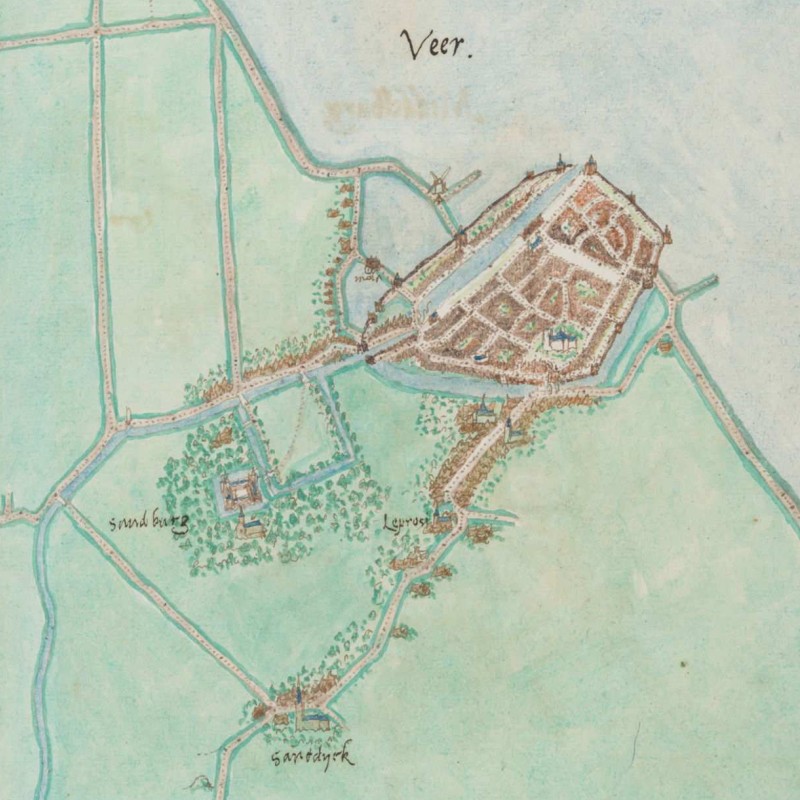
Veere, 1545

Zandenburg (“Sandburg”) and Zanddijk (“Sanddyck“) on van Deventer’s map
On the map, southwest of Veere, is Zandenburg Castle (“Sandburg”). Built in the thirteenth century, the castle gained prominence in the late fifteenth century as the seat of a line of the House of Burgundy. After the last Burgundian owner died childless in 1558, Philip II of Spain purchased Zandenburg in 1567. During the Eighty Years’ War, Veere supported the rebels from the outset and prevented the Spanish from using the castle as a stronghold. In 1572, much of Zandenburg was demolished, and its stones were used to strengthen Veere’s fortifications. By the time Samuel Kiechel visited, little of the castle remained. But our traveller must have passed by the ruins when he left Veere.
After a short break, Kiechel resumed his journey, walking another mile to Middelburg. He took the road heading southwest from Veere past the lepper house (“Leprosi“) and through the village of Zanddijk (“Sanddyck“).
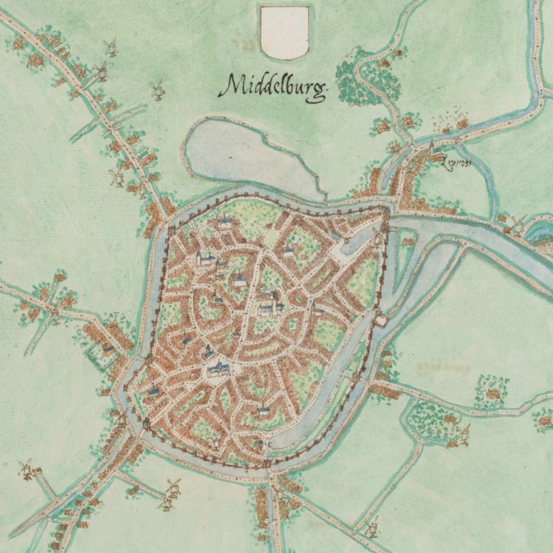
Middelburg, 1545
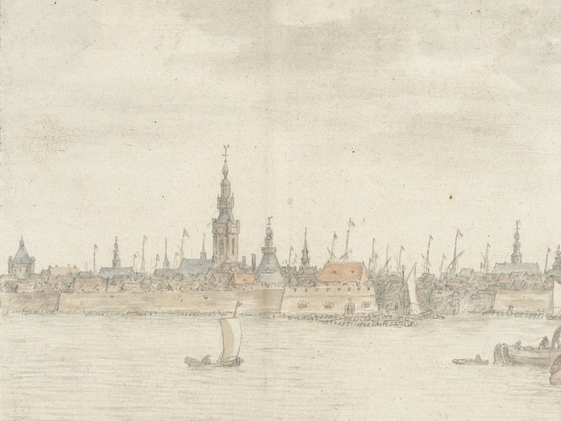
According to our traveller, Middelburg, the capital of Zeeland, is situated in the middle of the island. It is a large and densely populated city. However, Kiechel saw many houses that had been destroyed and not rebuilt.
Furthermore, Samuel Kiechel wrote that Middelburg is one mile from the sea, but ships could reach it via a canal. He learnt that the city was an important commercial centre before the war, with its merchants regularly sailing to Spain. Now, the ships were at risk of being boarded and their cargo seized.
Jacob van Deventer’s superb map of Middelburg not only depicts the city but also the canal leading to the sea. The canal flows into the sea southwest of Arnemuiden. The two towns are fairly close, and Kiechel’s visit to Veere was either an unplanned detour or a deliberate decision since all three locations are quite near each other.

Middelburg and Arnemuiden, 1545
During the Eighty Years’ War, Middelburg was the last city on Walcheren held by the Spanish. Dutch rebels besieged it (1572-1574), and ultimately, the city surrendered. The damaged houses, Kiechel observed, might still have been from the siege. Middelburg recovered from the siege and became one of the wealthiest and most prominent cities in the Dutch Republic during the seventeenth century.
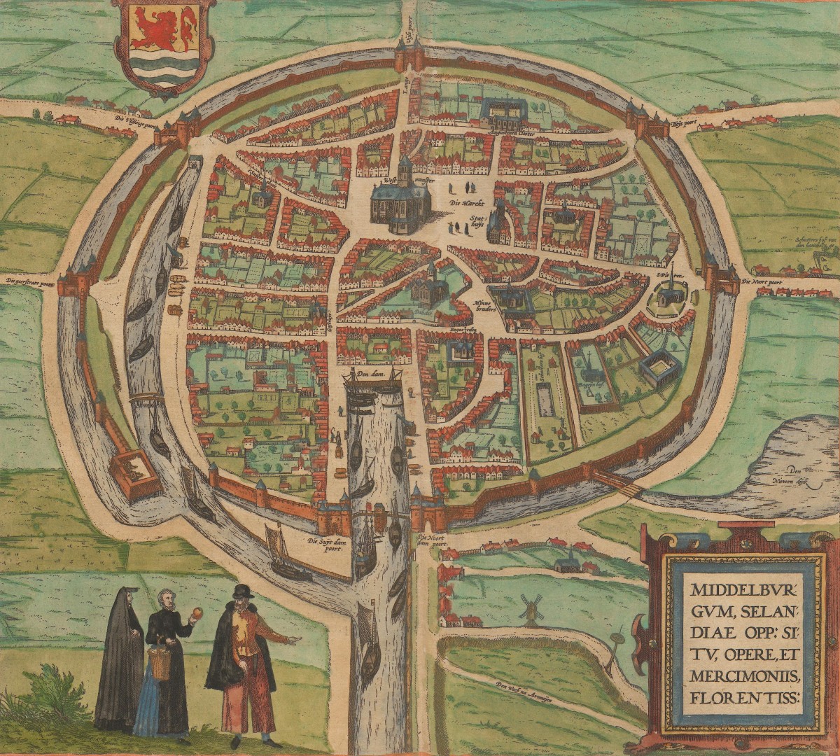
Middelburg, 1575
A bird’s-eye view in the second volume of the Civitates Orbis Terrarum depicts Middelburg as a fortified city with large open spaces inside the walls. This volume of the Civitates was first published in 1575, and depending on when the print was made, it may show the city before or after the siege. At the bottom of the image are Middelburg’s harbour and the canal leading to the sea. Ships are moored along the canal and within the city.

Middelburg, 1616
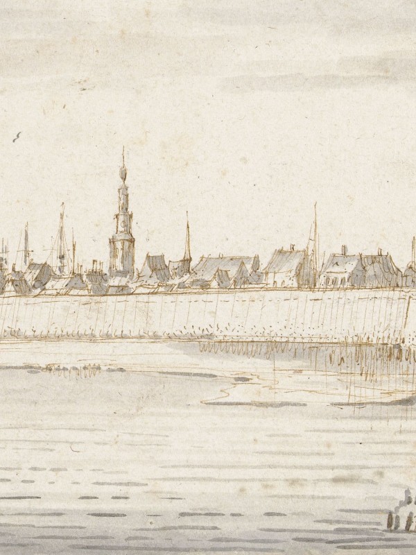
After spending the night in Middelburg, Samuel Kiechel travelled by cart to Vlissingen (5 August) on the southwestern coast of Walcheren. The road to Vlissingen is marked in the bird’s-eye view, located in the top left corner.
Vlissingen
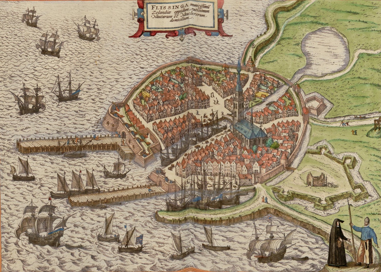
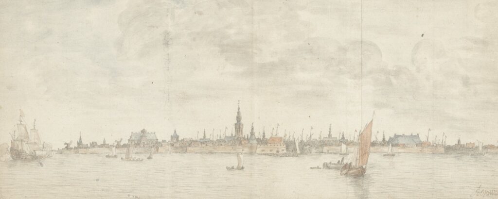
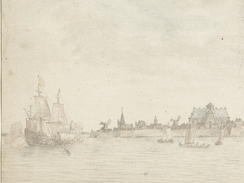
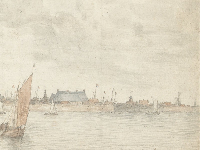
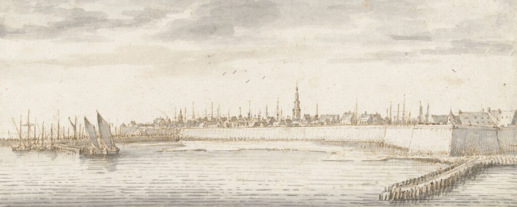
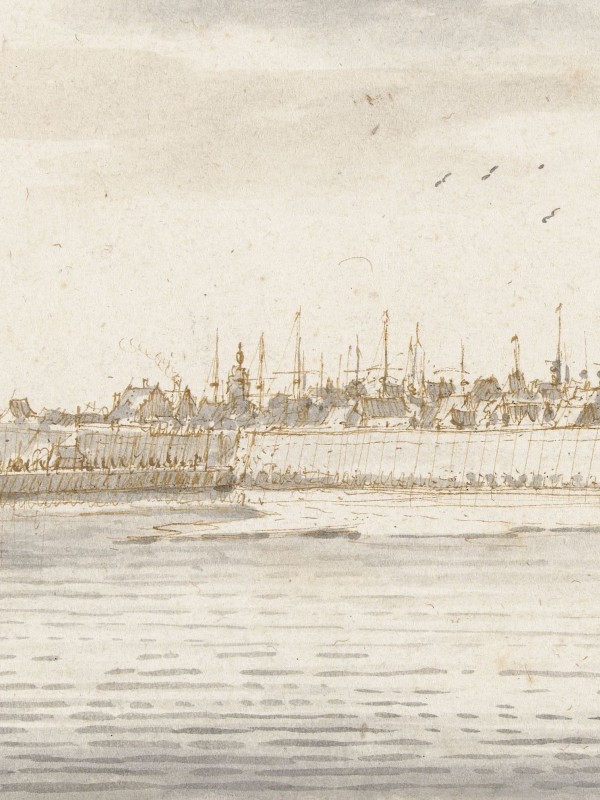
The cart carrying Samuel Kiechel approached Vlissingen from the north. According to the journal, the traveller saw a small but heavily fortified city. Vlissingen was by the sea, and a canal led into the town. The Prince of Orange, when he was still alive, had a residence in the city, and his widow still lived there.

Vlissingen, 1545
Kiechel learnt of a distinctive defensive tactic the townspeople used against attacks: flooding the surrounding countryside by opening the canal’s sluice gates. This was a common method employed by the Dutch during their war against Spain. The artificial, low-lying landscape of the northern Dutch provinces, with its many polders, encouraged this strategy. To stop the advancing Spanish armies, the Dutch would open sluice gates or even breach the dykes to flood the surrounding polders and block or push back their enemies.
Vlissingen, 1598
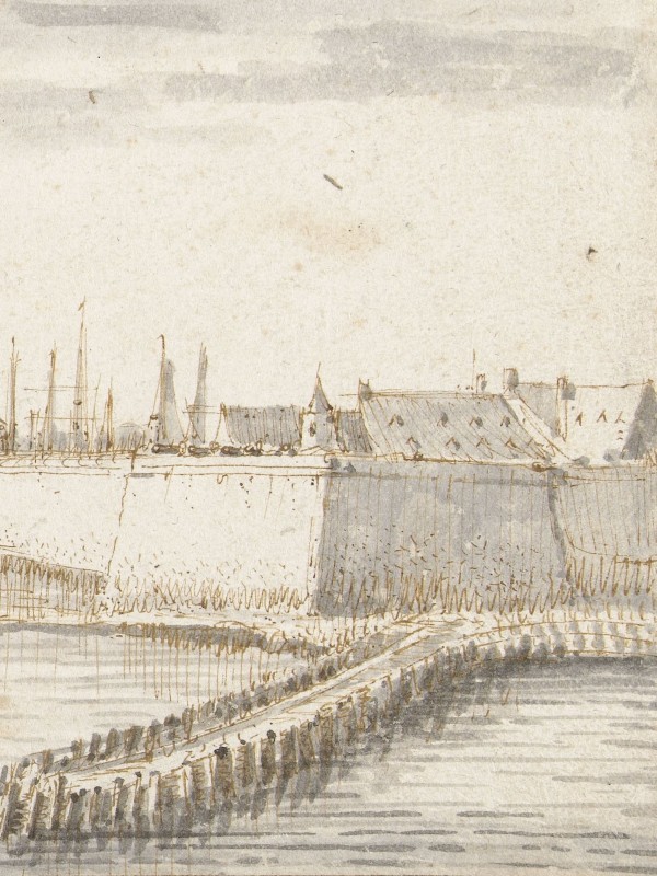
A bird’s-eye view of Vlissingen from the southeast is in the fifth volume of the Civitates Orbis Terrarum. In the view, the town, particularly the harbour area, is heavily fortified. The above-mentioned canal from the sea runs through Vlissingen. None of the buildings in the image is identified by name, and only the Sint Jacobskerk stands out above the roofs of the surrounding buildings. Along the coastline on both sides of the town, we see the dykes that were constructed to protect the reclaimed land and prevent flooding.
Samuel Kiechel visited the four towns of Walcheren in just over a day. Regarding its size, he noted that the island had a circumference of only twelve Dutch miles, and in summer, one could ride around it in a single day. The only larger settlements on Walcheren were Arnemuiden, Veere, Middelburg and Vlissingen, along with Fort Rammekens. The fortress was on the southern side of the island, and Kiechel visited it on a daytrip from Vlissingen. He mentioned that one part of Fort Rammekens was built into the sea, while another part was on land and was always garrisoned.
Forced Stopover
Samuel Kiechel did not intend to stay in Vlissingen; he wanted to depart for England as soon as possible. However, because the wind constantly blew from the west, he had to wait in the town from 5 August to 6 September. Despite this hold-up, our traveller kept himself busy; he made two unsuccessful attempts to continue his voyage.
The first attempt was on 27 August when the wind finally shifted. Kiechel prepared to leave and went on board a ship. But then, the wind changed course again in the evening, forcing him to return to the town.
The second attempt to leave Vlissingen soon followed. Kiechel overheard that some Frenchmen had paid the captain of a privateer ship to take them to Calais in France. Bored with waiting in Vlissingen, he decided to join them on their voyage.
As a side note, Kiechel spoke French. Later in his journal, he mentions that he had spent a few months in Paris before his journey, using that time to learn the language.
Our traveller had learnt that he needed a passport from the mayor of Vlissingen to leave by ship. He went to the town hall but was told that the city council had instructed the mayor not to issue any more passports for journeys to France. However, it was still possible to obtain a passport to England. Despite the potential difficulties that could arise from having the wrong papers, Kiechel decided to get one.
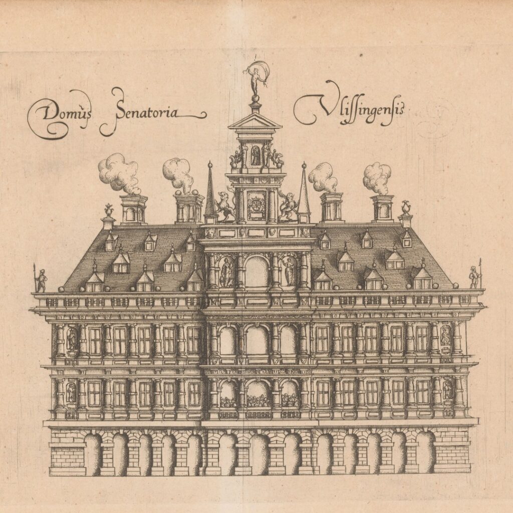
Vlissingen town hall, 1612
Unlike modern passports, early modern equivalents were issued only for a specific destination. The document was essentially an official letter that included the traveller’s name and, sometimes, physical features. Travellers like Samuel Kiechel often had to acquire new passports from local authorities, especially in regions affected by war or plague.
Samuel Kiechel took the passport for England as a precaution. He explained in his journal that privateers, when they stopped a ship at sea, would question the passengers about their destination. A traveller with a passport would be left in peace, but without it, he risked being robbed. Following Kiechel’s reasoning, it was essential to have a passport at sea. The destination for which the passport was issued was of lesser importance. Presumably, since sailing ships relied on the wind, there was always a chance of being blown off course — as Kiechel would later discover to his advantage.
With his passport to England in hand, our traveller boarded the French privateer bound for Calais. The ship’s captain informed him that he could not take on passengers without the mayor’s permission (passport). Kiechel showed him his passport, and he was allowed on board. The captain either did not read it or did not care that it was issued for England.
The ship set sail on the afternoon of 31 August despite strong winds and a rough sea. It sailed throughout the rest of the day and night but made little progress. The wind and heavy seas eventually forced the ship back to Vlissingen.
Upon returning to the port on 1 September, all passengers had to show their passports at the gate before being allowed into the city — a routine security check to ensure no one without the proper papers had been on the ship. It did not matter that the vessel had left Vlissingen the day prior.
Now, Samuel Kiechel was very worried. While he possessed a passport, it was not issued for a journey to France, and he had just disembarked from a French ship heading for Calais. Our traveller noted that if he were caught, he would not have been permitted to enter Vlissingen again. Given that the Dutch were at war with Spain, there might have been harsher consequences. However, being denied entry to Vlissingen meant Kiechel would need to find another port to continue his journey to England.
Fortunately for him, the poor weather worked in his favour. The guard at the gate, unwilling to spend too much time in the rain, merely glanced at his document and waved him through.
Smugglers
The heightened security measures in Vlissingen were not solely the result of the Dutch war against Spain. The island of Walcheren was strategically vital at the mouth of the Scheldt River. Further along the Scheldt lay Antwerp, the most crucial trading hub of the period, then under Spanish siege. Vlissingen served as the key port on the island, and its ships could target or at least harass all Spanish maritime traffic entering or leaving the Scheldt. Ships from Walcheren would play a vital role three years later when the Spanish Armada was defeated off the coast of Flanders (1588).
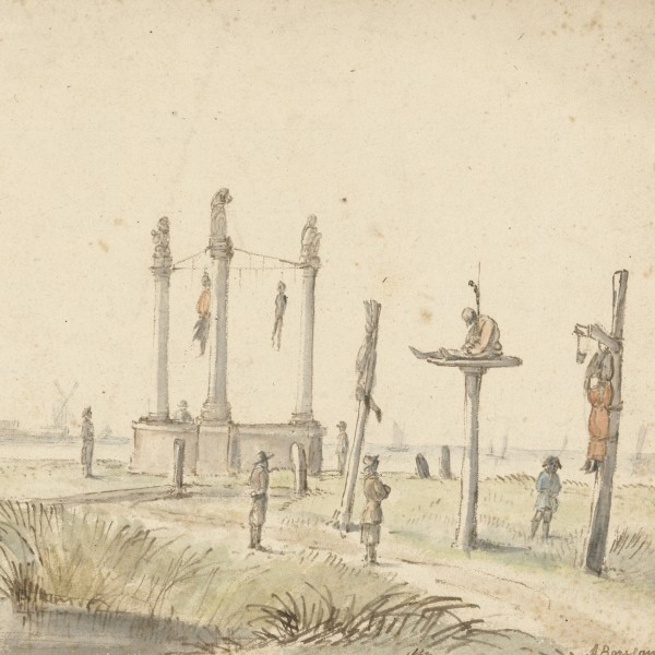
The proximity of Flanders not only posed a constant threat of Spanish attacks but also entailed collaboration and treachery. On the day Kiechel returned to Vlissingen, a boat loaded with cheese, butter and herring arrived along with five prisoners. The prisoners were smugglers who had supplied the Spanish with provisions. They had been caught sailing up the Scheldt to Antwerp. Kiechel reports that three of the prisoners were flogged, and their two leaders were sentenced to hang. The two convicts were taken across the estuary of the Scheldt to Flanders and executed in view of the Spanish army.
England and the Dutch Revolt
During Samuel Kiechel’s time in Vlissingen, the Dutch Republic and England signed the Treaty of Nonsuch (10 August 1585). Queen Elizabeth I agreed to provide troops to lift the siege of Antwerp and to pay a yearly subsidy to support the Dutch rebellion. In return, English garrisons were stationed in the towns of Brielle and Vlissingen, as well as at Fort Rammekens, until the Dutch repaid the loan. Robert Dudley, 1st Earl of Leicester, was sent to command the English forces.
English support for the Dutch Republic was motivated by the threat of Spanish-controlled provinces on the opposite side of the Channel. Tensions between the two kingdoms were already running high. Philip II of Spain considered himself the defender of the Catholic faith and was hostile to Elizabeth I’s establishment of the English Protestant church. In addition, English privateers like Francis Drake were harassing Spanish treasure ships.
Seven days after the Treaty of Nonsuch was signed, Antwerp was compelled to surrender to the Spanish on 17 August 1585. The clause that an English army would relieve the siege was expanded into broader support for the Dutch independence. The Treaty and England’s backing for the Dutch Republic marked the beginning of the Anglo-Spanish War (1585-1604). Nearly exactly three years later, the Spanish Armada was defeated near Walcheren. Simultaneously, Dutch ships from Vlissingen prevented Spanish transport barges from leaving the Scheldt delta to carry an invasion force to England.
While Kiechel waited in Vlissingen, he observed ships from England arriving daily, bringing soldiers. On 29 August, the commander of the English army arrived. According to our traveller, he was called “Mylord Oxford” and was received in the city with great fanfare. Since Robert Dudley came to the Netherlands only in December, the commander, our traveller mentioned, must have been a temporary leader until Dudley’s arrival.
After waiting a month in Vlissingen, the wind finally shifted. On 6 September, Samuel Kiechel boarded a French privateer in his third and final attempt to leave the city.
Illustrations & References
All images are in order of appearance with links to sources on external websites:
- Ortelius, Abraham, Theater of the World, Antwerp 1587, fol. 39v; Library of Congress.
- Cuyp, Aelbert, Gezicht op Dordrecht, 1630 – 1691; Rijksmuseum Amsterdam.
- Waghenaer, Lucas Jansz., Teerste [-tweede] deel vande Spieghel der zeevaerdt, vande navigatie der Westersche Zee, innehoudende alle de custen van Vranckrijck, Spaignen ende ‘t principaelste deel van Engelandt, in diversche zee caerten begrepen, Leiden 1585, fol. 3v; Utrecht University Repository.
- van Goyen, Jan, Ruïne van het Huis te Merwede, 1638; Rijksmuseum Amsterdam.
- Arnemuiden, in: Deventer, Jacob van, Planos de ciudades de los Países Bajos. Parte III [Manuscrito], 1545, p. 4; Biblioteca Nacional de España.
- Veere, in: Deventer, Jacob van, Planos de ciudades de los Países Bajos. Parte III [Manuscrito], 1545, p. 2; Biblioteca Nacional de España.
- Middelburg, in: Deventer, Jacob van, Planos de ciudades de los Países Bajos. Parte III [Manuscrito], 1545, p. 3; Biblioteca Nacional de España.
- Middelburg, in: Braun, Georg/Hogenberg, Frans, Civitates Orbis Terrarum (2), Cologne 1575, fol. 28v; Heidelberg University.
- Schillemans, François, Gezicht op Middelburg (derde deel), 1616; Rijksmuseum Amsterdam.
- Vlissingen, in: Deventer, Jacob van, Planos de ciudades de los Países Bajos. Parte III [Manuscrito], 1545, p. 1; Biblioteca Nacional de España.
- de Verwer, Abraham, Gezicht op Vlissingen, 1600 – 1650; Rijksmuseum Amsterdam.
- Vlissingen, in: Braun, Georg, Hogenberg, Frans, Civitates Orbis Terrarum (5), Cologne 1599, fol. 28v; Heidelberg University.
- Nooms, Reinier, Large Sailing Vessel and Rowing Boat, 17th century; Metropolitan Museum of Art, New York.
- de Verwer, Abraham, Gezicht op Vlissingen, vanaf de Schelde gezien, 1600-1650; Rijksmuseum Amsterdam.
- van Borssom, Anthonie, Galgenveld aan de rand van de Volewijk, 1664 – 1665; Rijksmuseum Amsterdam.